Estimated Value: $172,000 - $253,000
4
Beds
2
Baths
1,272
Sq Ft
$174/Sq Ft
Est. Value
About This Home
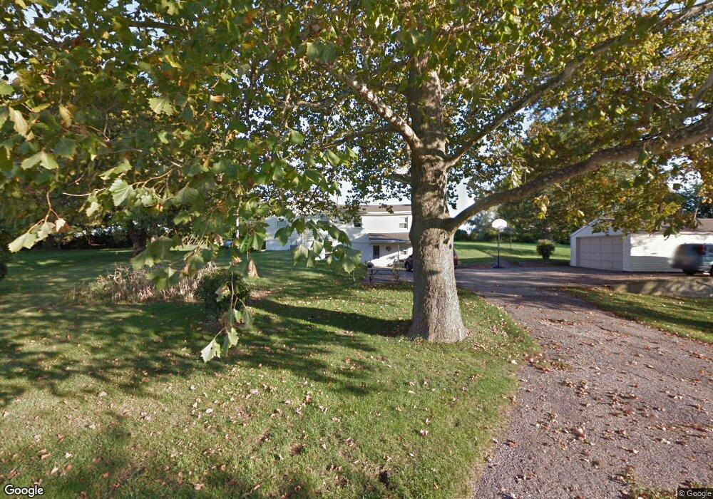
This home is located at 965 Beason Rd, Xenia, OH 45385 and is currently estimated at $221,888, approximately $174 per square foot. 965 Beason Rd is a home located in Greene County with nearby schools including Xenia High School, Summit Academy Community School for Alternative Learners - Xenia, and Legacy Christian Academy.
Ownership History
Date
Name
Owned For
Owner Type
Purchase Details
Closed on
Apr 18, 2025
Sold by
Markus Kayla and Doyle Kayla
Bought by
Doyle A-Jay and Doyle Kayla
Current Estimated Value
Purchase Details
Closed on
Jun 15, 2018
Sold by
Miller Grant E and Miller Lori Jill
Bought by
Markus Kayla
Home Financials for this Owner
Home Financials are based on the most recent Mortgage that was taken out on this home.
Original Mortgage
$135,800
Interest Rate
4.5%
Mortgage Type
New Conventional
Purchase Details
Closed on
Jan 30, 2001
Sold by
Evans Barbara L and Evans James E
Bought by
Miller Grant E and Miller Lori Jill
Home Financials for this Owner
Home Financials are based on the most recent Mortgage that was taken out on this home.
Original Mortgage
$60,000
Interest Rate
7.22%
Create a Home Valuation Report for This Property
The Home Valuation Report is an in-depth analysis detailing your home's value as well as a comparison with similar homes in the area
Home Values in the Area
Average Home Value in this Area
Purchase History
| Date | Buyer | Sale Price | Title Company |
|---|---|---|---|
| Doyle A-Jay | -- | None Listed On Document | |
| Markus Kayla | $140,000 | None Available | |
| Miller Grant E | $50,000 | -- | |
| Miller Grant E | $50,000 | -- |
Source: Public Records
Mortgage History
| Date | Status | Borrower | Loan Amount |
|---|---|---|---|
| Previous Owner | Markus Kayla | $135,800 | |
| Previous Owner | Miller Grant E | $60,000 |
Source: Public Records
Tax History Compared to Growth
Tax History
| Year | Tax Paid | Tax Assessment Tax Assessment Total Assessment is a certain percentage of the fair market value that is determined by local assessors to be the total taxable value of land and additions on the property. | Land | Improvement |
|---|---|---|---|---|
| 2024 | $3,065 | $63,060 | $15,240 | $47,820 |
| 2023 | $3,065 | $63,060 | $15,240 | $47,820 |
| 2022 | $2,711 | $50,550 | $13,250 | $37,300 |
| 2021 | $2,745 | $50,550 | $13,250 | $37,300 |
| 2020 | $2,638 | $50,550 | $13,250 | $37,300 |
| 2019 | $2,025 | $36,420 | $11,930 | $24,490 |
| 2018 | $1,979 | $36,420 | $11,930 | $24,490 |
| 2017 | $1,879 | $36,420 | $11,930 | $24,490 |
| 2016 | $1,880 | $34,040 | $11,430 | $22,610 |
| 2015 | $1,885 | $34,040 | $11,430 | $22,610 |
| 2014 | $1,808 | $34,040 | $11,430 | $22,610 |
Source: Public Records
Map
Nearby Homes
- 2096 High Wheel Dr
- 2223 Tandem Dr
- 2144 Tandem Dr
- 1881 Commonwealth Dr
- 701 Mount Vernon Dr
- 1272 Bellbrook Ave
- 1255 Colorado Dr
- 1208 Bellbrook Ave
- 2540 Cornwall Dr
- 2499 Jenny Marie Dr
- 1908 Whitt St
- 1319 Arlington Dr
- 2540 Jenny Marie Dr
- 2421 Louisiana Dr
- 0 Berkshire Dr Unit 942854
- 100 Prugh Ave
- 2187 Minnesota Dr
- 2265 Minnesota Dr
- 1766 Gayhart Dr
- 2189 Mississippi Dr
- 961 Us Route 42 S
- 961 Us Route 42 S
- 955 Us Route 42 S
- 986 Us Route 42 S
- 964 Us Route 42 S
- 1844 Beason Rd
- 1856 Beason Rd
- 824 Orville Way
- 804 Orville Way
- 832 Orville Way
- 816 Orville Way
- 838 Orville Way
- 846 Orville Way
- 852 Orville Way
- 809 Orville Way
- 801 Orville Way
- 821 Orville Way
- 829 Orville Way
- 860 Orville Way
- 837 Orville Way