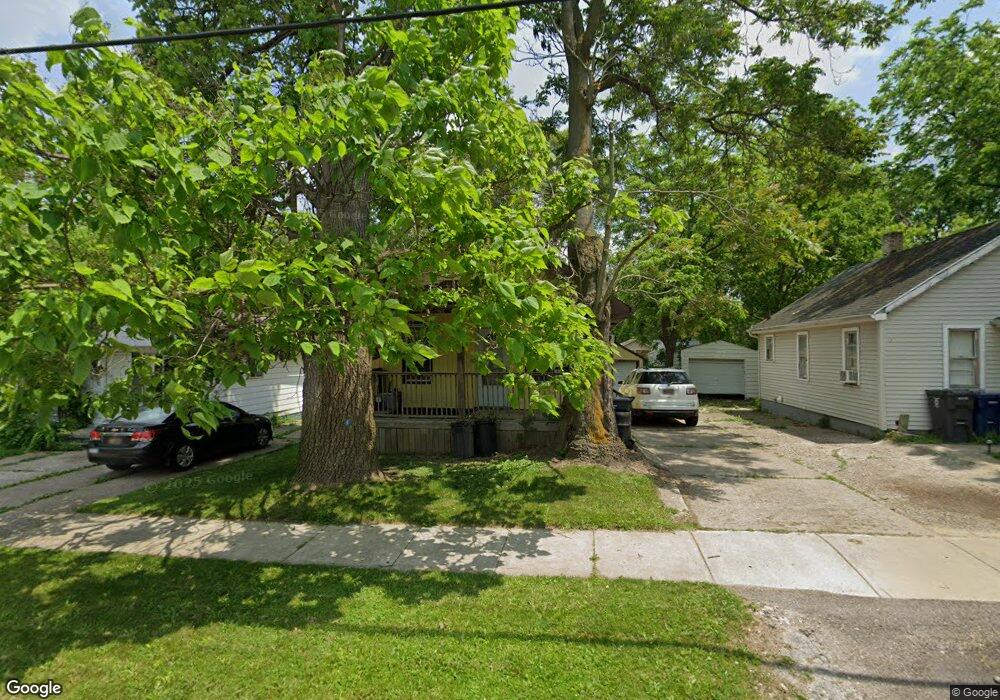
965 Bradley Ave Flint, MI 48503
Southwest Flint NeighborhoodEstimated Value: $39,000 - $52,000
2
Beds
1
Bath
660
Sq Ft
$68/Sq Ft
Est. Value
About This Home
This home is located at 965 Bradley Ave, Flint, MI 48503 and is currently estimated at $44,551, approximately $67 per square foot. 965 Bradley Ave is a home located in Genesee County with nearby schools including Eisenhower School, St. Paul Lutheran School, and St John Vianney Catholic School.
Ownership History
Date
Name
Owned For
Owner Type
Purchase Details
Closed on
Sep 9, 2005
Sold by
Land Trust Of 965 Bradley
Bought by
Rowland Kimberly A
Current Estimated Value
Purchase Details
Closed on
Apr 10, 2003
Sold by
Frank Kimberlee J and Frank Larry D
Bought by
Land Trust Of 965 Bradley
Purchase Details
Closed on
May 24, 2002
Sold by
Bacca Julius H
Bought by
Land Trust Of 965 Bradley
Create a Home Valuation Report for This Property
The Home Valuation Report is an in-depth analysis detailing your home's value as well as a comparison with similar homes in the area
Home Values in the Area
Average Home Value in this Area
Purchase History
| Date | Buyer | Sale Price | Title Company |
|---|---|---|---|
| Rowland Kimberly A | $68,000 | Sargents Title Company | |
| Land Trust Of 965 Bradley | -- | Sargents Title Company | |
| Frank Larry D | -- | Sargents Title Company | |
| Land Trust Of 965 Bradley | $14,250 | Sargents Title Company |
Source: Public Records
Tax History Compared to Growth
Tax History
| Year | Tax Paid | Tax Assessment Tax Assessment Total Assessment is a certain percentage of the fair market value that is determined by local assessors to be the total taxable value of land and additions on the property. | Land | Improvement |
|---|---|---|---|---|
| 2025 | $679 | $14,300 | $0 | $0 |
| 2024 | $625 | $14,400 | $0 | $0 |
| 2023 | $621 | $10,500 | $0 | $0 |
| 2022 | $0 | $9,000 | $0 | $0 |
| 2021 | $638 | $8,200 | $0 | $0 |
| 2020 | $586 | $7,300 | $0 | $0 |
| 2019 | $578 | $6,600 | $0 | $0 |
| 2018 | $579 | $7,200 | $0 | $0 |
| 2017 | $565 | $0 | $0 | $0 |
| 2016 | $562 | $0 | $0 | $0 |
| 2015 | -- | $0 | $0 | $0 |
| 2014 | -- | $0 | $0 | $0 |
| 2012 | -- | $9,100 | $0 | $0 |
Source: Public Records
Map
Nearby Homes
- 2710 Reynolds St
- 932 Bradley Ave
- 1006 Hammond Ave
- 2913 Gibson St
- 2663 W Court St
- 1114 Clancy Ave
- 1010 Hughes Ave
- 911 Hughes Ave
- 1126 Clancy Ave
- 2464 Gibson St
- 2618 Brown St
- 2537 Swayze St
- 2509 Corunna Rd
- 1017 Stocker Ave
- 2608 Cumings Ave
- 2437 Zimmerman St
- 612 Bradley Ave
- 1202 Knapp Ave
- 960 Mann Ave
- 1122 Stocker Ave
- 959 Bradley Ave
- 969 Bradley Ave
- 966 Hammond Ave
- 951 Bradley Ave
- 962 Hammond Ave
- 981 Bradley Ave
- 2701 Fielding St
- 974 Hammond St
- 972 Bradley Ave
- 2702 Fielding St
- 980 Hammond Ave
- 974 Bradley Ave
- 985 Bradley Ave
- 2706 Fielding St
- 974 Hammond Ave
- 980 Hammond St
- 982 Hammond Ave
- 2710 Fielding St
- 989 Bradley Ave
- 982 Bradley Ave