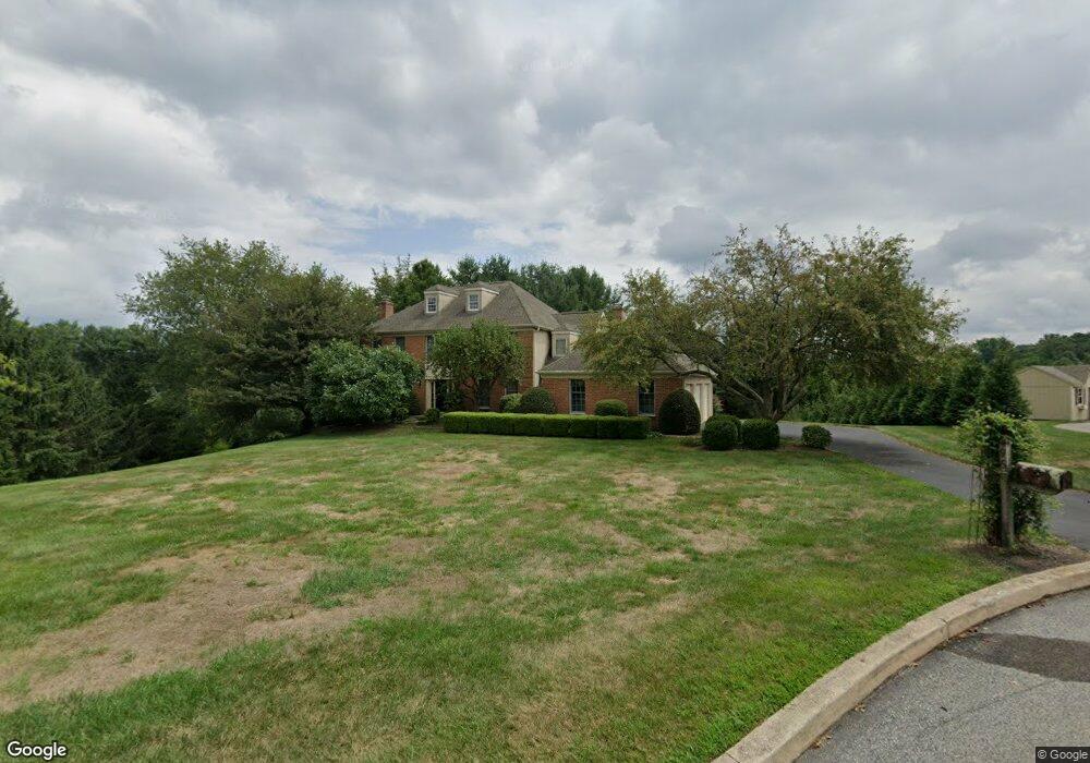
965 Brookside Ct West Chester, PA 19380
Estimated Value: $804,000 - $949,000
4
Beds
3
Baths
3,328
Sq Ft
$257/Sq Ft
Est. Value
About This Home
This home is located at 965 Brookside Ct, West Chester, PA 19380 and is currently estimated at $853,837, approximately $256 per square foot. 965 Brookside Ct is a home located in Chester County with nearby schools including Hillsdale Elementary School, E.N. Peirce Middle School, and Henderson High School.
Ownership History
Date
Name
Owned For
Owner Type
Purchase Details
Closed on
Jun 22, 2018
Sold by
Gabriel Frank C and Gabriel Susan M
Bought by
Gabriel Frank C and Gabriel Jr Revocable T Frank C
Current Estimated Value
Purchase Details
Closed on
Jun 1, 1992
Bought by
Gabriel Frank C and Gabriel Susan M
Create a Home Valuation Report for This Property
The Home Valuation Report is an in-depth analysis detailing your home's value as well as a comparison with similar homes in the area
Home Values in the Area
Average Home Value in this Area
Purchase History
| Date | Buyer | Sale Price | Title Company |
|---|---|---|---|
| Gabriel Frank C | -- | None Available | |
| Gabriel Frank C | $292,000 | -- |
Source: Public Records
Tax History Compared to Growth
Tax History
| Year | Tax Paid | Tax Assessment Tax Assessment Total Assessment is a certain percentage of the fair market value that is determined by local assessors to be the total taxable value of land and additions on the property. | Land | Improvement |
|---|---|---|---|---|
| 2025 | $7,888 | $272,110 | $54,210 | $217,900 |
| 2024 | $7,888 | $272,110 | $54,210 | $217,900 |
| 2023 | $7,888 | $272,110 | $54,210 | $217,900 |
| 2022 | $7,785 | $272,110 | $54,210 | $217,900 |
| 2021 | $7,677 | $272,110 | $54,210 | $217,900 |
| 2020 | $7,628 | $272,110 | $54,210 | $217,900 |
| 2019 | $7,521 | $272,110 | $54,210 | $217,900 |
| 2018 | $7,361 | $272,110 | $54,210 | $217,900 |
| 2017 | $7,202 | $272,110 | $54,210 | $217,900 |
| 2016 | $5,936 | $272,110 | $54,210 | $217,900 |
| 2015 | $5,936 | $272,110 | $54,210 | $217,900 |
| 2014 | $5,936 | $272,110 | $54,210 | $217,900 |
Source: Public Records
Map
Nearby Homes
- 530 Legion Dr
- 751 Mccardle Dr Unit 27
- 744 Mccardle Dr Unit 35
- 112 Crosspointe Dr
- 911 Baylowell Dr
- 1103 Judson Dr
- 806 Downingtown Pike
- 797 Tree Ln
- 505 S Maryland Ave
- 626 N Matlack St
- 532 N Walnut St
- 765 Bradford Terrace Unit 238
- 303 Star Tavern Ln
- 723 Hillside Dr
- 324 Star Tavern Ln
- 345 Star Tavern Ln
- 368 Star Tavern Ln
- 204 Ford Cir
- 303 W Washington St
- 418 Hannum Ave
- 961 Brookside Ct
- 404 Chrislena Ln
- 960 N New St
- 408 Chrislena Ln
- 402 Chrislena Ln
- 962 Brookside Ct
- 966 Brookside Ct
- 412 Chrislena Ln
- 959 N New St
- 401 Chrislena Ln
- 405 Chrislena Ln
- 961 N New St
- 963 N New St
- 416 Chrislena Ln
- 407 Chrislena Ln
- 497 Taylors Mill Rd
- 969 N New St
- 967 Rock Creek Rd
- 409 Chrislena Ln
- 955 N New St