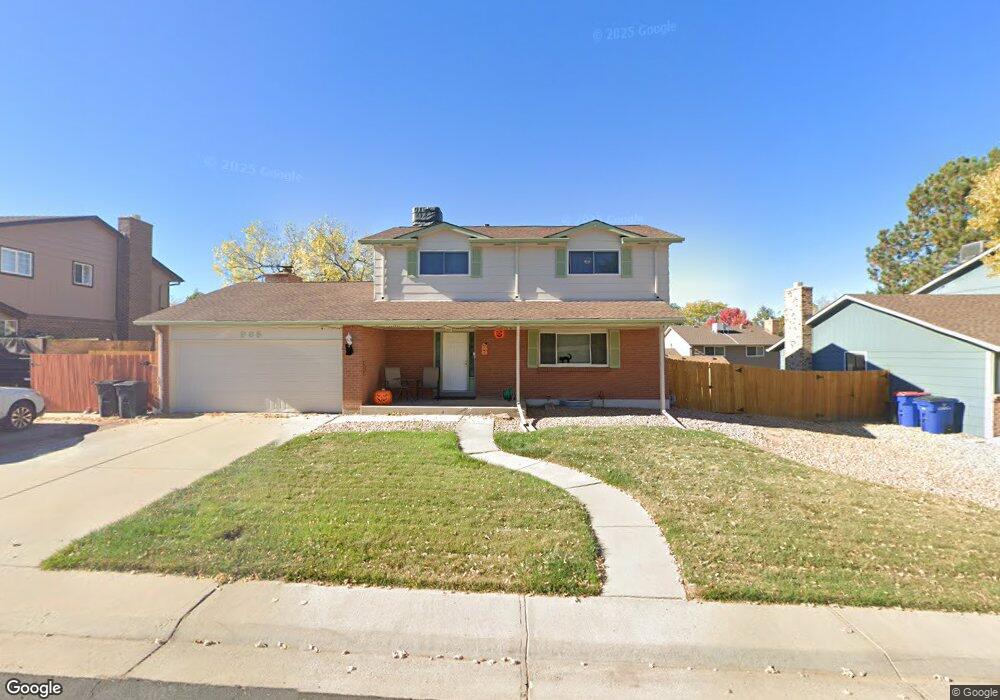
965 Mercury Cir Lone Tree, CO 80124
Estimated Value: $555,644 - $645,000
4
Beds
3
Baths
1,982
Sq Ft
$303/Sq Ft
Est. Value
About This Home
This home is located at 965 Mercury Cir, Lone Tree, CO 80124 and is currently estimated at $600,322, approximately $302 per square foot. 965 Mercury Cir is a home located in Douglas County with nearby schools including Acres Green Elementary School, Cresthill Middle School, and Highlands Ranch High School.
Ownership History
Date
Name
Owned For
Owner Type
Purchase Details
Closed on
Sep 8, 2000
Sold by
Shea Patrick J and Shea Melissa M
Bought by
Clark Bradley Dean and Clark Deborah Dawn
Current Estimated Value
Home Financials for this Owner
Home Financials are based on the most recent Mortgage that was taken out on this home.
Original Mortgage
$221,850
Outstanding Balance
$80,111
Interest Rate
7.97%
Estimated Equity
$520,211
Purchase Details
Closed on
Sep 3, 1998
Sold by
Johnson Jerry A and Johnson Rhonda J
Bought by
Shea Patrick J and Shea Melissa M
Home Financials for this Owner
Home Financials are based on the most recent Mortgage that was taken out on this home.
Original Mortgage
$140,000
Interest Rate
6.87%
Purchase Details
Closed on
Aug 11, 1998
Sold by
Johnson Jerry A
Bought by
Froland Darrel W
Home Financials for this Owner
Home Financials are based on the most recent Mortgage that was taken out on this home.
Original Mortgage
$140,000
Interest Rate
6.87%
Purchase Details
Closed on
Aug 6, 1998
Sold by
Johnson Rhonda J
Bought by
Froland Darrel W
Home Financials for this Owner
Home Financials are based on the most recent Mortgage that was taken out on this home.
Original Mortgage
$140,000
Interest Rate
6.87%
Purchase Details
Closed on
Jul 15, 1997
Sold by
Payne Mark A and Payne Karen L
Bought by
Johnson Jerry A and Johnson Rhonda J
Home Financials for this Owner
Home Financials are based on the most recent Mortgage that was taken out on this home.
Original Mortgage
$152,000
Interest Rate
7.85%
Purchase Details
Closed on
Jun 6, 1991
Sold by
Musgrave Jeffery D and Musgrave Anna E
Bought by
Payne Mark A and Payne Karen L
Purchase Details
Closed on
Sep 7, 1984
Sold by
Falkner Patrick N and Falkner Deana L
Bought by
Musgrave Jeffrey D and Musgrave Anna E
Create a Home Valuation Report for This Property
The Home Valuation Report is an in-depth analysis detailing your home's value as well as a comparison with similar homes in the area
Home Values in the Area
Average Home Value in this Area
Purchase History
| Date | Buyer | Sale Price | Title Company |
|---|---|---|---|
| Clark Bradley Dean | $223,000 | -- | |
| Shea Patrick J | $177,900 | -- | |
| Froland Darrel W | -- | -- | |
| Froland Darrel W | -- | -- | |
| Johnson Jerry A | $160,000 | -- | |
| Payne Mark A | $102,000 | -- | |
| Musgrave Jeffrey D | $95,000 | -- |
Source: Public Records
Mortgage History
| Date | Status | Borrower | Loan Amount |
|---|---|---|---|
| Open | Clark Bradley Dean | $221,850 | |
| Previous Owner | Shea Patrick J | $140,000 | |
| Previous Owner | Johnson Jerry A | $152,000 |
Source: Public Records
Tax History Compared to Growth
Tax History
| Year | Tax Paid | Tax Assessment Tax Assessment Total Assessment is a certain percentage of the fair market value that is determined by local assessors to be the total taxable value of land and additions on the property. | Land | Improvement |
|---|---|---|---|---|
| 2024 | $2,804 | $40,940 | $7,930 | $33,010 |
| 2023 | $2,833 | $40,940 | $7,930 | $33,010 |
| 2022 | $2,011 | $29,530 | $6,730 | $22,800 |
| 2021 | $2,091 | $29,530 | $6,730 | $22,800 |
| 2020 | $1,964 | $28,880 | $6,350 | $22,530 |
| 2019 | $1,971 | $28,880 | $6,350 | $22,530 |
| 2018 | $1,490 | $24,790 | $5,530 | $19,260 |
| 2017 | $1,515 | $24,790 | $5,530 | $19,260 |
| 2016 | $1,908 | $21,710 | $3,890 | $17,820 |
| 2015 | $1,951 | $21,710 | $3,890 | $17,820 |
| 2014 | $1,763 | $18,370 | $3,980 | $14,390 |
Source: Public Records
Map
Nearby Homes
- 789 Hamal Dr
- 802 Altair Dr
- 13117 Deneb Dr
- 13134 Deneb Dr
- 7057 Chestnut Hill St
- 9275 Erminedale Dr
- 8159 Lodgepole Trail
- 7041 Chestnut Hill Trail
- 6887 Chestnut Hill St
- 9412 La Quinta Way
- 9308 Miles Dr Unit 5
- 13483 Achilles Dr
- 181 Dianna Dr
- 13542 Achilles Dr
- 130 Dianna Dr
- 108 Olympus Cir
- 7469 La Quinta Place
- 6426 Nassau Ct
- 9390 Yale Ln
- 8860 Kachina Way
- 959 Mercury Cir
- 969 Mercury Cir
- 13154 Peacock Dr
- 13164 Peacock Dr
- 13144 Peacock Dr
- 955 Mercury Cir
- 964 Mercury Cir
- 975 Mercury Cir
- 13174 Peacock Dr
- 958 Mercury Cir
- 13134 Peacock Dr
- 974 Mercury Cir
- 954 Mercury Cir
- 949 Mercury Cir
- 13184 Peacock Dr
- 13153 Peacock Dr
- 13163 Peacock Dr
- 978 Mercury Cir
- 13183 Rigel Dr
- 13225 Rigel Dr