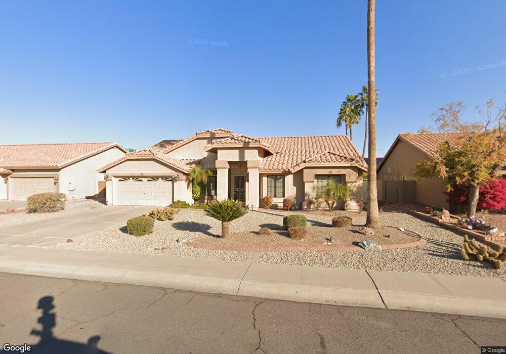
9650 W Sierra Pinta Dr Peoria, AZ 85382
Estimated Value: $438,418 - $548,000
2
Beds
2
Baths
2,147
Sq Ft
$230/Sq Ft
Est. Value
About This Home
This home is located at 9650 W Sierra Pinta Dr, Peoria, AZ 85382 and is currently estimated at $494,355, approximately $230 per square foot. 9650 W Sierra Pinta Dr is a home located in Maricopa County with nearby schools including Apache Elementary School, Sunrise Mountain High School, and Sonoran Science Academy-Peoria.
Ownership History
Date
Name
Owned For
Owner Type
Purchase Details
Closed on
Apr 16, 2019
Sold by
Lewis Joyce M
Bought by
The Joyce M Lewis Trust
Current Estimated Value
Purchase Details
Closed on
Sep 23, 2005
Sold by
Ferlaak Gary M and Ferlaak Barbara J
Bought by
Lewis Joyce
Purchase Details
Closed on
Apr 9, 2003
Sold by
Long Mary F
Bought by
Ferlaak Gary M and Ferlaak Barbara J
Home Financials for this Owner
Home Financials are based on the most recent Mortgage that was taken out on this home.
Original Mortgage
$162,000
Interest Rate
5.54%
Mortgage Type
New Conventional
Purchase Details
Closed on
Feb 27, 1997
Sold by
James Norman A and James Berniece Pearl
Bought by
Long Mary F
Create a Home Valuation Report for This Property
The Home Valuation Report is an in-depth analysis detailing your home's value as well as a comparison with similar homes in the area
Home Values in the Area
Average Home Value in this Area
Purchase History
| Date | Buyer | Sale Price | Title Company |
|---|---|---|---|
| The Joyce M Lewis Trust | -- | None Available | |
| Lewis Joyce | $329,900 | Security Title Agency Inc | |
| Ferlaak Gary M | $180,000 | North American Title Co | |
| Long Mary F | $158,000 | First American Title |
Source: Public Records
Mortgage History
| Date | Status | Borrower | Loan Amount |
|---|---|---|---|
| Previous Owner | Ferlaak Gary M | $162,000 |
Source: Public Records
Tax History Compared to Growth
Tax History
| Year | Tax Paid | Tax Assessment Tax Assessment Total Assessment is a certain percentage of the fair market value that is determined by local assessors to be the total taxable value of land and additions on the property. | Land | Improvement |
|---|---|---|---|---|
| 2025 | $2,114 | $27,160 | -- | -- |
| 2024 | $2,082 | $25,867 | -- | -- |
| 2023 | $2,082 | $34,760 | $6,950 | $27,810 |
| 2022 | $2,039 | $28,770 | $5,750 | $23,020 |
| 2021 | $2,183 | $27,270 | $5,450 | $21,820 |
| 2020 | $2,204 | $26,030 | $5,200 | $20,830 |
| 2019 | $2,132 | $24,160 | $4,830 | $19,330 |
| 2018 | $2,062 | $22,880 | $4,570 | $18,310 |
| 2017 | $2,063 | $21,180 | $4,230 | $16,950 |
| 2016 | $2,042 | $20,010 | $4,000 | $16,010 |
| 2015 | $1,905 | $19,120 | $3,820 | $15,300 |
Source: Public Records
Map
Nearby Homes
- 9627 W Menadota Dr
- 9551 W Sierra Pinta Dr
- 9510 W Menadota Dr
- 20424 N 96th Ln
- 9455 W Behrend Dr
- 9869 W Chino Dr
- 9704 W Tonto Ln
- 9832 W Behrend Dr
- 9403 W Escuda Dr
- 19562 N 96th Ln Unit 80
- 19702 N 98th Ln
- 9529 W Runion Dr
- 9729 W Burnett Rd
- 9901 W Mescalero Ct
- 9706 W Rimrock Dr Unit 95
- 9708 W Rimrock Dr Unit 96
- 19605 N Pine Springs Dr
- 20967 N 96th Ln
- 9856 W Rimrock Dr
- 19838 N Pine Springs Dr
- 9642 W Sierra Pinta Dr
- 9651 W Menadota Dr
- 9643 W Menadota Dr
- 9659 W Menadota Dr
- 9634 W Sierra Pinta Dr
- 9666 W Sierra Pinta Dr
- 9651 W Sierra Pinta Dr
- 9643 W Sierra Pinta Dr
- 9635 W Menadota Dr
- 9667 W Menadota Dr
- 9659 W Sierra Pinta Dr
- 9635 W Sierra Pinta Dr
- 9626 W Sierra Pinta Dr
- 9667 W Sierra Pinta Dr
- 9627 W Sierra Pinta Dr
- 9618 W Sierra Pinta Dr
- 20120 N 97th Ave
- 20110 N 97th Ave
- 9619 W Sierra Pinta Dr
- 20100 N 97th Ave