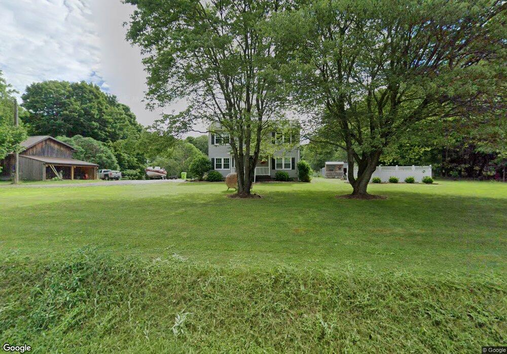
9651 Old Route 99 Mc Kean, PA 16426
Estimated Value: $284,000 - $382,975
4
Beds
3
Baths
1,872
Sq Ft
$173/Sq Ft
Est. Value
About This Home
This home is located at 9651 Old Route 99, Mc Kean, PA 16426 and is currently estimated at $323,994, approximately $173 per square foot. 9651 Old Route 99 is a home located in Erie County with nearby schools including McKean Elementary School, James W. Parker Middle School, and General McLane High School.
Ownership History
Date
Name
Owned For
Owner Type
Purchase Details
Closed on
Sep 29, 2013
Sold by
Timmers John A and Timmers Michele L
Bought by
Comstock Joseph T
Current Estimated Value
Home Financials for this Owner
Home Financials are based on the most recent Mortgage that was taken out on this home.
Original Mortgage
$164,161
Outstanding Balance
$122,970
Interest Rate
4.42%
Mortgage Type
FHA
Estimated Equity
$201,024
Purchase Details
Closed on
Oct 15, 2007
Sold by
Thomas Mark E and Thomas Edith B
Bought by
Timmers John A and Timmers Michele L
Home Financials for this Owner
Home Financials are based on the most recent Mortgage that was taken out on this home.
Original Mortgage
$127,950
Interest Rate
6.39%
Mortgage Type
Purchase Money Mortgage
Create a Home Valuation Report for This Property
The Home Valuation Report is an in-depth analysis detailing your home's value as well as a comparison with similar homes in the area
Home Values in the Area
Average Home Value in this Area
Purchase History
| Date | Buyer | Sale Price | Title Company |
|---|---|---|---|
| Comstock Joseph T | $168,500 | None Available | |
| Timmers John A | $130,000 | None Available |
Source: Public Records
Mortgage History
| Date | Status | Borrower | Loan Amount |
|---|---|---|---|
| Open | Comstock Joseph T | $164,161 | |
| Previous Owner | Timmers John A | $127,950 |
Source: Public Records
Tax History Compared to Growth
Tax History
| Year | Tax Paid | Tax Assessment Tax Assessment Total Assessment is a certain percentage of the fair market value that is determined by local assessors to be the total taxable value of land and additions on the property. | Land | Improvement |
|---|---|---|---|---|
| 2025 | $4,058 | $178,200 | $63,000 | $115,200 |
| 2024 | $3,929 | $178,200 | $63,000 | $115,200 |
| 2023 | $3,698 | $178,200 | $63,000 | $115,200 |
| 2022 | $3,591 | $178,200 | $63,000 | $115,200 |
| 2021 | $3,544 | $178,200 | $63,000 | $115,200 |
| 2020 | $3,500 | $178,200 | $63,000 | $115,200 |
| 2019 | $3,477 | $178,200 | $63,000 | $115,200 |
| 2018 | $3,402 | $178,200 | $63,000 | $115,200 |
| 2017 | $3,402 | $178,200 | $63,000 | $115,200 |
| 2016 | $4,061 | $178,200 | $63,000 | $115,200 |
| 2015 | $4,017 | $178,200 | $63,000 | $115,200 |
| 2014 | $1,926 | $178,200 | $63,000 | $115,200 |
Source: Public Records
Map
Nearby Homes
- 702 Skyline Dr
- 5115 West Rd
- 11897 Silverthorn (Tr 86 Rt T438) Rd
- 209 Timberlake Dr
- 4954 East Ave
- 0 Edinboro Rd Unit 182375
- 4854 N Main St
- 8580 Rick Rd
- 6330 Rick Rd
- 9731 Silverthorn Rd
- 11060 Edinboro Rd
- 8389 Edinboro Rd
- 4919 Old State Rd
- 15 Woodside Dr
- 6797 Sterrettania Rd
- 11261 Lay Rd
- 6419 Sterrettania Rd
- 2880 Cardinal Dr Unit 34
- 2800 Sun Ridge Dr
- 8535 Oliver Rd
- 9670 Old Route 99
- 9600 Old Route 99
- 9644 Old Route 99
- 9690 Old Route 99
- 9683 Old Route 99
- 9711 Old Route 99
- 9696 Edinboro Rd
- 4951 S Hill Rd
- 4971 S Hill Rd
- 4931 S Hill Rd
- 9721 Old Route 99
- 4928 S Hill
- 4928 S Hill Rd
- 9745 Old Route 99
- 9755 Old Route 99
- 9740 Edinboro Rd
- 9579 Old Route 99
- 9755 Edinboro Rd
- 9750 Edinboro Rd