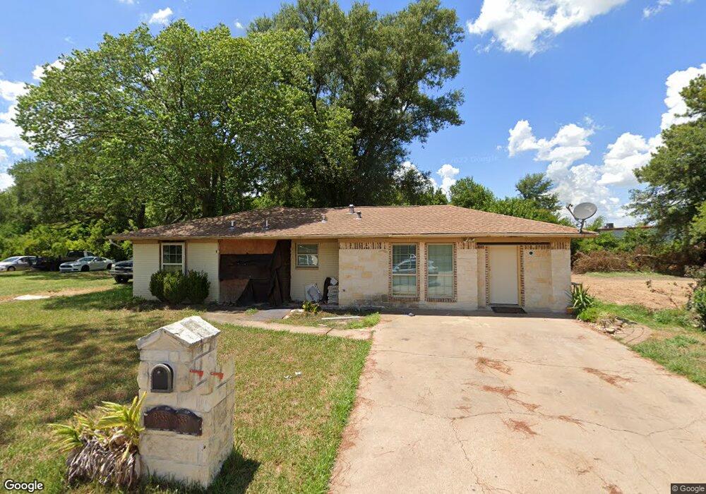
9655 Angie Ln Houston, TX 77038
North Houston NeighborhoodEstimated Value: $128,275 - $208,000
3
Beds
2
Baths
1,154
Sq Ft
$146/Sq Ft
Est. Value
About This Home
This home is located at 9655 Angie Ln, Houston, TX 77038 and is currently estimated at $168,138, approximately $145 per square foot. 9655 Angie Ln is a home located in Harris County with nearby schools including Jerry Keeble Ec/Pre-K, Goodman Elementary School, and Aldine Ninth Grade School.
Ownership History
Date
Name
Owned For
Owner Type
Purchase Details
Closed on
Jul 26, 2022
Sold by
Turrubiartes Cynthia M
Bought by
Tristan Milton E
Current Estimated Value
Purchase Details
Closed on
Nov 4, 2005
Sold by
Overholt Rick
Bought by
Cosme Myrna
Home Financials for this Owner
Home Financials are based on the most recent Mortgage that was taken out on this home.
Original Mortgage
$62,000
Interest Rate
5.9%
Mortgage Type
Fannie Mae Freddie Mac
Purchase Details
Closed on
Jan 5, 2005
Sold by
Associates First Capital Corp
Bought by
Overholt Rick
Purchase Details
Closed on
Jul 11, 1997
Sold by
Sumlin Bonita
Bought by
Malbro John
Create a Home Valuation Report for This Property
The Home Valuation Report is an in-depth analysis detailing your home's value as well as a comparison with similar homes in the area
Home Values in the Area
Average Home Value in this Area
Purchase History
| Date | Buyer | Sale Price | Title Company |
|---|---|---|---|
| Tristan Milton E | -- | Capital Title | |
| Cosme Myrna | -- | Stewart Title Houston Div | |
| Overholt Rick | -- | First American Title | |
| Malbro John | -- | -- |
Source: Public Records
Mortgage History
| Date | Status | Borrower | Loan Amount |
|---|---|---|---|
| Previous Owner | Cosme Myrna | $62,000 |
Source: Public Records
Tax History Compared to Growth
Tax History
| Year | Tax Paid | Tax Assessment Tax Assessment Total Assessment is a certain percentage of the fair market value that is determined by local assessors to be the total taxable value of land and additions on the property. | Land | Improvement |
|---|---|---|---|---|
| 2025 | -- | -- | -- | -- |
| 2024 | -- | -- | -- | -- |
| 2023 | -- | -- | -- | -- |
| 2022 | $1,143 | $55,809 | $14,721 | $41,088 |
| 2021 | $1,201 | $55,809 | $14,296 | $41,513 |
| 2020 | $1,268 | $55,809 | $14,296 | $41,513 |
| 2019 | $1,328 | $55,809 | $15,372 | $40,437 |
| 2018 | $801 | $55,809 | $15,372 | $40,437 |
| 2017 | $1,265 | $55,809 | $15,372 | $40,437 |
| 2016 | $1,045 | $46,116 | $9,150 | $36,966 |
| 2015 | $1,028 | $46,116 | $9,150 | $36,966 |
| 2014 | $1,028 | $46,116 | $9,150 | $36,966 |
Source: Public Records
Map
Nearby Homes
- 9710 Debbie Ln
- 0 Veterans Memorial Rd Unit 43555293
- 1326 Twin Falls Rd
- 1119 Twin Falls Rd
- 1102 Mosher Ln
- 1330 Mosher Ln
- 907 Twin Falls Rd
- 1615 Mosher Ln
- 1011 Beaver Bend Rd
- 1710 Beaver Bend Rd
- 10026 Lasaber Ct
- 2110 Mosher Ln
- 1907 Bunzel St
- 1806 Saddle Rock Dr Unit 770
- 10134 Lasaber Ct
- 9621 Sweetwater Ln
- 8835 Glenhouse Dr
- 9018 Lazy River Ln
- 9006 Winding River Dr
- 2146 Twinbrooke Dr
- 9659 Angie Ln
- 9654 Angie Ln
- 9658 Angie Ln
- 9642 Angie Ln
- 9666 Angie Ln
- 9707 Rose Mist Ln
- 9711 Rose Mist Ln
- 9715 Rose Mist Ln
- 1217 Blue Bell Rd
- 9719 Rose Mist Ln
- 9723 Rose Mist Ln
- 9727 Rose Mist Ln
- 9703 Rose Mist Ln
- 9731 Rose Mist Ln
- 9735 Rose Mist Ln
- 9702 Daisy Mist Ln
- 9739 Rose Mist Ln
- 1222 Blue Bell Rd
- 9707 Daisy Mist Ln
- 9706 Daisy Mist Ln