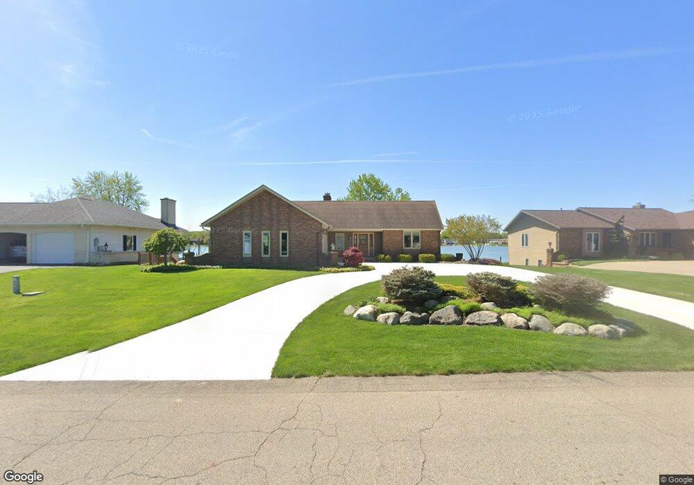
966 Brentwood St Jenison, MI 49428
Estimated Value: $428,000 - $506,000
4
Beds
3
Baths
1,460
Sq Ft
$332/Sq Ft
Est. Value
About This Home
This home is located at 966 Brentwood St, Jenison, MI 49428 and is currently estimated at $484,661, approximately $331 per square foot. 966 Brentwood St is a home located in Ottawa County with nearby schools including Bursley School, Jenison Junior High School, and Jenison High School.
Ownership History
Date
Name
Owned For
Owner Type
Purchase Details
Closed on
Jan 6, 2014
Sold by
Opatic James and Opatic Elizabeth
Bought by
Cox James T and Cox Kristin M
Current Estimated Value
Home Financials for this Owner
Home Financials are based on the most recent Mortgage that was taken out on this home.
Original Mortgage
$120,000
Outstanding Balance
$90,315
Interest Rate
4.31%
Mortgage Type
New Conventional
Estimated Equity
$394,346
Create a Home Valuation Report for This Property
The Home Valuation Report is an in-depth analysis detailing your home's value as well as a comparison with similar homes in the area
Home Values in the Area
Average Home Value in this Area
Purchase History
| Date | Buyer | Sale Price | Title Company |
|---|---|---|---|
| Cox James T | $180,000 | None Available |
Source: Public Records
Mortgage History
| Date | Status | Borrower | Loan Amount |
|---|---|---|---|
| Open | Cox James T | $120,000 |
Source: Public Records
Tax History Compared to Growth
Tax History
| Year | Tax Paid | Tax Assessment Tax Assessment Total Assessment is a certain percentage of the fair market value that is determined by local assessors to be the total taxable value of land and additions on the property. | Land | Improvement |
|---|---|---|---|---|
| 2025 | $4,662 | $267,800 | $0 | $0 |
| 2024 | $3,894 | $227,900 | $0 | $0 |
| 2023 | $3,718 | $210,800 | $0 | $0 |
| 2022 | $4,256 | $198,700 | $0 | $0 |
| 2021 | $4,137 | $175,100 | $0 | $0 |
| 2020 | $4,094 | $171,500 | $0 | $0 |
| 2019 | $4,097 | $166,400 | $0 | $0 |
| 2018 | $3,833 | $154,600 | $0 | $0 |
| 2017 | $3,769 | $151,900 | $0 | $0 |
| 2016 | $3,747 | $150,000 | $0 | $0 |
| 2015 | $3,584 | $143,300 | $0 | $0 |
| 2014 | $3,584 | $129,800 | $0 | $0 |
Source: Public Records
Map
Nearby Homes
- 950 Brentwood St
- 1241 S Marymark Dr
- 6516 Andre's Crossing
- 6501 Andre's Crossing Unit 14
- 6451 12th Ave
- 7452 Melody Ln
- 1306 Carol Dr
- 1361 Carol Dr
- 7482 Louise Ave
- 1433 Winifred St
- 1101 Robin St
- 7450 Boulder Bluff Dr Unit 66
- 7450 Boulder Bluff Dr Unit 61
- 6905 Maple Ave
- 1187 Fairfield Dr
- 1037 Fairfield Dr
- 893 Baldwin St
- 7425 Boulder Bluff Dr Unit 112
- 180 Brookwood Ct SW
- 1355 Bent Tree Dr Unit 12
- 984 Brentwood St
- 1000 Brentwood St
- 934 Brentwood St
- 981 Brentwood St
- 848 Brentwood St
- 967 Brentwood St
- 920 Brentwood St
- 1010 Brentwood St
- 951 Brentwood St
- 1005 Brentwood St
- 1018 Brentwood St
- 904 Brentwood St
- 927 Brentwood St
- 6965 Cranford Ave
- 993 Brentwood St
- 1017 Brentwood St
- 1030 Brentwood St
- 890 Brentwood St
- 6966 Cranford Ave
- 1029 Brentwood St