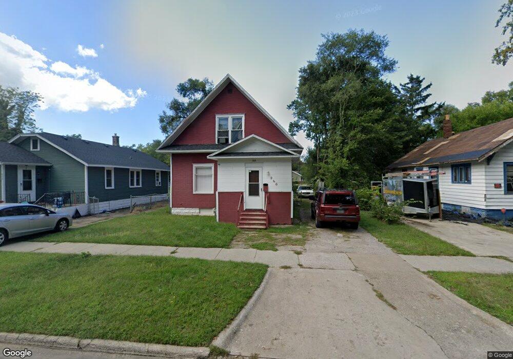
966 Jennings Ave Benton Harbor, MI 49022
Estimated Value: $84,000 - $117,000
3
Beds
2
Baths
1,260
Sq Ft
$78/Sq Ft
Est. Value
About This Home
This home is located at 966 Jennings Ave, Benton Harbor, MI 49022 and is currently estimated at $98,246, approximately $77 per square foot. 966 Jennings Ave is a home located in Berrien County with nearby schools including Fair Plain Middle School, Benton Harbor High School, and Benton Harbor Charter School Academy.
Ownership History
Date
Name
Owned For
Owner Type
Purchase Details
Closed on
Jan 29, 2021
Sold by
M & W Rental Properties Llc
Bought by
Scott Bennett & Stein Properties Llc
Current Estimated Value
Purchase Details
Closed on
Mar 15, 1998
Purchase Details
Closed on
Jan 26, 1998
Purchase Details
Closed on
Oct 3, 1996
Purchase Details
Closed on
Feb 7, 1996
Purchase Details
Closed on
Oct 25, 1993
Purchase Details
Closed on
Aug 1, 1988
Purchase Details
Closed on
Aug 1, 1976
Create a Home Valuation Report for This Property
The Home Valuation Report is an in-depth analysis detailing your home's value as well as a comparison with similar homes in the area
Home Values in the Area
Average Home Value in this Area
Purchase History
| Date | Buyer | Sale Price | Title Company |
|---|---|---|---|
| Scott Bennett & Stein Properties Llc | -- | None Available | |
| -- | -- | -- | |
| -- | $100 | -- | |
| -- | -- | -- | |
| -- | -- | -- | |
| -- | -- | -- | |
| -- | -- | -- | |
| -- | -- | -- | |
| -- | $2,000 | -- |
Source: Public Records
Mortgage History
| Date | Status | Borrower | Loan Amount |
|---|---|---|---|
| Closed | Scott Bennett & Stein Properties Llc | $0 |
Source: Public Records
Tax History Compared to Growth
Tax History
| Year | Tax Paid | Tax Assessment Tax Assessment Total Assessment is a certain percentage of the fair market value that is determined by local assessors to be the total taxable value of land and additions on the property. | Land | Improvement |
|---|---|---|---|---|
| 2025 | $954 | $30,000 | $0 | $0 |
| 2024 | $918 | $26,500 | $0 | $0 |
| 2023 | $734 | $18,600 | $0 | $0 |
| 2022 | $833 | $13,800 | $0 | $0 |
| 2021 | $700 | $13,700 | $700 | $13,000 |
| 2020 | $1,314 | $13,900 | $0 | $0 |
| 2019 | $625 | $12,600 | $0 | $0 |
| 2018 | $610 | $12,400 | $0 | $0 |
| 2017 | $598 | $9,700 | $0 | $0 |
| 2016 | $588 | $9,800 | $0 | $0 |
| 2015 | $587 | $9,400 | $0 | $0 |
| 2014 | $634 | $11,400 | $0 | $0 |
Source: Public Records
Map
Nearby Homes
- 960 Jennings Ave
- 1129 Jennings Ave
- 960 Union Ave
- 349 E Empire Ave
- 972 Pearl St
- 361 E May St
- 1219 Ogden Ave
- 1097 Pearl St
- 833 Pearl St
- 730 Superior St
- 1045 Broadway
- 1301 Superior St
- 688 S Fair Ave
- 0 V/L E Empire Ave
- 872 Mcalister Ave
- 1267 Broadway
- 1332 Columbus Ave
- 979 Lavette Ave
- 1337 Agard Ave
- 171 E Empire Ave
- 974 Jennings Ave
- 982 Jennings Ave
- 965 Jennings Ave
- 975 Jennings Ave
- 946 Jennings Ave
- 990 Jennings Ave
- 961 Jennings Ave
- 998 Jennings Ave
- 989 Jennings Ave
- 947 Jennings Ave
- 938 Jennings Ave
- 995 Jennings Ave
- 955 Monroe St
- 969 Monroe St
- 961 Monroe St
- 975 Monroe St
- 983 Monroe St
- 939 Jennings Ave
- 947 Monroe St
- 930 Jennings Ave