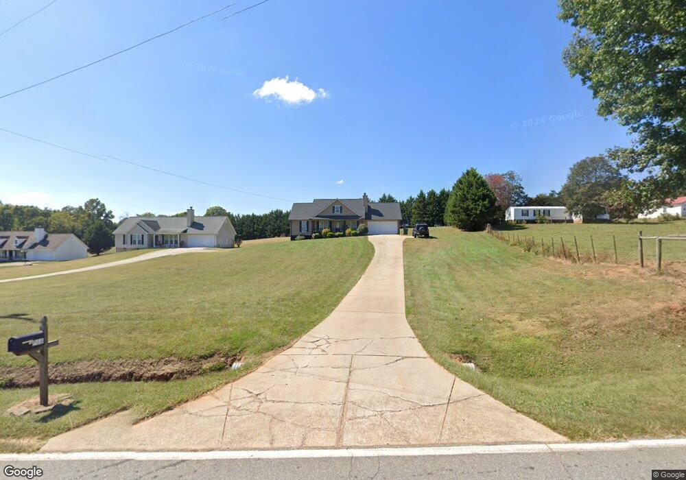
966 Lothridge Rd Cleveland, GA 30528
Estimated Value: $291,000 - $312,000
3
Beds
2
Baths
1,178
Sq Ft
$259/Sq Ft
Est. Value
About This Home
This home is located at 966 Lothridge Rd, Cleveland, GA 30528 and is currently estimated at $305,386, approximately $259 per square foot. 966 Lothridge Rd is a home located in White County with nearby schools including White County 9th Grade Academy, Mount Yonah Elementary School, and White County Middle School.
Ownership History
Date
Name
Owned For
Owner Type
Purchase Details
Closed on
Dec 1, 2008
Sold by
Not Provided
Bought by
Johnson April D
Current Estimated Value
Purchase Details
Closed on
Oct 7, 2008
Sold by
Countrywide Home Loans Inc
Bought by
Sec Of Housing & Urban
Purchase Details
Closed on
Sep 1, 2007
Sold by
Not Provided
Bought by
Johnson April D
Home Financials for this Owner
Home Financials are based on the most recent Mortgage that was taken out on this home.
Original Mortgage
$139,410
Interest Rate
6.63%
Mortgage Type
FHA
Purchase Details
Closed on
Oct 1, 2006
Sold by
Not Provided
Bought by
Johnson April D
Create a Home Valuation Report for This Property
The Home Valuation Report is an in-depth analysis detailing your home's value as well as a comparison with similar homes in the area
Home Values in the Area
Average Home Value in this Area
Purchase History
| Date | Buyer | Sale Price | Title Company |
|---|---|---|---|
| Johnson April D | -- | -- | |
| Sec Of Housing & Urban | -- | -- | |
| Countrywide Home Loans Inc | -- | -- | |
| Johnson April D | $141,600 | -- | |
| Johnson April D | $315,000 | -- |
Source: Public Records
Mortgage History
| Date | Status | Borrower | Loan Amount |
|---|---|---|---|
| Previous Owner | Johnson April D | $139,410 |
Source: Public Records
Tax History Compared to Growth
Tax History
| Year | Tax Paid | Tax Assessment Tax Assessment Total Assessment is a certain percentage of the fair market value that is determined by local assessors to be the total taxable value of land and additions on the property. | Land | Improvement |
|---|---|---|---|---|
| 2025 | $1,348 | $83,572 | $10,984 | $72,588 |
| 2024 | $1,348 | $82,472 | $9,884 | $72,588 |
| 2023 | $924 | $71,584 | $8,788 | $62,796 |
| 2022 | $1,270 | $62,084 | $7,688 | $54,396 |
| 2021 | $1,227 | $49,108 | $6,056 | $43,052 |
| 2020 | $1,204 | $44,776 | $5,624 | $39,152 |
| 2019 | $1,208 | $44,776 | $5,624 | $39,152 |
| 2018 | $1,208 | $44,776 | $5,624 | $39,152 |
| 2017 | $1,109 | $41,632 | $5,624 | $36,008 |
| 2016 | $1,109 | $41,632 | $5,624 | $36,008 |
| 2015 | $1,058 | $104,080 | $5,624 | $36,008 |
| 2014 | $974 | $96,040 | $0 | $0 |
Source: Public Records
Map
Nearby Homes
- 79 Hampton Hills Ln
- 164 Leatherford Rd
- 0 Holiness Campground Rd Unit 10629188
- 915 Holiness Campground Rd
- 0 Black Rd Unit 7662078
- 0 Black Rd Unit 10620540
- 2011 Lothridge Rd
- 841 Yonah Meadow Dr
- 0 Highway 115 E Unit 10627896
- 1021 Black Rd
- 22 Laurel Park Dr
- 00 Freeman Rd
- 0 Freeman Rd Unit LOT 3 10539998
- 0 Freeman Rd Unit LOT 4
- 0 Freeman Rd Unit LOT 2 10539989
- 675 Washboard Rd
- 2301 Highway 254
- 0 Highland Forest Rd Unit TRACT "2" 10559371
- 96 Joyce Dr Unit (OFF AIRPORT ROAD)
- 77 N Shore Dr
- 998 Lothridge Rd
- 1042 Lothridge Rd
- 1044 Lothridge Rd Unit 5
- 1044 Lothridge Rd
- 246 Skelton Rd
- 2451 Black Rd
- 2499 Black Rd
- 2449 Black Rd
- 345 Skelton Rd
- 2501 Black Rd
- 749 Lothridge Rd
- 2444 Black Rd
- 2506 Black Rd
- 915 Lothridge Rd
- 2410 Black Rd
- 75 Skelton Rd
- 123 Skelton Rd
- 1219 Lothridge Rd
- 2174 Black Rd
- 23 Autumn Ln