Estimated Value: $242,666 - $277,000
3
Beds
2
Baths
1,518
Sq Ft
$175/Sq Ft
Est. Value
About This Home
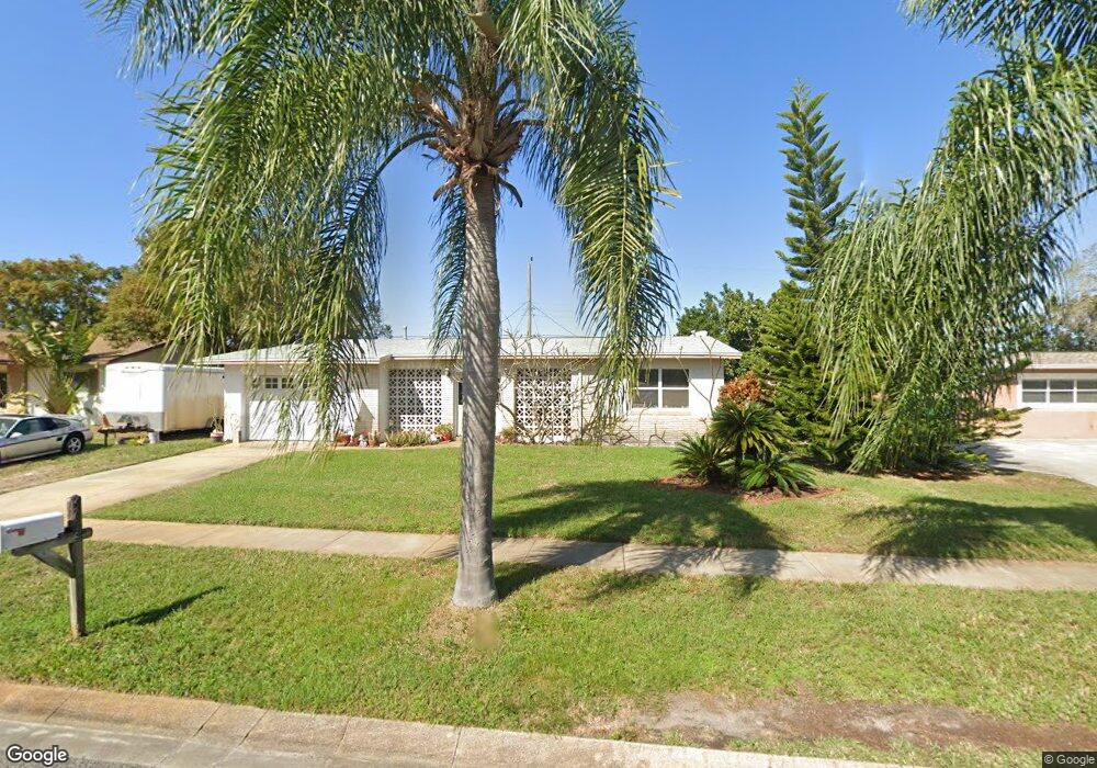
This home is located at 966 MacCo Rd, Cocoa, FL 32927 and is currently estimated at $265,167, approximately $174 per square foot. 966 MacCo Rd is a home located in Brevard County with nearby schools including Atlantis Elementary School, Space Coast Junior/Senior High School, and East Atlantic Prep of Brevard County.
Ownership History
Date
Name
Owned For
Owner Type
Purchase Details
Closed on
Nov 21, 2005
Sold by
Craigen Bridgett A and Pulliam Bridgett A
Bought by
Craigen Mark J
Current Estimated Value
Home Financials for this Owner
Home Financials are based on the most recent Mortgage that was taken out on this home.
Original Mortgage
$95,000
Outstanding Balance
$50,708
Interest Rate
5.62%
Estimated Equity
$214,459
Purchase Details
Closed on
Oct 20, 2005
Sold by
Craigen Bridgette
Bought by
Craigen Mark
Home Financials for this Owner
Home Financials are based on the most recent Mortgage that was taken out on this home.
Original Mortgage
$95,000
Outstanding Balance
$50,708
Interest Rate
5.62%
Estimated Equity
$214,459
Create a Home Valuation Report for This Property
The Home Valuation Report is an in-depth analysis detailing your home's value as well as a comparison with similar homes in the area
Home Values in the Area
Average Home Value in this Area
Purchase History
| Date | Buyer | Sale Price | Title Company |
|---|---|---|---|
| Craigen Mark J | -- | -- | |
| Craigen Mark | -- | -- |
Source: Public Records
Mortgage History
| Date | Status | Borrower | Loan Amount |
|---|---|---|---|
| Open | Craigen Mark J | $95,000 |
Source: Public Records
Tax History Compared to Growth
Tax History
| Year | Tax Paid | Tax Assessment Tax Assessment Total Assessment is a certain percentage of the fair market value that is determined by local assessors to be the total taxable value of land and additions on the property. | Land | Improvement |
|---|---|---|---|---|
| 2025 | $813 | $60,400 | -- | -- |
| 2024 | $787 | $44,550 | -- | -- |
| 2023 | $787 | $43,260 | $0 | $0 |
| 2022 | $748 | $42,000 | $0 | $0 |
| 2021 | $731 | $40,780 | $0 | $0 |
| 2020 | $678 | $40,220 | $0 | $0 |
| 2019 | $615 | $39,320 | $0 | $0 |
| 2018 | $605 | $38,590 | $0 | $0 |
| 2017 | $591 | $37,800 | $0 | $0 |
| 2016 | $581 | $37,030 | $18,000 | $19,030 |
| 2015 | $574 | $36,780 | $15,000 | $21,780 |
| 2014 | $572 | $36,490 | $11,000 | $25,490 |
Source: Public Records
Map
Nearby Homes
- 000 Arabella Ln
- 973 Poinsetta St
- 977 Poinsetta St
- 1010 Illinois Rd
- 1008 Jersey St
- 361 Payne Ave
- 961 Kaufman St
- 1029 Illinois Rd
- 973 Kaufman St
- 520 Arabella Ln
- 995 Barclay Dr
- 453 Camel Cir
- 219 Fecco St
- 1015 Hibiscus St
- 0 Kanawha St
- 208 Capron Rd
- 7210 N Highway 1 Unit 102
- 7240 N Highway 1 Unit 106
- 7170 N Highway 1 Unit 103
- 3970 Curtis Blvd