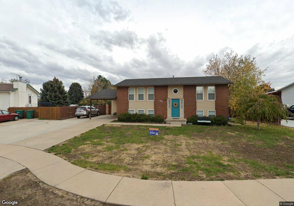
966 S 25 E Layton, UT 84041
Estimated Value: $422,000 - $442,000
5
Beds
2
Baths
1,986
Sq Ft
$218/Sq Ft
Est. Value
About This Home
This home is located at 966 S 25 E, Layton, UT 84041 and is currently estimated at $433,115, approximately $218 per square foot. 966 S 25 E is a home located in Davis County with nearby schools including Layton Elementary School, Fairfield Junior High School, and Davis High School.
Ownership History
Date
Name
Owned For
Owner Type
Purchase Details
Closed on
Jul 14, 2020
Sold by
Hancock Amanda Davis
Bought by
Davis Amanda Maria
Current Estimated Value
Purchase Details
Closed on
Apr 8, 2014
Sold by
Randall Jason K and Randall Stacy
Bought by
Hancock Amanda Davis
Home Financials for this Owner
Home Financials are based on the most recent Mortgage that was taken out on this home.
Original Mortgage
$85,500
Interest Rate
4.32%
Mortgage Type
New Conventional
Purchase Details
Closed on
May 13, 2010
Sold by
Buhler Yvonne J and Buhler Randall H
Bought by
Randall Jason K and Randall Stacy
Home Financials for this Owner
Home Financials are based on the most recent Mortgage that was taken out on this home.
Original Mortgage
$140,113
Interest Rate
5.05%
Mortgage Type
FHA
Create a Home Valuation Report for This Property
The Home Valuation Report is an in-depth analysis detailing your home's value as well as a comparison with similar homes in the area
Home Values in the Area
Average Home Value in this Area
Purchase History
| Date | Buyer | Sale Price | Title Company |
|---|---|---|---|
| Davis Amanda Maria | -- | None Available | |
| Hancock Amanda Davis | -- | Hickman Land Title C | |
| Randall Jason K | -- | Equity Title Ins Agency Inc |
Source: Public Records
Mortgage History
| Date | Status | Borrower | Loan Amount |
|---|---|---|---|
| Previous Owner | Hancock Amanda Davis | $85,500 | |
| Previous Owner | Randall Jason K | $140,113 |
Source: Public Records
Tax History
| Year | Tax Paid | Tax Assessment Tax Assessment Total Assessment is a certain percentage of the fair market value that is determined by local assessors to be the total taxable value of land and additions on the property. | Land | Improvement |
|---|---|---|---|---|
| 2025 | $2,143 | $224,951 | $106,211 | $118,740 |
| 2024 | $2,070 | $218,900 | $118,446 | $100,454 |
| 2023 | $1,931 | $360,000 | $115,293 | $244,707 |
| 2022 | $2,081 | $210,650 | $73,391 | $137,259 |
| 2021 | $1,862 | $281,000 | $110,122 | $170,878 |
| 2020 | $1,678 | $243,000 | $92,264 | $150,736 |
| 2019 | $1,615 | $229,000 | $95,783 | $133,217 |
| 2018 | $1,468 | $209,000 | $83,884 | $125,116 |
| 2016 | $1,281 | $94,105 | $32,390 | $61,715 |
| 2015 | $1,218 | $84,920 | $32,390 | $52,530 |
| 2014 | $1,240 | $88,399 | $32,390 | $56,009 |
| 2013 | -- | $78,335 | $17,588 | $60,747 |
Source: Public Records
Map
Nearby Homes
- 80 E 850 S
- 799 S 125 E
- 949 S 225 E
- 948 S 250 E
- 282 E 925 S
- 753 S 300 E
- 1460 W Pleasant View Dr Unit 7
- 1435 W Pleasant View Dr Unit 37
- 1439 W Pleasant View Dr Unit 35
- 1440 W Pleasant View Dr Unit 3
- 389 Morgan St
- 706 S 600 E
- 811 S Main St
- 623 E Clearwater Dr Unit 15
- 189 S Main St Unit 76
- 189 S Main St Unit 21
- 905 S Main St Unit G
- 895 S Main St Unit E
- 917 S Main St Unit H
- 617 E 405 S
Your Personal Tour Guide
Ask me questions while you tour the home.