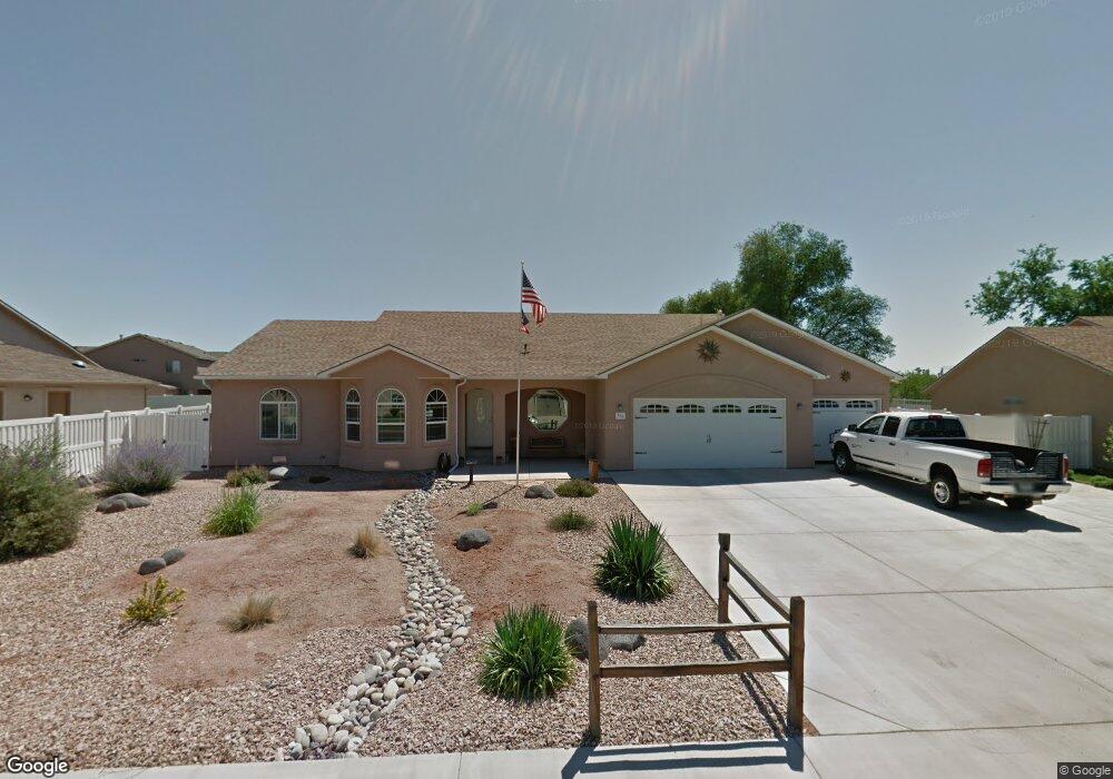
966 Sabil Dr Fruita, CO 81521
Estimated Value: $604,813 - $683,000
3
Beds
3
Baths
2,271
Sq Ft
$283/Sq Ft
Est. Value
About This Home
This home is located at 966 Sabil Dr, Fruita, CO 81521 and is currently estimated at $642,703, approximately $283 per square foot. 966 Sabil Dr is a home located in Mesa County with nearby schools including Monument Ridge Elementary School, Fruita Middle School, and Fruita 8/9 School.
Ownership History
Date
Name
Owned For
Owner Type
Purchase Details
Closed on
Aug 18, 2016
Sold by
Tubach Tom R and Tubach Penny L
Bought by
Tubach Tom R and Tubach Penny
Current Estimated Value
Purchase Details
Closed on
Jun 15, 2006
Sold by
Wildwood Fruita Homes Llc
Bought by
Tubach Tom R and Tubach Penny L
Home Financials for this Owner
Home Financials are based on the most recent Mortgage that was taken out on this home.
Original Mortgage
$300,000
Outstanding Balance
$174,394
Interest Rate
6.37%
Mortgage Type
Fannie Mae Freddie Mac
Estimated Equity
$468,309
Create a Home Valuation Report for This Property
The Home Valuation Report is an in-depth analysis detailing your home's value as well as a comparison with similar homes in the area
Home Values in the Area
Average Home Value in this Area
Purchase History
| Date | Buyer | Sale Price | Title Company |
|---|---|---|---|
| Tubach Tom R | -- | None Available | |
| Tubach Tom R | -- | None Available | |
| Tubach Tom R | $316,631 | Fahtco |
Source: Public Records
Mortgage History
| Date | Status | Borrower | Loan Amount |
|---|---|---|---|
| Open | Tubach Tom R | $300,000 |
Source: Public Records
Tax History
| Year | Tax Paid | Tax Assessment Tax Assessment Total Assessment is a certain percentage of the fair market value that is determined by local assessors to be the total taxable value of land and additions on the property. | Land | Improvement |
|---|---|---|---|---|
| 2024 | $2,251 | $34,300 | $5,930 | $28,370 |
| 2023 | $2,251 | $34,300 | $5,930 | $28,370 |
| 2022 | $1,818 | $28,870 | $4,170 | $24,700 |
| 2021 | $1,830 | $29,700 | $4,290 | $25,410 |
| 2020 | $1,501 | $26,010 | $4,220 | $21,790 |
| 2019 | $1,431 | $26,010 | $4,220 | $21,790 |
| 2018 | $1,234 | $22,200 | $3,780 | $18,420 |
| 2017 | $1,185 | $22,200 | $3,780 | $18,420 |
| 2016 | $1,557 | $21,870 | $3,980 | $17,890 |
Source: Public Records
Map
Nearby Homes
- 858 St Peppin Dr
- 791 Yew St
- 951 Vintners Ct
- 921 Caledonia Ct
- 1105 Sprocket Ct
- 1026 Lone Tree Ct
- 1107 Mee Canyon Cir
- 1109 Mee Canyon Cir
- 362 Toms Canyon Dr
- 370 Toms Canyon Dr
- 1124 Sprocket Ct
- 1112 Sprocket Ct
- 1111 Sprocket Ct
- 825 E Ottley Ave Unit B9
- 825 E Ottley Ave Unit B5
- 825 E Ottley Ave Unit F1
- 825 E Ottley Ave Unit E 3
- 825 E Ottley Ave Unit F4
- 516 Vermont Ln
- 1123 Sprocket Ct
- 944 Sabil Dr
- 748 Dean Ct
- 965 Sabil Dr
- 0 Wildwood Dr Unit 639036
- 0 Wildwood Dr Unit 598874
- 0 Wildwood Dr Unit 628157
- 0 Wildwood Dr Unit 630557
- 0 Wildwood Dr Unit 630555
- 0 Wildwood Dr Unit 633355
- 0 Wildwood Dr Unit 638792
- 943 Sabil Dr
- 998 Wildwood Dr
- 989 Sabil Dr
- 922 Sabil Dr
- 772 Dean Ct
- 921 Sabil Dr
- 993 Dee Ann St
- 856 Darcy Jo Ln
- 892 Darcy Jo Ln
- 715 Doug Dr
Your Personal Tour Guide
Ask me questions while you tour the home.