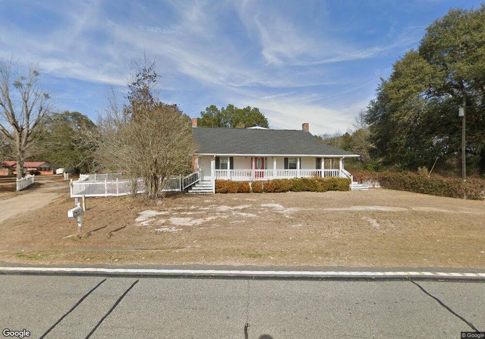
9667 Ga Highway 200 Damascus, GA 39841
Estimated Value: $172,000 - $374,000
4
Beds
4
Baths
3,277
Sq Ft
$83/Sq Ft
Est. Value
About This Home
This home is located at 9667 Ga Highway 200, Damascus, GA 39841 and is currently estimated at $270,381, approximately $82 per square foot. 9667 Ga Highway 200 is a home located in Early County with nearby schools including Early County Elementary School, Early County Middle School, and Early County High School.
Ownership History
Date
Name
Owned For
Owner Type
Purchase Details
Closed on
Mar 16, 2016
Sold by
Moore Brandon Michael
Bought by
Moore Martha Dale
Current Estimated Value
Purchase Details
Closed on
Aug 15, 2012
Sold by
Moore Martha Dale
Bought by
Moore Brandon Michael
Purchase Details
Closed on
Aug 16, 2006
Sold by
Moore Michael A
Bought by
Moore Michael A and Moore Martha Dale
Purchase Details
Closed on
Apr 12, 2005
Sold by
Mcdowell Heath E
Bought by
Moore Michael A
Home Financials for this Owner
Home Financials are based on the most recent Mortgage that was taken out on this home.
Original Mortgage
$18,000
Interest Rate
5.88%
Mortgage Type
New Conventional
Purchase Details
Closed on
Nov 28, 2002
Sold by
Smith Robert Lane An
Bought by
Mcdowell Heath E
Purchase Details
Closed on
Aug 26, 1998
Sold by
Parrish Sue Ellen
Bought by
Smith Robert Lane An
Purchase Details
Closed on
Dec 13, 1996
Bought by
Parrish Sue Ellen
Create a Home Valuation Report for This Property
The Home Valuation Report is an in-depth analysis detailing your home's value as well as a comparison with similar homes in the area
Home Values in the Area
Average Home Value in this Area
Purchase History
| Date | Buyer | Sale Price | Title Company |
|---|---|---|---|
| Moore Martha Dale | -- | -- | |
| Moore Brandon Michael | -- | -- | |
| Moore Michael A | -- | -- | |
| Moore Michael A | $18,000 | -- | |
| Mcdowell Heath E | $25,500 | -- | |
| Smith Robert Lane An | $23,000 | -- | |
| Parrish Sue Ellen | -- | -- |
Source: Public Records
Mortgage History
| Date | Status | Borrower | Loan Amount |
|---|---|---|---|
| Previous Owner | Moore Michael A | $18,000 |
Source: Public Records
Tax History Compared to Growth
Tax History
| Year | Tax Paid | Tax Assessment Tax Assessment Total Assessment is a certain percentage of the fair market value that is determined by local assessors to be the total taxable value of land and additions on the property. | Land | Improvement |
|---|---|---|---|---|
| 2024 | $1,649 | $63,232 | $2,976 | $60,256 |
| 2023 | $1,559 | $63,232 | $2,976 | $60,256 |
| 2022 | $1,519 | $62,217 | $2,152 | $60,065 |
| 2021 | $1,352 | $55,110 | $2,152 | $52,958 |
| 2020 | $1,324 | $54,994 | $2,152 | $52,842 |
| 2019 | $1,261 | $51,038 | $2,152 | $48,886 |
| 2018 | $1,261 | $51,038 | $2,152 | $48,886 |
| 2017 | $1,296 | $52,312 | $2,152 | $50,160 |
| 2016 | $1,233 | $48,260 | $2,152 | $46,108 |
| 2015 | -- | $48,692 | $1,845 | $46,847 |
| 2014 | -- | $48,692 | $1,845 | $46,847 |
| 2013 | -- | $48,692 | $1,845 | $46,846 |
Source: Public Records
Map
Nearby Homes
- 8667 Joe Bryan St
- 7855 Joe Bryan St
- Pullen Rd
- 0 Big Pond Rd
- 17015 Arlington Hwy
- 1563 Ga Highway 27 N
- 745 Harmony Church Rd
- 17234 S Highland Ave
- 10 Re Jennings Ave SE
- Nantze Springs Rd
- 000 Georgia 200
- 69 Greenleaf Ave NE
- 18802 E South Blvd
- 000 Georgia 62
- 0 Nantze Springs Rd
- 216 Willow Glen Dr
- 203 Willow Glen Dr
- 74 S Lancelot St
- 21141 Lucile Rd
- 93 Arnall Blvd
- 9613 Ga Highway 200
- 9551 Ga Highway 200
- 9457 Ga Highway 200
- 9816 Ga Highway 200
- 9333 Ga Highway 200
- 10030 Ga Highway 200
- 9285 Ga Highway 200
- 1758 White Pond Rd
- 9167 Highway 200
- 1471 White Pond Rd
- 567 Willis Grove Rd
- 10239 Ga Highway 200
- 8900 Ga Highway 200
- 10219 Ga Highway 200
- 1474 White Pond Rd
- 10403 Ga Highway 200
- 8786 Ga Highway 200
- 570 White Pond Rd
- 994 White Pond Rd
- 8000 Five Bridges Rd