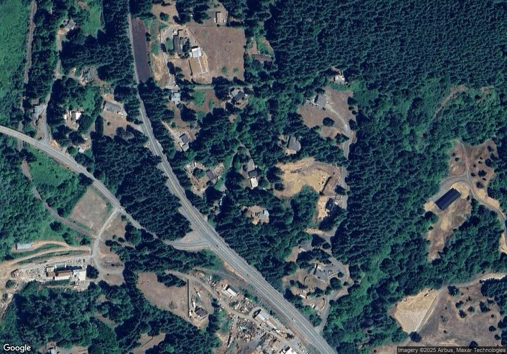
96685 Highway 42 Coos Bay, OR 97420
Estimated Value: $333,000 - $421,424
2
Beds
1
Bath
1,396
Sq Ft
$270/Sq Ft
Est. Value
About This Home
This home is located at 96685 Highway 42, Coos Bay, OR 97420 and is currently estimated at $377,212, approximately $270 per square foot. 96685 Highway 42 is a home located in Coos County with nearby schools including Lincoln School of Early Learning, Coquille Valley Elementary School, and Coquille JR/SR High School.
Ownership History
Date
Name
Owned For
Owner Type
Purchase Details
Closed on
Nov 28, 2016
Sold by
Malabag Sylvester M
Bought by
Ryan Albert A and Ryan Kristy Ann
Current Estimated Value
Home Financials for this Owner
Home Financials are based on the most recent Mortgage that was taken out on this home.
Original Mortgage
$177,272
Outstanding Balance
$142,922
Interest Rate
3.47%
Mortgage Type
New Conventional
Estimated Equity
$234,290
Purchase Details
Closed on
Jul 8, 2008
Sold by
Bank Of New York
Bought by
Malabag Sylvester M and Malabag Lois L
Home Financials for this Owner
Home Financials are based on the most recent Mortgage that was taken out on this home.
Original Mortgage
$80,000
Interest Rate
6.04%
Mortgage Type
Purchase Money Mortgage
Purchase Details
Closed on
Sep 2, 2005
Sold by
Firestenberg Robert Lee and Firestenberg Sharon A
Bought by
House Daniel and House Patricia
Home Financials for this Owner
Home Financials are based on the most recent Mortgage that was taken out on this home.
Original Mortgage
$157,600
Interest Rate
5.84%
Mortgage Type
Fannie Mae Freddie Mac
Create a Home Valuation Report for This Property
The Home Valuation Report is an in-depth analysis detailing your home's value as well as a comparison with similar homes in the area
Home Values in the Area
Average Home Value in this Area
Purchase History
| Date | Buyer | Sale Price | Title Company |
|---|---|---|---|
| Ryan Albert A | $175,500 | Ticor Title Company Of Or | |
| Malabag Sylvester M | $150,000 | First American Title | |
| House Daniel | $197,000 | Fidelity National Title Co |
Source: Public Records
Mortgage History
| Date | Status | Borrower | Loan Amount |
|---|---|---|---|
| Open | Ryan Albert A | $177,272 | |
| Previous Owner | Malabag Sylvester M | $80,000 | |
| Previous Owner | House Daniel | $157,600 |
Source: Public Records
Tax History Compared to Growth
Tax History
| Year | Tax Paid | Tax Assessment Tax Assessment Total Assessment is a certain percentage of the fair market value that is determined by local assessors to be the total taxable value of land and additions on the property. | Land | Improvement |
|---|---|---|---|---|
| 2024 | $1,673 | $153,700 | -- | -- |
| 2023 | $1,627 | $149,230 | $0 | $0 |
| 2022 | $1,613 | $144,890 | $0 | $0 |
| 2021 | $1,570 | $140,670 | $0 | $0 |
| 2020 | $1,620 | $140,670 | $0 | $0 |
| 2019 | $1,543 | $132,610 | $0 | $0 |
| 2018 | $1,507 | $128,750 | $0 | $0 |
| 2017 | $1,471 | $125,000 | $0 | $0 |
| 2016 | $1,434 | $121,360 | $0 | $0 |
| 2015 | $1,345 | $117,830 | $0 | $0 |
| 2014 | $1,345 | $114,400 | $0 | $0 |
Source: Public Records
Map
Nearby Homes
- 96620 Highway 42
- 58812 Garden Valley Rd
- 58894 Old Railroad Grade Rd
- 91424 N Bank Ln
- Tax Lot # Hill Rd
- 93176 Beaver Creek Ln
- 59553 Halfway Rd
- 1050 N Cedar Point Rd
- 1050 N Cedar Point Rd Unit B06
- 1312 W 14th St
- 1296 W Central Blvd
- 0 Beaver Creek Rd
- 1599 N Hemlock St
- 1548 N Ivy St
- 1575 N Hemlock St
- 0 Confusion Hill Rd Unit 300 22216414
- 1735 N Elm St
- 96673 Highway 42 S
- 63450 Fairview Rd
- 00 Fairview Rd
- 96685 Highway 42
- 96687 Highway 42
- 96681 Highway 42
- 58706 Fernwood Rd
- 58672 Fernwood Rd
- 83832 N Bank Ln
- 0 Fernwood Rd
- 58708 Fernwood Rd
- 92330 Alder Hill Ln
- 92260 Alder Hill Ln
- 58650 Fernwood Rd
- 92314 Alder Hill Ln
- 92282 Alder Hill Ln
- 58626 Fernwood Rd
- 317 Alder Hill Ln
- 92337 Alder Hill Ln
- 92285 Alder Hill Ln
- 96620 Oregon 42
- 96533 Highway 42
- 92193 N Bank Ln
