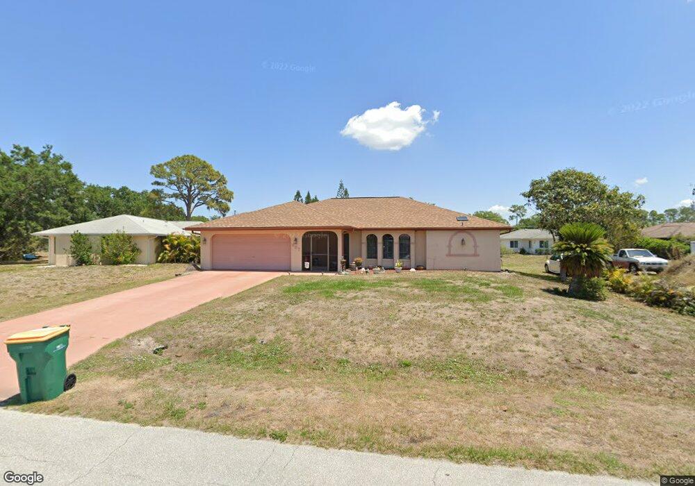
967 Andrews Ave NW Port Charlotte, FL 33948
Estimated Value: $298,524 - $394,000
3
Beds
2
Baths
2,187
Sq Ft
$158/Sq Ft
Est. Value
About This Home
This home is located at 967 Andrews Ave NW, Port Charlotte, FL 33948 and is currently estimated at $346,381, approximately $158 per square foot. 967 Andrews Ave NW is a home located in Charlotte County with nearby schools including Meadow Park Elementary School, Murdock Middle School, and Port Charlotte High School.
Ownership History
Date
Name
Owned For
Owner Type
Purchase Details
Closed on
Jul 15, 2011
Sold by
Centerstate Bank Of Florida Na
Bought by
Kinard Garry L and Kinard Pamela Y
Current Estimated Value
Purchase Details
Closed on
Mar 15, 1996
Sold by
Steidle Shirley
Bought by
Kinard Garry L and Kinard Pamela Y
Home Financials for this Owner
Home Financials are based on the most recent Mortgage that was taken out on this home.
Original Mortgage
$79,450
Interest Rate
7.03%
Mortgage Type
VA
Purchase Details
Closed on
Mar 12, 1995
Sold by
Steidle Dorothy
Bought by
Steidle David J and Steidle Shirley
Create a Home Valuation Report for This Property
The Home Valuation Report is an in-depth analysis detailing your home's value as well as a comparison with similar homes in the area
Home Values in the Area
Average Home Value in this Area
Purchase History
| Date | Buyer | Sale Price | Title Company |
|---|---|---|---|
| Kinard Garry L | $2,500 | Everglades Abstract & Title | |
| Kinard Garry L | $77,900 | -- | |
| Steidle David J | -- | -- |
Source: Public Records
Mortgage History
| Date | Status | Borrower | Loan Amount |
|---|---|---|---|
| Previous Owner | Kinard Garry L | $79,450 |
Source: Public Records
Tax History Compared to Growth
Tax History
| Year | Tax Paid | Tax Assessment Tax Assessment Total Assessment is a certain percentage of the fair market value that is determined by local assessors to be the total taxable value of land and additions on the property. | Land | Improvement |
|---|---|---|---|---|
| 2023 | $1,935 | $98,163 | $0 | $0 |
| 2022 | $1,842 | $95,304 | $0 | $0 |
| 2021 | $1,835 | $93,286 | $0 | $0 |
| 2020 | $1,780 | $91,998 | $0 | $0 |
| 2019 | $1,693 | $89,930 | $0 | $0 |
| 2018 | $1,561 | $88,253 | $0 | $0 |
| 2017 | $1,539 | $86,438 | $0 | $0 |
| 2016 | $1,521 | $84,660 | $0 | $0 |
| 2015 | $1,445 | $80,534 | $0 | $0 |
| 2014 | $1,102 | $76,117 | $0 | $0 |
Source: Public Records
Map
Nearby Homes
- 948 Andrews Ave NW
- 948 Columbia Terrace
- 1249 Tropical Cir NW
- 2193 Hyatt Dr
- 2201 Hyatt Dr
- 2136 Pellam Blvd
- 2184 Pellam Blvd
- 908 Tropical Cir NW
- 1237 Pike Ave NW
- 2216 Pellam Blvd
- 2088 Pellam Blvd
- 2709 Rock Creek Dr
- 18503 Yarbrough Ave
- 2119 Pellam Blvd
- 931 Red Bay Terrace NW
- 2080 Pellam Blvd
- 2678 Rock Creek Dr
- 2638 Rock Creek Dr
- 1150 Great Falls Ave
- 2070 Carpetgreen St
- 961 Andrews Ave NW
- 991 Andrews Ave NW
- 966 Columbia Terrace
- 972 Columbia Terrace
- 960 Columbia Terrace
- 972 Neptune St
- 955 Andrews Ave NW
- 955 Neptune St NW
- 966 Andrews Ave NW
- 972 Andrews Ave NW
- 954 Columbia Terrace
- 960 Andrews Ave NW
- 949 Andrews Ave NW
- 973 Columbia Terrace
- 936 Columbia Terrace
- 954 Andrews Ave NW
- 996 Andrews Ave NW
- 967 Columbia Terrace
- 961 Columbia St