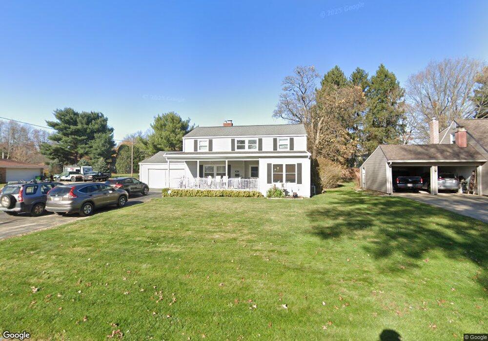
967 Ashwood Dr Wooster, OH 44691
Estimated Value: $288,781 - $338,000
4
Beds
4
Baths
2,363
Sq Ft
$131/Sq Ft
Est. Value
About This Home
This home is located at 967 Ashwood Dr, Wooster, OH 44691 and is currently estimated at $309,945, approximately $131 per square foot. 967 Ashwood Dr is a home located in Wayne County with nearby schools including Parkview Elementary School, Edgewood Middle School, and Wooster High School.
Ownership History
Date
Name
Owned For
Owner Type
Purchase Details
Closed on
Sep 15, 1998
Sold by
Thomas Audrey D
Bought by
Grifo James J and Grifo Nancy T
Current Estimated Value
Home Financials for this Owner
Home Financials are based on the most recent Mortgage that was taken out on this home.
Original Mortgage
$101,500
Outstanding Balance
$21,983
Interest Rate
7.06%
Mortgage Type
New Conventional
Estimated Equity
$287,962
Purchase Details
Closed on
Feb 20, 1992
Sold by
Thomas Robert W and Thomas Audrey
Bought by
Thomas Robert W and Thomas Audrey
Create a Home Valuation Report for This Property
The Home Valuation Report is an in-depth analysis detailing your home's value as well as a comparison with similar homes in the area
Home Values in the Area
Average Home Value in this Area
Purchase History
| Date | Buyer | Sale Price | Title Company |
|---|---|---|---|
| Grifo James J | $116,500 | -- | |
| Thomas Robert W | -- | -- |
Source: Public Records
Mortgage History
| Date | Status | Borrower | Loan Amount |
|---|---|---|---|
| Open | Grifo James J | $101,500 |
Source: Public Records
Tax History Compared to Growth
Tax History
| Year | Tax Paid | Tax Assessment Tax Assessment Total Assessment is a certain percentage of the fair market value that is determined by local assessors to be the total taxable value of land and additions on the property. | Land | Improvement |
|---|---|---|---|---|
| 2024 | $3,439 | $82,930 | $14,280 | $68,650 |
| 2023 | $3,439 | $82,930 | $14,280 | $68,650 |
| 2022 | $3,272 | $62,820 | $10,820 | $52,000 |
| 2021 | $3,375 | $62,820 | $10,820 | $52,000 |
| 2020 | $3,080 | $60,470 | $10,820 | $49,650 |
| 2019 | $2,622 | $49,410 | $10,590 | $38,820 |
| 2018 | $2,629 | $49,410 | $10,590 | $38,820 |
| 2017 | $2,552 | $49,410 | $10,590 | $38,820 |
| 2016 | $2,578 | $44,850 | $10,190 | $34,660 |
| 2015 | $2,491 | $44,150 | $10,190 | $33,960 |
| 2014 | $2,492 | $44,150 | $10,190 | $33,960 |
| 2013 | $2,490 | $43,610 | $10,210 | $33,400 |
Source: Public Records
Map
Nearby Homes
- 1047 Ashwood Dr
- 1650 Carlin Trail
- 1627 Carlin Trail
- 1720 Carlin Trail
- Birch Plan at Clear Creek Run - Single Family Homes
- Aspen Plan at Clear Creek Run - Single Family Homes
- Tupelo Plan at Clear Creek Run - Single Family Homes
- Spruce Plan at Clear Creek Run - Single Family Homes
- Hazel Plan at Clear Creek Run - Single Family Homes
- 622 Northwestern Ave
- 557 Oak Hill Rd
- 1587 Saunders Dr
- 758 Western Dr
- 0 Eden
- 862 Marilyn Dr
- 596 Meadow Ln
- 900 Quinby Ave
- 636 Saybolt Ave
- 537 N Grant St
- 1117 Quinby Ave
- 955 Ashwood Dr
- 1011 Ashwood Dr
- 966 Bucholz Dr
- 1012 Bucholz Dr
- 954 Bucholz Dr
- 966 Ashwood Dr
- 945 Ashwood Dr
- 1023 Ashwood Dr
- 1012 Ashwood Dr
- 948 Ashwood Dr
- 958 Ashwood Dr
- 1026 Bucholz Dr
- 940 Bucholz Dr
- 1035 Ashwood Dr
- 933 Ashwood Dr
- 928 Ashwood Dr
- 926 Bucholz Dr
- 919 Ashwood Dr
- 1020 Ashwood Dr
- 967 Ridgecrest Dr