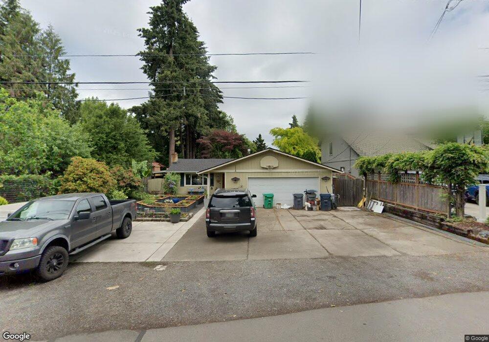
967 Fir Acres Dr Eugene, OR 97401
Cal Young NeighborhoodEstimated Value: $417,000 - $477,000
3
Beds
2
Baths
1,056
Sq Ft
$427/Sq Ft
Est. Value
About This Home
This home is located at 967 Fir Acres Dr, Eugene, OR 97401 and is currently estimated at $450,914, approximately $427 per square foot. 967 Fir Acres Dr is a home located in Lane County with nearby schools including Willagillespie Elementary School, Cal Young Middle School, and Sheldon High School.
Ownership History
Date
Name
Owned For
Owner Type
Purchase Details
Closed on
Apr 27, 2023
Sold by
Magee Martin R
Bought by
Magee Martin R and Magee Tamara L
Current Estimated Value
Purchase Details
Closed on
Dec 21, 2009
Sold by
Magee Martin R and Magee Tamara L
Bought by
Magee Martin R
Home Financials for this Owner
Home Financials are based on the most recent Mortgage that was taken out on this home.
Original Mortgage
$173,839
Interest Rate
4.88%
Mortgage Type
FHA
Create a Home Valuation Report for This Property
The Home Valuation Report is an in-depth analysis detailing your home's value as well as a comparison with similar homes in the area
Home Values in the Area
Average Home Value in this Area
Purchase History
| Date | Buyer | Sale Price | Title Company |
|---|---|---|---|
| Magee Martin R | -- | None Listed On Document | |
| Magee Martin R | -- | Fidelity National Title Insu |
Source: Public Records
Mortgage History
| Date | Status | Borrower | Loan Amount |
|---|---|---|---|
| Previous Owner | Magee Martin R | $173,839 |
Source: Public Records
Tax History Compared to Growth
Tax History
| Year | Tax Paid | Tax Assessment Tax Assessment Total Assessment is a certain percentage of the fair market value that is determined by local assessors to be the total taxable value of land and additions on the property. | Land | Improvement |
|---|---|---|---|---|
| 2025 | $4,338 | $222,652 | -- | -- |
| 2024 | $4,284 | $216,167 | -- | -- |
| 2023 | $4,284 | $209,871 | $0 | $0 |
| 2022 | $4,013 | $203,759 | $0 | $0 |
| 2021 | $3,770 | $197,825 | $0 | $0 |
| 2020 | $3,783 | $192,064 | $0 | $0 |
| 2019 | $3,654 | $186,470 | $0 | $0 |
| 2018 | $3,439 | $175,766 | $0 | $0 |
| 2017 | $3,285 | $175,766 | $0 | $0 |
| 2016 | $3,204 | $170,647 | $0 | $0 |
| 2015 | $3,112 | $165,677 | $0 | $0 |
| 2014 | $3,042 | $160,851 | $0 | $0 |
Source: Public Records
Map
Nearby Homes
- 1059 Cal Young Rd
- 1641 Chasa St
- 1170 Cal Young Rd
- 993 Robin Hood Ave
- 1332 Jeppesen Ave
- 1193 Rio Glen Dr
- 1750 Tabor St
- 1254 Rio Glen Dr
- 1163 Cedar Ridge Dr
- 1565 Monterey Ave
- 2001 Lake Isle Terrace
- 1328 Spyglass Dr
- 0 Butte Ln
- 2062 Lake Isle Dr
- 1632 Larkspur Loop
- 0 Crenshaw Rd Unit 740506614
- 3338 Lakeside Dr
- 410 Spyglass Dr
- 1654 Brewer Ave
- 1735 Minda Dr
- 989 Fir Acres Dr
- 945 Fir Acres Dr
- 1615 Russet Dr
- 1747 Russet Dr
- 1753 Russet Dr
- 1001 Fir Acres Dr
- 1635 Russet Dr
- 976 Fir Acres Dr
- 1592 Willagillespie Rd
- 1595 Russet Dr
- 944 Fir Acres Dr
- 1759 Russet Dr
- 1657 Russet Dr
- 1612 Russet Dr
- 1589 Russet Dr
- 1039 Fir Acres Dr
- 1582 Willagillespie Rd
- 1600 Russet Dr
- 1010 Fir Acres Dr