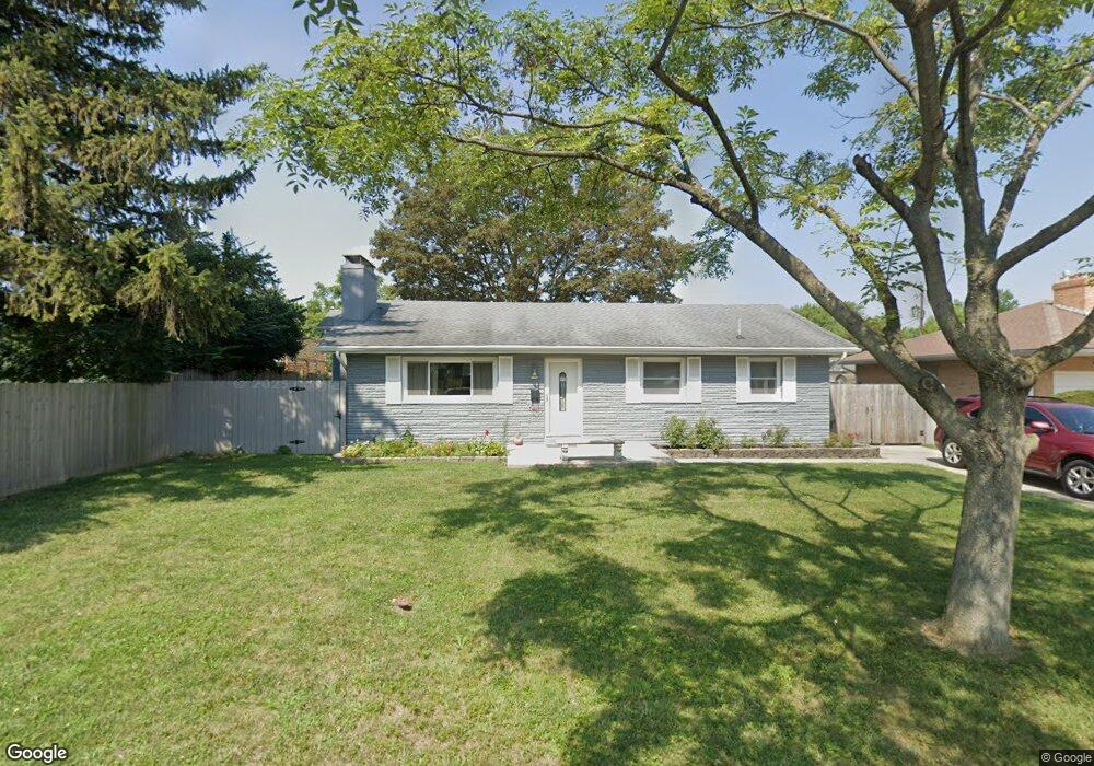
967 Miriam Dr E Columbus, OH 43204
Southwest Hilltop NeighborhoodEstimated Value: $212,000 - $240,000
3
Beds
2
Baths
1,251
Sq Ft
$180/Sq Ft
Est. Value
About This Home
This home is located at 967 Miriam Dr E, Columbus, OH 43204 and is currently estimated at $225,627, approximately $180 per square foot. 967 Miriam Dr E is a home located in Franklin County with nearby schools including Binns Elementary School, Wedgewood Middle School, and Briggs High School.
Ownership History
Date
Name
Owned For
Owner Type
Purchase Details
Closed on
Oct 28, 2014
Sold by
King Elizabeth M
Bought by
Aponte Elizabeth
Current Estimated Value
Home Financials for this Owner
Home Financials are based on the most recent Mortgage that was taken out on this home.
Original Mortgage
$53,000
Interest Rate
4.19%
Mortgage Type
Purchase Money Mortgage
Purchase Details
Closed on
Jul 7, 2003
Sold by
King Elizabeth M
Bought by
King Elizabeth M and Aponte Elizabeth
Purchase Details
Closed on
Oct 13, 1992
Create a Home Valuation Report for This Property
The Home Valuation Report is an in-depth analysis detailing your home's value as well as a comparison with similar homes in the area
Home Values in the Area
Average Home Value in this Area
Purchase History
| Date | Buyer | Sale Price | Title Company |
|---|---|---|---|
| Aponte Elizabeth | $49,800 | Nordic Title | |
| King Elizabeth M | $53,300 | -- | |
| -- | $83,900 | -- |
Source: Public Records
Mortgage History
| Date | Status | Borrower | Loan Amount |
|---|---|---|---|
| Previous Owner | Aponte Elizabeth | $53,000 |
Source: Public Records
Tax History
| Year | Tax Paid | Tax Assessment Tax Assessment Total Assessment is a certain percentage of the fair market value that is determined by local assessors to be the total taxable value of land and additions on the property. | Land | Improvement |
|---|---|---|---|---|
| 2025 | $2,868 | $63,910 | $14,840 | $49,070 |
| 2024 | $2,868 | $63,910 | $14,840 | $49,070 |
| 2023 | $2,832 | $63,910 | $14,840 | $49,070 |
| 2022 | $2,119 | $40,850 | $8,090 | $32,760 |
| 2021 | $2,122 | $40,850 | $8,090 | $32,760 |
| 2020 | $2,125 | $40,850 | $8,090 | $32,760 |
| 2019 | $2,045 | $33,710 | $6,760 | $26,950 |
| 2018 | $1,911 | $33,710 | $6,760 | $26,950 |
| 2017 | $2,003 | $33,710 | $6,760 | $26,950 |
| 2016 | $1,961 | $29,610 | $5,670 | $23,940 |
| 2015 | $1,781 | $29,610 | $5,670 | $23,940 |
| 2014 | $1,785 | $29,610 | $5,670 | $23,940 |
| 2013 | $1,036 | $34,825 | $6,650 | $28,175 |
Source: Public Records
Map
Nearby Homes
- 3318 Miriam Dr S
- 3340 Miriam Dr S
- 840 Mark Place
- 814 Miriam Dr W
- 894 Binns Blvd
- 988 S Roys Ave
- 3029 Rosedale Ave
- 793 Binns Blvd
- 3551 Glorious Rd
- 814 Chestershire Rd
- 695 Demorest Rd
- 2929 Briggs Rd
- 638 Binns Blvd
- 1168 Racine Ave
- 642 S Roys Ave
- 733 S Hague Ave
- 857 Regina Ct
- 1147 Parma Ave
- 3664-3670 Mccarley Dr S
- 2757 Bernadette Rd
- 959 Miriam Dr E
- 3248 Miriam Dr S
- 960 S Brinker Ave
- 951 Miriam Dr E
- 952 S Brinker Ave
- 3258 Miriam Dr S
- 970 Miriam Dr E
- 962 Miriam Dr E
- 942 S Brinker Ave
- 941 Miriam Dr E
- 952 Miriam Dr E
- 986 Miriam Dr E
- 932 S Brinker Ave
- 3251 Miriam Dr S
- 3243 Miriam Dr S
- 3235 Miriam Dr S
- 3261 Miriam Dr S
- 944 Miriam Dr E
- 931 Miriam Dr E
- 963 S Brinker Ave
Your Personal Tour Guide
Ask me questions while you tour the home.