Estimated Value: $280,861 - $568,000
Studio
--
Bath
--
Sq Ft
5,009
Sq Ft Lot
About This Home
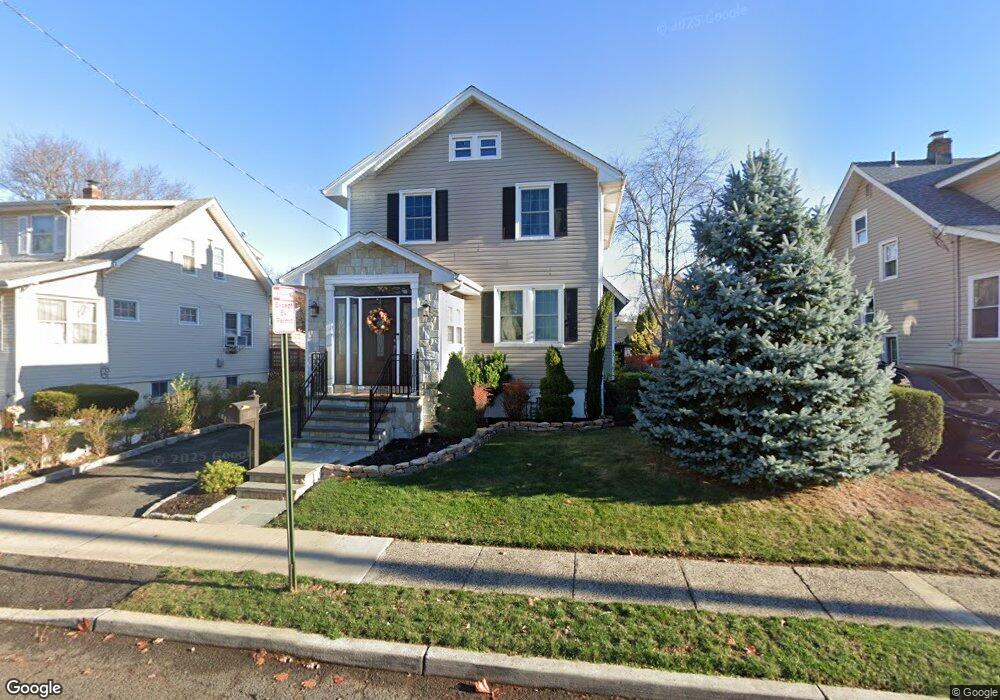
This home is located at 967 Moessner Ave, Union, NJ 07083 and is currently estimated at $475,215. 967 Moessner Ave is a home located in Union County with nearby schools including Battle Hill Elementary School, Burnet Middle School, and Union High School.
Ownership History
Date
Name
Owned For
Owner Type
Purchase Details
Closed on
May 30, 2007
Sold by
Gregoriades Arelys
Bought by
Fonseca Rodolfo
Current Estimated Value
Home Financials for this Owner
Home Financials are based on the most recent Mortgage that was taken out on this home.
Original Mortgage
$264,000
Outstanding Balance
$161,102
Interest Rate
6.14%
Mortgage Type
Purchase Money Mortgage
Estimated Equity
$314,113
Purchase Details
Closed on
Mar 22, 1996
Sold by
Roth Robert A and Rosmarin Cathy R
Bought by
Gregoriades Arelys
Create a Home Valuation Report for This Property
The Home Valuation Report is an in-depth analysis detailing your home's value as well as a comparison with similar homes in the area
Home Values in the Area
Average Home Value in this Area
Purchase History
| Date | Buyer | Sale Price | Title Company |
|---|---|---|---|
| Fonseca Rodolfo | $330,000 | United General Title Ins Co | |
| Gregoriades Arelys | $129,000 | -- |
Source: Public Records
Mortgage History
| Date | Status | Borrower | Loan Amount |
|---|---|---|---|
| Open | Fonseca Rodolfo | $264,000 |
Source: Public Records
Tax History
| Year | Tax Paid | Tax Assessment Tax Assessment Total Assessment is a certain percentage of the fair market value that is determined by local assessors to be the total taxable value of land and additions on the property. | Land | Improvement |
|---|---|---|---|---|
| 2025 | $8,382 | $37,500 | $20,000 | $17,500 |
| 2024 | $8,126 | $37,500 | $20,000 | $17,500 |
Source: Public Records
Map
Nearby Homes
- 960 Moessner Ave
- 968 Moessner Ave
- 2636 Frederick Terrace
- 2785 Larchmont Rd
- 1042 Battle Hill Terrace
- 823 Pinewood Rd
- 2705 Andrea Rd
- 933 Douglas Terrace
- 750 Andover Rd
- 67 Battle Hill Ave
- 5 Bashford Ave Unit 5
- 14 Bashford Ave Unit 14
- 105 Battle Hill Ave
- 2659 Hawthorne Ave
- 6 Bashford Ave Unit 6
- 2462 Woodside Rd
- 1 Perry Place
- 2469 Macarthur Dr
- 38 Warner Ave
- 2442 Terrill Rd
- 963 Moessner Ave
- 971 Moessner Ave
- 966 Liberty Ave
- 975 Moessner Ave
- 957 Moessner Ave
- 968 Liberty Ave
- 964 Liberty Ave
- 970 Liberty Ave
- 962 Liberty Ave
- 979 Moessner Ave
- 955 Moessner Ave
- 976 Moessner Ave
- 960 Liberty Ave
- 978 Moessner Ave
- 954 Moessner Ave
- 983 Moessner Ave
- 951 Moessner Ave
- 982 Liberty Ave
- 946 Liberty Ave Unit 8
- 952 Moessner Ave
Your Personal Tour Guide
Ask me questions while you tour the home.