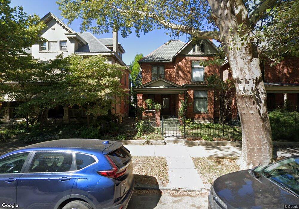
967 Neil Ave Columbus, OH 43201
Victorian Village NeighborhoodEstimated Value: $547,589 - $589,000
3
Beds
2
Baths
1,780
Sq Ft
$315/Sq Ft
Est. Value
About This Home
This home is located at 967 Neil Ave, Columbus, OH 43201 and is currently estimated at $561,397, approximately $315 per square foot. 967 Neil Ave is a home located in Franklin County with nearby schools including Hubbard Elementary School, Dominion Middle School, and Whetstone High School.
Ownership History
Date
Name
Owned For
Owner Type
Purchase Details
Closed on
May 18, 1990
Bought by
Cocchiarale Frank
Current Estimated Value
Purchase Details
Closed on
Sep 30, 1988
Purchase Details
Closed on
Jun 1, 1984
Create a Home Valuation Report for This Property
The Home Valuation Report is an in-depth analysis detailing your home's value as well as a comparison with similar homes in the area
Home Values in the Area
Average Home Value in this Area
Purchase History
| Date | Buyer | Sale Price | Title Company |
|---|---|---|---|
| Cocchiarale Frank | $114,000 | -- | |
| -- | -- | -- | |
| -- | $70,000 | -- |
Source: Public Records
Tax History Compared to Growth
Tax History
| Year | Tax Paid | Tax Assessment Tax Assessment Total Assessment is a certain percentage of the fair market value that is determined by local assessors to be the total taxable value of land and additions on the property. | Land | Improvement |
|---|---|---|---|---|
| 2024 | $7,650 | $170,450 | $77,000 | $93,450 |
| 2023 | $8,765 | $197,820 | $104,370 | $93,450 |
| 2022 | $6,531 | $125,930 | $32,550 | $93,380 |
| 2021 | $6,543 | $125,930 | $32,550 | $93,380 |
| 2020 | $6,551 | $125,930 | $32,550 | $93,380 |
| 2019 | $7,814 | $128,810 | $27,130 | $101,680 |
| 2018 | $7,292 | $126,920 | $27,130 | $99,790 |
| 2017 | $7,695 | $126,920 | $27,130 | $99,790 |
| 2016 | $7,603 | $114,770 | $26,250 | $88,520 |
| 2015 | $6,902 | $114,770 | $26,250 | $88,520 |
| 2014 | $6,918 | $114,770 | $26,250 | $88,520 |
| 2013 | $3,102 | $104,335 | $23,870 | $80,465 |
Source: Public Records
Map
Nearby Homes
- 986 Highland St
- 969 Hunter Ave
- 1016 Neil Ave
- 1018 Neil Ave
- 313 W 1st Ave
- 938 Hunter Ave
- 319 W 2nd Ave Unit 319
- 1042 Neil Ave
- 884 Neil Ave
- 1025 Hunter Ave
- 994 Harrison Ave
- 998 Ewing Alley Unit 998
- 915 Dennison Ave Unit 915
- 162 E 2nd Ave
- 1001 Dennison Ave
- 337 Tappan St
- 867-871 Delaware Ave
- 1003 Pennsylvania Ave Unit 5
- 312 Buttles Ave Unit 314
- 83 W 1st Ave
- 971 Neil Ave
- 961 Neil Ave
- 963 Neil Ave Unit 963
- 977 Neil Ave Unit 979
- 957 Neil Ave
- 983 Neil Ave
- 953 Neil Ave
- 974 Delaware Ave
- 970 Delaware Ave Unit 970
- 964 Delaware Ave
- 984 Delaware Ave
- 972 Delaware Ave Unit 972
- 972 Delaware Ave
- 949 Neil Ave
- 962 Delaware Ave
- 991 Neil Ave
- 988 Delaware Ave Unit 990
- 956 Delaware Ave Unit 958
- 956 Delaware Ave Unit 58
- 962 Neil Ave Unit 962