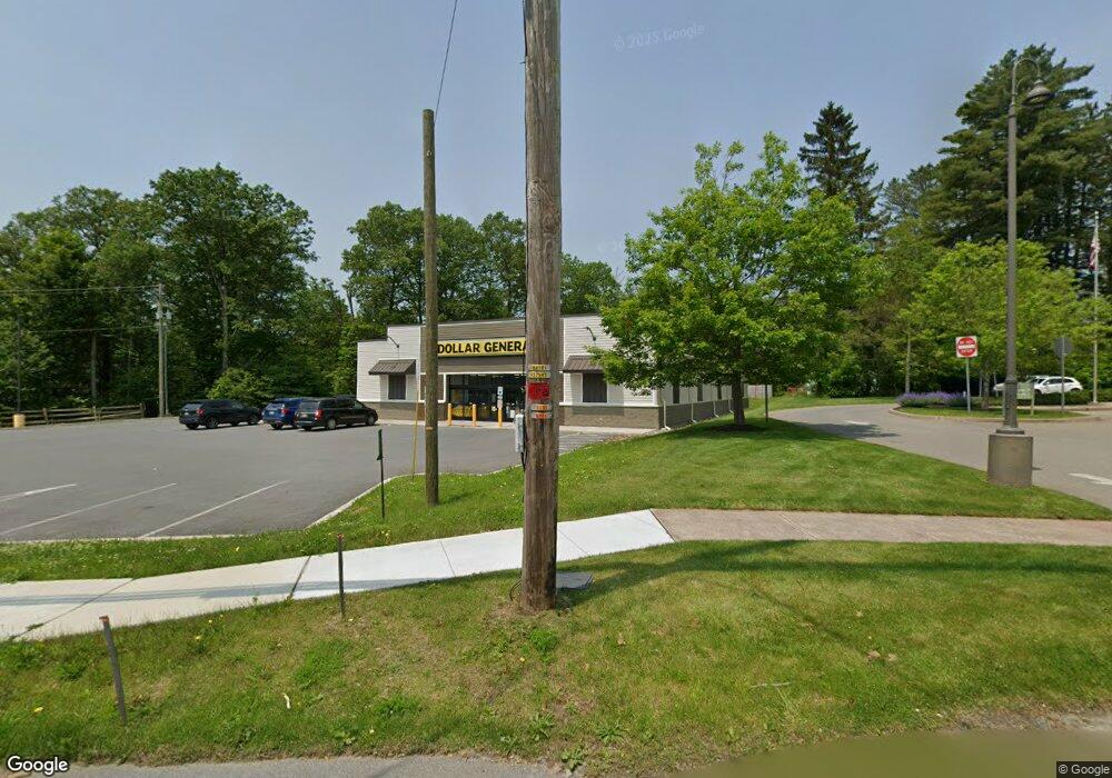
967 Route 390 Cresco, PA 18326
Estimated Value: $1,799,578
--
Bed
--
Bath
2,000
Sq Ft
$900/Sq Ft
Est. Value
About This Home
This home is located at 967 Route 390, Cresco, PA 18326 and is currently estimated at $1,799,578, approximately $899 per square foot. 967 Route 390 is a home located in Monroe County with nearby schools including Swiftwater Interm School, Swiftwater Elementary Center, and Pocono Mountain East Junior High School.
Ownership History
Date
Name
Owned For
Owner Type
Purchase Details
Closed on
Nov 26, 2024
Sold by
Cresco Dg Llc
Bought by
Dgb Buyer Pa Llc
Current Estimated Value
Purchase Details
Closed on
Sep 7, 2023
Sold by
Cresco Dg Llc
Bought by
Commonwealth Of Pennsylvania Department Of Tr
Purchase Details
Closed on
Aug 19, 2021
Sold by
Frias Jose G and Frias Eneida
Bought by
Cresco Dg Llc
Home Financials for this Owner
Home Financials are based on the most recent Mortgage that was taken out on this home.
Original Mortgage
$1,512,000
Interest Rate
2.16%
Purchase Details
Closed on
Mar 10, 2011
Sold by
Rubin S Jerome and Rubin Phyllis
Bought by
Frias Jose G and Frias Eneida
Home Financials for this Owner
Home Financials are based on the most recent Mortgage that was taken out on this home.
Original Mortgage
$150,000
Interest Rate
4.83%
Mortgage Type
Commercial
Create a Home Valuation Report for This Property
The Home Valuation Report is an in-depth analysis detailing your home's value as well as a comparison with similar homes in the area
Home Values in the Area
Average Home Value in this Area
Purchase History
| Date | Buyer | Sale Price | Title Company |
|---|---|---|---|
| Dgb Buyer Pa Llc | $1,734,582 | None Listed On Document | |
| Commonwealth Of Pennsylvania Department Of Tr | -- | Title365 | |
| Cresco Dg Llc | $240,000 | None Available | |
| Frias Jose G | $279,000 | First American Title Ins Co |
Source: Public Records
Mortgage History
| Date | Status | Borrower | Loan Amount |
|---|---|---|---|
| Previous Owner | Cresco Dg Llc | $1,512,000 | |
| Previous Owner | Frias Jose G | $150,000 |
Source: Public Records
Tax History Compared to Growth
Tax History
| Year | Tax Paid | Tax Assessment Tax Assessment Total Assessment is a certain percentage of the fair market value that is determined by local assessors to be the total taxable value of land and additions on the property. | Land | Improvement |
|---|---|---|---|---|
| 2025 | $7,970 | $987,430 | $88,350 | $899,080 |
| 2024 | $6,488 | $987,430 | $88,350 | $899,080 |
| 2023 | $25,842 | $987,430 | $88,350 | $899,080 |
| 2022 | $2,273 | $88,350 | $88,350 | $0 |
| 2021 | $4,828 | $187,670 | $88,350 | $99,320 |
| 2020 | $4,828 | $187,670 | $88,350 | $99,320 |
| 2019 | $3,760 | $21,270 | $6,140 | $15,130 |
| 2018 | $3,760 | $21,270 | $6,140 | $15,130 |
| 2017 | $3,803 | $21,270 | $6,140 | $15,130 |
| 2016 | $883 | $21,270 | $6,140 | $15,130 |
| 2015 | -- | $21,270 | $6,140 | $15,130 |
| 2014 | -- | $21,270 | $6,140 | $15,130 |
Source: Public Records
Map
Nearby Homes
- 6733 Route 191
- 6683 Pennsylvania 191
- 6663 Pennsylvania 191
- 6656 Route 191
- 455 Laurel Pine Rd
- 130 Barn Swallow Ln
- 781 White Oak Rd
- 0 Route 191 Unit PWBPW243056
- 4299 High Rd
- 612 Prices Dr
- 4130 Mill Creek Dr
- 6509 Route 191
- 371 Ridge Cir
- 519 Pheasant Ln
- 136 Oak Ln
- 104 Haverhill Rd
- 119 Falls Dr
- 136 Falls Dr
- 122 Treetop Trail
- 2138 Laurel Ln
- 967 Pennsylvania 390
- 111 Trailer Court Rd Unit 3
- 111 Trailer Court Rd Unit 1
- 111 Trailer Court Rd
- 111 Trailer Court Rd Unit 3
- 111 Trailer Court Rd Unit 1
- 278 Saundra Ct
- 109 Oak Ln
- 951 Pennsylvania 390
- 215 Krummel Ln
- 212 Krummel Ln
- 118 Trailer Court Rd
- 211 Krummel Ln
- RR#2 Box 2884
- 116 Oak Ln
- 105 Robinson Ln
- 996 Route 390 Unit 1
- 996 Route 390 Unit 1
- 996 Route 390 Unit 2
- 996 Route 390