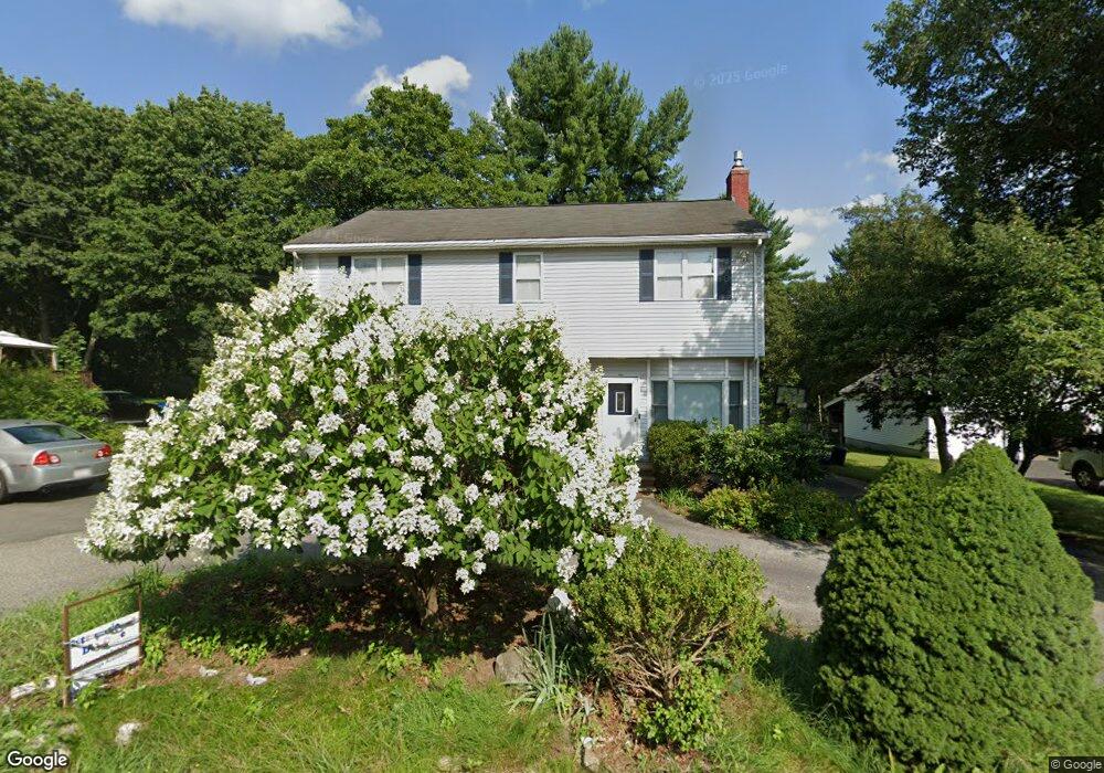
967 Shawsheen St Tewksbury, MA 01876
Estimated Value: $684,000 - $818,000
3
Beds
3
Baths
1,848
Sq Ft
$399/Sq Ft
Est. Value
About This Home
This home is located at 967 Shawsheen St, Tewksbury, MA 01876 and is currently estimated at $737,203, approximately $398 per square foot. 967 Shawsheen St is a home located in Middlesex County with nearby schools including Heath-Brook Elementary School, John W. Wynn Middle School, and John F. Ryan Elementary School.
Ownership History
Date
Name
Owned For
Owner Type
Purchase Details
Closed on
Feb 12, 2009
Sold by
Allen Brian K and Allen Nancy L
Bought by
Allen Nancy L
Current Estimated Value
Purchase Details
Closed on
Mar 27, 1992
Sold by
Demoura Jeffrey A and Wolfram Diane
Bought by
Allen Brian K and Allen Nancy
Home Financials for this Owner
Home Financials are based on the most recent Mortgage that was taken out on this home.
Original Mortgage
$114,600
Interest Rate
8.66%
Mortgage Type
Purchase Money Mortgage
Create a Home Valuation Report for This Property
The Home Valuation Report is an in-depth analysis detailing your home's value as well as a comparison with similar homes in the area
Home Values in the Area
Average Home Value in this Area
Purchase History
| Date | Buyer | Sale Price | Title Company |
|---|---|---|---|
| Allen Nancy L | -- | -- | |
| Allen Brian K | $120,700 | -- |
Source: Public Records
Mortgage History
| Date | Status | Borrower | Loan Amount |
|---|---|---|---|
| Previous Owner | Allen Brian K | $75,000 | |
| Previous Owner | Allen Brian K | $35,000 | |
| Previous Owner | Allen Brian K | $114,600 |
Source: Public Records
Tax History Compared to Growth
Tax History
| Year | Tax Paid | Tax Assessment Tax Assessment Total Assessment is a certain percentage of the fair market value that is determined by local assessors to be the total taxable value of land and additions on the property. | Land | Improvement |
|---|---|---|---|---|
| 2025 | $7,456 | $564,000 | $275,400 | $288,600 |
| 2024 | $7,298 | $545,000 | $262,400 | $282,600 |
| 2023 | $7,074 | $501,700 | $238,600 | $263,100 |
| 2022 | $6,662 | $438,300 | $207,100 | $231,200 |
| 2021 | $6,472 | $411,700 | $188,500 | $223,200 |
| 2020 | $6,235 | $390,400 | $179,300 | $211,100 |
| 2019 | $5,721 | $361,200 | $170,900 | $190,300 |
| 2018 | $5,413 | $335,600 | $170,900 | $164,700 |
| 2017 | $5,394 | $330,700 | $170,900 | $159,800 |
| 2016 | $5,335 | $326,300 | $170,900 | $155,400 |
| 2015 | $5,157 | $315,000 | $165,700 | $149,300 |
| 2014 | $4,878 | $302,800 | $165,700 | $137,100 |
Source: Public Records
Map
Nearby Homes
- 906 Old Shawsheen St
- 261 Apache Way
- 71 Apache Way Unit 71
- 109 Apache Way
- 127 Caddy Ct
- 93 Fairway Dr
- 7 Wamesit Rd
- 16 Eagle Dr
- 640 South St
- 610 South St
- 110 Royal Crest Cir
- 22 Carleton Rd
- 14 Hinckley Rd
- 6 Stonebury Way Unit 6
- 54 Delwood Rd
- 20 Oakland Ave
- 5 Kensington Way Unit 5
- 40 Nichols St
- 111 Patrick Rd Unit 111
- 142 Patrick Rd
- 959 Shawsheen St
- 951 Shawsheen St
- 975 Shawsheen St
- 943 Shawsheen St
- 1 Memorial Dr
- 299 Apache Way
- 298 Apache Way
- 297 Apache Way
- 296 Apache Way
- 295 Apache Way
- 297 Apache Way Unit 297
- 300 Apache Way
- 3 Memorial Dr
- 991 Shawsheen St
- 294 Apache Way
- 293 Apache Way
- 292 Apache Way
- 291 Apache Way
- 289 Apache Way
- 294 Apache Way Unit 294 - 1