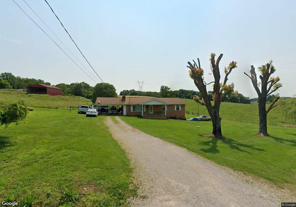
967 Stone Rd Blaine, TN 37709
Estimated Value: $290,000 - $397,767
Studio
1
Bath
1,372
Sq Ft
$257/Sq Ft
Est. Value
About This Home
This home is located at 967 Stone Rd, Blaine, TN 37709 and is currently estimated at $353,256, approximately $257 per square foot. 967 Stone Rd is a home located in Grainger County with nearby schools including Joppa Elementary School, Rutledge Middle School, and Grainger High School.
Ownership History
Date
Name
Owned For
Owner Type
Purchase Details
Closed on
Nov 30, 2004
Sold by
Shelton Mary Jane
Bought by
Mills Jennifer Lynn
Current Estimated Value
Purchase Details
Closed on
Aug 19, 1999
Sold by
Lindsey Frank
Bought by
Shelton Mary J
Purchase Details
Closed on
Jul 10, 1997
Sold by
Lindsey Frank
Bought by
Lindsey Brad E
Purchase Details
Closed on
Feb 12, 1994
Bought by
Lindsey Frank
Purchase Details
Closed on
Jun 2, 1993
Bought by
Lindsey Frank
Create a Home Valuation Report for This Property
The Home Valuation Report is an in-depth analysis detailing your home's value as well as a comparison with similar homes in the area
Home Values in the Area
Average Home Value in this Area
Purchase History
| Date | Buyer | Sale Price | Title Company |
|---|---|---|---|
| Mills Jennifer Lynn | -- | -- | |
| Shelton Mary J | $7,000 | -- | |
| Lindsey Jason | -- | -- | |
| Lindsey Brad E | $2,000 | -- | |
| Lindsey Frank | $27,000 | -- | |
| Lindsey Frank | $27,000 | -- |
Source: Public Records
Tax History
| Year | Tax Paid | Tax Assessment Tax Assessment Total Assessment is a certain percentage of the fair market value that is determined by local assessors to be the total taxable value of land and additions on the property. | Land | Improvement |
|---|---|---|---|---|
| 2025 | $1,093 | $46,500 | $10,425 | $36,075 |
| 2024 | $1,093 | $46,500 | $10,425 | $36,075 |
| 2023 | $1,093 | $46,500 | $10,425 | $36,075 |
| 2022 | $1,068 | $46,500 | $10,425 | $36,075 |
| 2021 | $1,068 | $46,500 | $10,425 | $36,075 |
| 2020 | $1,088 | $46,500 | $10,425 | $36,075 |
| 2019 | $1,088 | $38,850 | $9,075 | $29,775 |
| 2018 | $940 | $38,850 | $9,075 | $29,775 |
| 2017 | $940 | $38,850 | $9,075 | $29,775 |
| 2016 | $940 | $38,850 | $9,075 | $29,775 |
| 2015 | $813 | $38,850 | $9,075 | $29,775 |
| 2014 | $813 | $32,531 | $0 | $0 |
Source: Public Records
Map
Nearby Homes
- 747 Stone Rd
- 0 Collins Rd
- 2324 Holston View Rd
- 598 Horse Shoe Bend Rd
- 2005 River Mist Cir
- 1958 River Mist Cir
- 2501 Stone Rd
- 2049 River Mist Cir
- lot 31 River Stone Dr
- 290 Frank Bend Ln Unit 94 011.01
- 0 Holston Shores Dr Unit RTC3152326
- 00 Mary Ln
- 718 Patterson Town Rd
- 2485 Indian Ridge Rd
- 854 Holston Shores Dr
- Lot 8 Holston Shores Dr
- 000 Holston Shores Dr
- 925 Holston Shores Dr
- 1741 Redwing Ln
- 1739 Redwing Ln
- lot 36 Stone Rd
- Lot 35 Stone Rd
- 0 Stone Rd
- Par 46 Indian Cave Rd
- 1100 Stone Rd
- Par 46 Indian Cave Rd
- 203B Indian Cave Rd Unit 203B
- 577 Indian Cave Rd
- 209 Clubhouse Dr
- 285 Indian Cave Rd
- 700 Stone Rd
- 490 Memory Ln
- 4212 Indian Ridge Rd
- 697 Stone Rd
- 589 Memory Ln
- 0000 Memory Ln
- 602 Stone Rd
- 811 Indian Cave Rd
- 0 Indian Cave Rd Unit RTC2861248
- 0 Indian Cave Rd Unit RTC2853450
Your Personal Tour Guide
Ask me questions while you tour the home.