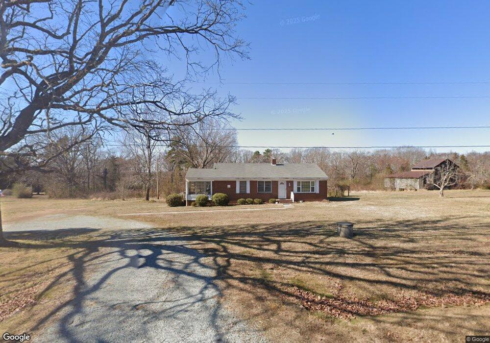
9675 Dirgie Mine Rd Roxboro, NC 27574
Estimated Value: $152,424 - $291,000
--
Bed
1
Bath
1,344
Sq Ft
$176/Sq Ft
Est. Value
About This Home
This home is located at 9675 Dirgie Mine Rd, Roxboro, NC 27574 and is currently estimated at $236,856, approximately $176 per square foot. 9675 Dirgie Mine Rd is a home located in Person County with nearby schools including Person High School.
Create a Home Valuation Report for This Property
The Home Valuation Report is an in-depth analysis detailing your home's value as well as a comparison with similar homes in the area
Home Values in the Area
Average Home Value in this Area
Tax History Compared to Growth
Tax History
| Year | Tax Paid | Tax Assessment Tax Assessment Total Assessment is a certain percentage of the fair market value that is determined by local assessors to be the total taxable value of land and additions on the property. | Land | Improvement |
|---|---|---|---|---|
| 2025 | $1,049 | $155,333 | $0 | $0 |
| 2024 | $640 | $81,839 | $0 | $0 |
| 2023 | $640 | $81,839 | $0 | $0 |
| 2022 | $638 | $81,839 | $0 | $0 |
| 2021 | $620 | $81,839 | $0 | $0 |
| 2020 | $525 | $69,183 | $0 | $0 |
| 2019 | $532 | $69,183 | $0 | $0 |
| 2018 | $499 | $69,183 | $0 | $0 |
| 2017 | $492 | $69,183 | $0 | $0 |
| 2016 | $492 | $69,183 | $0 | $0 |
| 2015 | $492 | $69,183 | $0 | $0 |
| 2014 | $492 | $69,183 | $0 | $0 |
Source: Public Records
Map
Nearby Homes
- 0 Blue Wing Rd
- 9175 Virgilina Rd
- 0 Shady Oak Rd Unit 10102994
- 0 Shady Oak Rd Unit 23863061
- 8365 Aaron Creek Church Rd
- 9593 N Carolina 96
- 1310 Gillis Rd
- 0 Webb Chapel Rd Unit 10099652
- 0 New Mayo Dr Unit 10121125
- 00 New Mayo Dr
- 17.03ac New Mayo Dr
- 682 Wolf Pit Rd
- 87.39 AC Virgilina Rd
- 0 Thomas Green Rd Unit 10110795
- 8596 Redding Rd
- A67 85 Bowmantown Rd
- A67 178 Bowmantown Rd
- 0 Noel Tuck Rd
- 84 Macbeth Ln
- 1105 Fontaine Rd