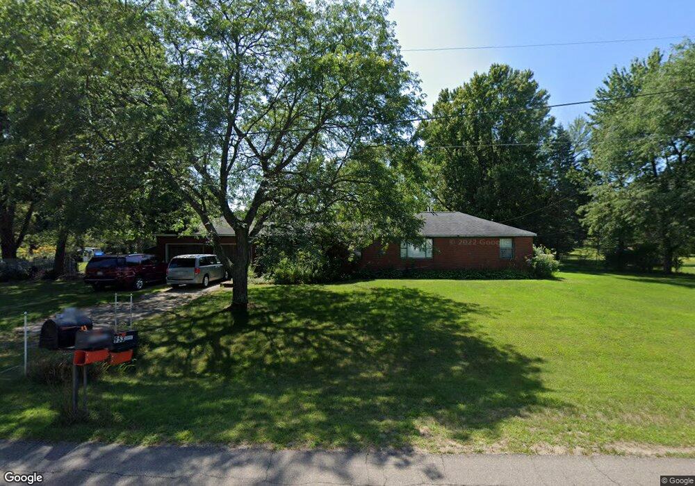
968 Brookfield Dr Saint Joseph, MI 49085
Estimated Value: $240,356 - $298,000
3
Beds
2
Baths
1,648
Sq Ft
$164/Sq Ft
Est. Value
About This Home
This home is located at 968 Brookfield Dr, Saint Joseph, MI 49085 and is currently estimated at $269,589, approximately $163 per square foot. 968 Brookfield Dr is a home located in Berrien County with nearby schools including Upton Middle School, St. Joseph High School, and Michigan Lutheran High School.
Ownership History
Date
Name
Owned For
Owner Type
Purchase Details
Closed on
Jan 8, 2025
Sold by
Privett Lonna Fay
Bought by
Craft Margaret Christina
Current Estimated Value
Purchase Details
Closed on
Nov 3, 2022
Sold by
Steffey Joy L
Bought by
Privett Lonna
Purchase Details
Closed on
May 18, 2021
Sold by
Privett Lonna Fay and Estate Of Verna J Martin
Bought by
Steffey Joy Lynne and Privett Lonna Fay
Purchase Details
Closed on
Mar 19, 2021
Sold by
Finding Darren and Estate Of Junior Clifford Mart
Bought by
Privett Lonna and Steffey Joy Lynne
Create a Home Valuation Report for This Property
The Home Valuation Report is an in-depth analysis detailing your home's value as well as a comparison with similar homes in the area
Home Values in the Area
Average Home Value in this Area
Purchase History
| Date | Buyer | Sale Price | Title Company |
|---|---|---|---|
| Craft Margaret Christina | -- | None Listed On Document | |
| Craft Margaret Christina | -- | None Listed On Document | |
| Privett Lonna | -- | -- | |
| Steffey Joy Lynne | -- | None Available | |
| Privett Lonna | -- | None Available |
Source: Public Records
Tax History Compared to Growth
Tax History
| Year | Tax Paid | Tax Assessment Tax Assessment Total Assessment is a certain percentage of the fair market value that is determined by local assessors to be the total taxable value of land and additions on the property. | Land | Improvement |
|---|---|---|---|---|
| 2025 | $3,192 | $90,900 | $0 | $0 |
| 2024 | $2,568 | $83,400 | $0 | $0 |
| 2023 | $2,445 | $72,600 | $0 | $0 |
| 2022 | $2,329 | $66,100 | $0 | $0 |
| 2021 | $2,800 | $58,600 | $24,100 | $34,500 |
| 2020 | $1,810 | $71,700 | $0 | $0 |
| 2019 | $1,688 | $70,700 | $21,900 | $48,800 |
| 2018 | $1,653 | $70,700 | $0 | $0 |
| 2017 | $1,628 | $61,800 | $0 | $0 |
| 2016 | $1,586 | $57,800 | $0 | $0 |
| 2015 | $1,561 | $56,800 | $0 | $0 |
| 2014 | $1,100 | $60,800 | $0 | $0 |
Source: Public Records
Map
Nearby Homes
- 1153 W Glenlord Rd Unit 22
- 792 Lonesome Pine Trail
- 1332 W Glenlord Rd
- 3553 Martin Path
- 940 Vineland Rd
- 3595 Martin Path
- 484 W Glenlord Rd
- 1521 Maiden Ln
- 4111 Hailey Dr
- 1481 Kristen Path
- 670 Marvin Ave
- 4143 Browning Dr
- 631 Marvin Ave
- 4159 Browning Dr
- 317 Maiden Ln
- 530 Manitou Rd
- 3215 Meade Ct
- 753 Lattimer Dr
- 1373 Saint Joseph Cir
- Elements 2100 Plan at Marquette Woods
- 926 Brookfield Dr
- 978 Brookfield Dr
- 967 Brookfield Dr
- 925 Brookfield Dr
- 953 Brookfield Dr
- 981 Brookfield Dr
- 992 Brookfield Dr
- 3817 Meadow Ln
- 3834 Lincoln Ave
- 3839 Meadow Ln
- 997 Brookfield Dr
- 1004 Brookfield Dr
- 3857 Meadow Ln
- 3862 Lincoln Ave
- 3883 Meadow Ln
- 1009 Brookfield Dr
- 3871 Meadow Ln
- 3886 Lincoln Ave
- 3905 Meadow Ln
- 3822 Meadow Ln