Estimated Value: $526,000 - $684,000
Studio
3
Baths
2,507
Sq Ft
$244/Sq Ft
Est. Value
About This Home
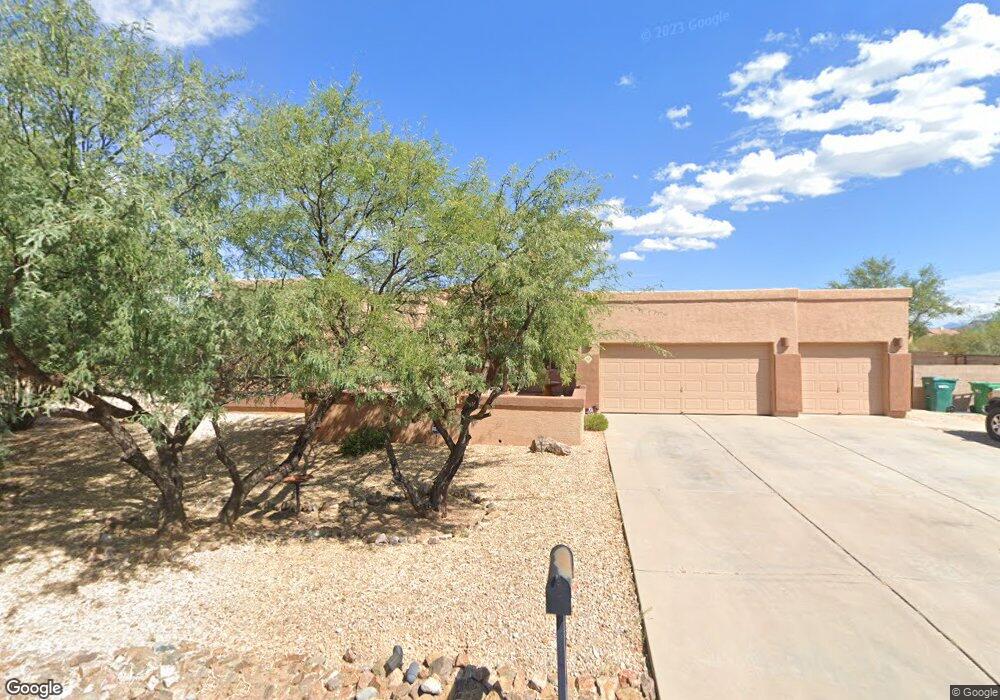
This home is located at 968 N Deep Rock Dr, Vail, AZ 85641 and is currently estimated at $612,511, approximately $244 per square foot. 968 N Deep Rock Dr is a home located in Pima County with nearby schools including Acacia Elementary School, Vail Academy and High School, and Old Vail Middle School.
Ownership History
Date
Name
Owned For
Owner Type
Purchase Details
Closed on
Jun 23, 2005
Sold by
Title Security Agency Of Arizona
Bought by
Estrella Robert M and Estrella Julie M
Current Estimated Value
Home Financials for this Owner
Home Financials are based on the most recent Mortgage that was taken out on this home.
Original Mortgage
$231,963
Outstanding Balance
$118,455
Interest Rate
5.72%
Mortgage Type
New Conventional
Estimated Equity
$494,056
Purchase Details
Closed on
Oct 29, 2004
Sold by
Lawyers Title Of Arizona Inc
Bought by
Sierra Pacific Co Llc
Home Financials for this Owner
Home Financials are based on the most recent Mortgage that was taken out on this home.
Original Mortgage
$1,200,000
Interest Rate
5.69%
Mortgage Type
New Conventional
Create a Home Valuation Report for This Property
The Home Valuation Report is an in-depth analysis detailing your home's value as well as a comparison with similar homes in the area
Home Values in the Area
Average Home Value in this Area
Purchase History
| Date | Buyer | Sale Price | Title Company |
|---|---|---|---|
| Estrella Robert M | $289,954 | Title Security Agency Of Az | |
| Estrella Robert M | $289,954 | Title Security Agency Of Az | |
| Sierra Pacific Co Llc | $899,000 | -- | |
| Sierra Pacific Co Llc | $899,000 | -- |
Source: Public Records
Mortgage History
| Date | Status | Borrower | Loan Amount |
|---|---|---|---|
| Open | Estrella Robert M | $231,963 | |
| Closed | Estrella Robert M | $231,963 | |
| Previous Owner | Sierra Pacific Co Llc | $1,200,000 | |
| Closed | Estrella Robert M | $28,995 |
Source: Public Records
Tax History
| Year | Tax Paid | Tax Assessment Tax Assessment Total Assessment is a certain percentage of the fair market value that is determined by local assessors to be the total taxable value of land and additions on the property. | Land | Improvement |
|---|---|---|---|---|
| 2026 | $3,586 | $32,987 | -- | -- |
| 2025 | $3,586 | $31,416 | -- | -- |
| 2024 | $3,402 | $29,920 | -- | -- |
| 2023 | $3,354 | $28,495 | $0 | $0 |
| 2022 | $3,169 | $27,139 | $0 | $0 |
| 2021 | $3,258 | $24,615 | $0 | $0 |
| 2020 | $3,139 | $24,615 | $0 | $0 |
| 2019 | $3,120 | $26,132 | $0 | $0 |
| 2018 | $2,907 | $21,264 | $0 | $0 |
| 2017 | $2,859 | $21,264 | $0 | $0 |
| 2016 | $2,641 | $20,251 | $0 | $0 |
| 2015 | $2,538 | $19,287 | $0 | $0 |
Source: Public Records
Map
Nearby Homes
- 930 N Blue Slate Dr N
- 921 N Blue Slate Dr
- 913 N Blue Slate Dr N
- 3723 E Wetstones Rd
- 1168 N Slot Canyon Place
- 1144 N Range Rider Place
- 1216 N Range Rider Place
- 3379 E Calle Agassiz
- 3161 E Cardenas Dr
- 1467 N Branding Place
- 1415 N Range Rider Place Unit 35
- 3610 E Andrada Rd
- 1385 N Blazing Saddle Rd
- 3081 E Wiley Ln
- 1479 N Blazing Saddle Rd Unit 33
- 1499 N Blazing Saddle Rd Unit 32
- 1569 N Blazing Saddle Rd Unit 30
- 3180 E Andrada Rd
- 3166 E Andrada Rd
- 1525 N Cattle Tank Dr Unit 68
- 940 N Deep Rock Dr
- 1002 N Deep Rock Dr
- 973 N Deep Rock Dr
- 3445 E Drystone Rd
- 1001 N Deep Rock Dr
- 3511 E Cavern Ct
- 3512 E Cavern Ct
- 1030 N Deep Rock Dr
- 3513 E Drystone Rd
- 3423 E Drystone Rd
- 1029 N Deep Rock Dr
- 3488 E Drystone Rd
- 3514 E Drystone Rd
- 894 N Drystone Ct
- 3510 E Slippery Rock Dr
- 972 N Davidson Canyon Rd
- 1000 N Davidson Canyon Rd
- 3539 E Drystone Rd
- 3538 E Cavern Ct
- 3397 E Drystone Rd
Your Personal Tour Guide
Ask me questions while you tour the home.