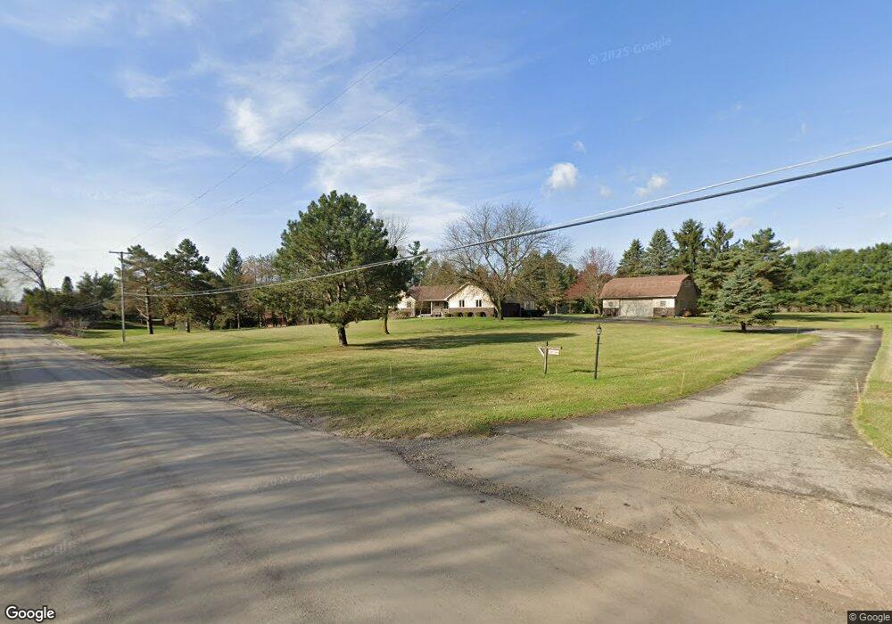
9688 Peer Rd South Lyon, MI 48178
Estimated Value: $444,000 - $547,982
--
Bed
--
Bath
1,891
Sq Ft
$258/Sq Ft
Est. Value
About This Home
This home is located at 9688 Peer Rd, South Lyon, MI 48178 and is currently estimated at $488,246, approximately $258 per square foot. 9688 Peer Rd is a home located in Livingston County with nearby schools including William A. Brummer Elementary School, Centennial Middle School, and South Lyon High School.
Ownership History
Date
Name
Owned For
Owner Type
Purchase Details
Closed on
Jul 6, 2011
Sold by
Vandusen Lawrence J
Bought by
Vandusen Lawrence J and Bates Leslieann
Current Estimated Value
Home Financials for this Owner
Home Financials are based on the most recent Mortgage that was taken out on this home.
Original Mortgage
$102,500
Interest Rate
4.52%
Mortgage Type
Purchase Money Mortgage
Purchase Details
Closed on
Dec 5, 2003
Sold by
Vandusen Lawrence J and Bates Leslieann
Bought by
Vandusen Lawrence J and Vandusen Leslieann
Create a Home Valuation Report for This Property
The Home Valuation Report is an in-depth analysis detailing your home's value as well as a comparison with similar homes in the area
Home Values in the Area
Average Home Value in this Area
Purchase History
| Date | Buyer | Sale Price | Title Company |
|---|---|---|---|
| Vandusen Lawrence J | -- | -- | |
| Vandusen Lawrence J | -- | -- |
Source: Public Records
Mortgage History
| Date | Status | Borrower | Loan Amount |
|---|---|---|---|
| Closed | Vandusen Lawrence J | $102,500 |
Source: Public Records
Tax History Compared to Growth
Tax History
| Year | Tax Paid | Tax Assessment Tax Assessment Total Assessment is a certain percentage of the fair market value that is determined by local assessors to be the total taxable value of land and additions on the property. | Land | Improvement |
|---|---|---|---|---|
| 2025 | $4,734 | $256,300 | $0 | $0 |
| 2024 | $3,189 | $239,700 | $0 | $0 |
| 2023 | $3,041 | $217,800 | $0 | $0 |
| 2022 | $3,865 | $179,200 | $0 | $0 |
| 2021 | $3,865 | $181,700 | $0 | $0 |
| 2020 | $3,846 | $179,400 | $0 | $0 |
| 2019 | $3,884 | $179,200 | $0 | $0 |
| 2018 | $3,831 | $164,200 | $0 | $0 |
| 2017 | $3,891 | $155,500 | $0 | $0 |
| 2016 | $3,948 | $137,000 | $0 | $0 |
| 2014 | $3,817 | $119,800 | $0 | $0 |
| 2012 | $3,817 | $117,300 | $0 | $0 |
Source: Public Records
Map
Nearby Homes
- 12459 Janes Landing Unit 41
- 9851 Atwood Dr
- 25 Loretta Ln Unit 25
- 48 Loretta Ln Unit 48
- 28 Loretta Ln Unit 28
- 47 Loretta Ln Unit 47
- 64 Loretta Ln Unit 64
- 9931 Loretta Ln
- 12485 Cambridge Blvd Unit 2
- 12493 Cambridge Blvd Unit 44
- 37 Janes Landing Unit 37
- 12421 Cambridge Blvd Unit 4
- 51 Deanna Kay Ct Unit 51
- 50 Deanna Kay Ct Unit 50
- 13428 Sequoia Ln
- 12518 Clover Ln
- 9859 Aylebury Dr
- 12324 Nantucket Dr Unit 1
- 9870 Cambridge Ct Unit 2
- 9920 Cambridge Ct
- 9744 Annabelle Ct
- 9764 Annabelle Ct
- 9711 Dickerson Ct
- 9763 Dickerson Ct
- 9755 Annabelle Ct
- 9703 Dickerson Ct
- 12921 Ann Lynn Dr
- 9787 Dickerson Ct
- 9650 Peer Rd
- 9680 Peer Rd
- 9783 Annabelle Ct
- 9713 Peer Rd
- 9788 Dickerson Ct
- 9724 Dickerson Ct
- 12908 Ann Lynn Dr
- 12934 Ann Lynn Dr
- 9700 Dickerson Ct
- 12884 Ann Lynn Dr
- 12988 Ann Lynn Dr
- 9761 Mildred Ct