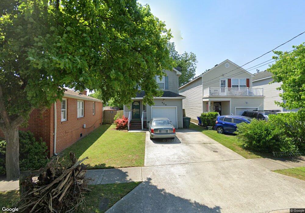
969 Avenue E Norfolk, VA 23513
Colonial Heights NeighborhoodEstimated Value: $305,000 - $366,000
4
Beds
3
Baths
1,752
Sq Ft
$191/Sq Ft
Est. Value
About This Home
This home is located at 969 Avenue E, Norfolk, VA 23513 and is currently estimated at $334,619, approximately $190 per square foot. 969 Avenue E is a home located in Norfolk City with nearby schools including Crossroads School, Norview Middle School, and Norview High School.
Ownership History
Date
Name
Owned For
Owner Type
Purchase Details
Closed on
Jun 21, 2006
Sold by
Evans Herbert and Evans Marianna
Bought by
Blount William M and Blount Marzetta
Current Estimated Value
Home Financials for this Owner
Home Financials are based on the most recent Mortgage that was taken out on this home.
Original Mortgage
$39,700
Outstanding Balance
$23,595
Interest Rate
6.67%
Mortgage Type
Stand Alone Second
Estimated Equity
$311,024
Purchase Details
Closed on
Aug 12, 2005
Sold by
Rich Andrea M
Bought by
Evans Herbert and Evans Marianna
Home Financials for this Owner
Home Financials are based on the most recent Mortgage that was taken out on this home.
Original Mortgage
$182,100
Interest Rate
8.89%
Mortgage Type
Adjustable Rate Mortgage/ARM
Create a Home Valuation Report for This Property
The Home Valuation Report is an in-depth analysis detailing your home's value as well as a comparison with similar homes in the area
Home Values in the Area
Average Home Value in this Area
Purchase History
| Date | Buyer | Sale Price | Title Company |
|---|---|---|---|
| Blount William M | $198,500 | -- | |
| Evans Herbert | $179,000 | -- |
Source: Public Records
Mortgage History
| Date | Status | Borrower | Loan Amount |
|---|---|---|---|
| Open | Blount William M | $39,700 | |
| Open | Blount William M | $158,800 | |
| Previous Owner | Evans Herbert | $182,100 |
Source: Public Records
Tax History
| Year | Tax Paid | Tax Assessment Tax Assessment Total Assessment is a certain percentage of the fair market value that is determined by local assessors to be the total taxable value of land and additions on the property. | Land | Improvement |
|---|---|---|---|---|
| 2025 | $3,370 | $269,600 | $33,000 | $236,600 |
| 2024 | $3,139 | $251,100 | $33,000 | $218,100 |
| 2023 | $3,075 | $246,000 | $30,000 | $216,000 |
| 2022 | $3,013 | $241,000 | $25,000 | $216,000 |
| 2021 | $2,684 | $214,700 | $18,500 | $196,200 |
| 2020 | $2,561 | $204,900 | $14,000 | $190,900 |
| 2019 | $2,543 | $203,400 | $12,500 | $190,900 |
| 2018 | $2,364 | $189,100 | $11,500 | $177,600 |
| 2017 | $2,156 | $187,500 | $11,500 | $176,000 |
| 2016 | $2,119 | $179,000 | $11,500 | $167,500 |
| 2015 | $2,059 | $179,000 | $11,500 | $167,500 |
| 2014 | $2,059 | $179,000 | $11,500 | $167,500 |
Source: Public Records
Map
Nearby Homes
- 7416 Pomona St
- 7417 Evelyn T Butts Ave
- 7409 Hooper St
- 1077 Kittrell St
- 909 Workwood Rd
- 809 Craten Rd
- 6804 Thaxton St
- 968 Wolcott Ave
- 936 Widgeon Rd
- 977 Wolcott Ave
- 6618 Palem Rd
- 920 Widgeon Rd
- 6841 Cedarwood Ct
- 837 Tifton St
- 1005 Marietta Ave
- 805 Tifton St
- 974 Philpotts Rd
- 7449 Fenner St
- 7434 Spartan Ave
- 7948 Merritt St
Your Personal Tour Guide
Ask me questions while you tour the home.