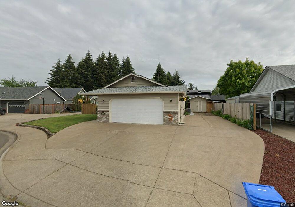
969 Belair Dr Eugene, OR 97404
Santa Clara NeighborhoodEstimated Value: $429,373 - $504,000
3
Beds
2
Baths
1,376
Sq Ft
$332/Sq Ft
Est. Value
About This Home
This home is located at 969 Belair Dr, Eugene, OR 97404 and is currently estimated at $456,343, approximately $331 per square foot. 969 Belair Dr is a home located in Lane County with nearby schools including Irving Elementary School and Willamette High School.
Ownership History
Date
Name
Owned For
Owner Type
Purchase Details
Closed on
Aug 28, 2025
Sold by
Darby Lance S and Helbling Janice M
Bought by
Darby Lance S and Helbling Janice M
Current Estimated Value
Purchase Details
Closed on
Jan 9, 1998
Sold by
Ellibee Gery G
Bought by
Helbling Joe C and Helbling Janice M
Home Financials for this Owner
Home Financials are based on the most recent Mortgage that was taken out on this home.
Original Mortgage
$75,000
Interest Rate
7.14%
Create a Home Valuation Report for This Property
The Home Valuation Report is an in-depth analysis detailing your home's value as well as a comparison with similar homes in the area
Home Values in the Area
Average Home Value in this Area
Purchase History
| Date | Buyer | Sale Price | Title Company |
|---|---|---|---|
| Darby Lance S | -- | None Listed On Document | |
| Helbling Joe C | $133,500 | Western Pioneer Title Co |
Source: Public Records
Mortgage History
| Date | Status | Borrower | Loan Amount |
|---|---|---|---|
| Previous Owner | Helbling Joe C | $75,000 |
Source: Public Records
Tax History Compared to Growth
Tax History
| Year | Tax Paid | Tax Assessment Tax Assessment Total Assessment is a certain percentage of the fair market value that is determined by local assessors to be the total taxable value of land and additions on the property. | Land | Improvement |
|---|---|---|---|---|
| 2025 | $4,380 | $251,828 | -- | -- |
| 2024 | $4,270 | $244,494 | -- | -- |
| 2023 | $4,270 | $237,373 | $0 | $0 |
| 2022 | $3,975 | $230,460 | $0 | $0 |
| 2021 | $3,891 | $223,748 | $0 | $0 |
| 2020 | $3,777 | $217,232 | $0 | $0 |
| 2019 | $3,592 | $210,905 | $0 | $0 |
| 2018 | $3,491 | $198,799 | $0 | $0 |
| 2017 | $3,337 | $198,799 | $0 | $0 |
| 2016 | $3,252 | $193,009 | $0 | $0 |
| 2015 | $3,188 | $187,387 | $0 | $0 |
| 2014 | $3,139 | $181,929 | $0 | $0 |
Source: Public Records
Map
Nearby Homes
- 871 Corvette Ln
- 2734 Kalmia St
- 2451 Bowtie Ave
- 2488 Northampton
- 2795 Kalmia St
- 2698 Crowther Dr
- 2429 Northampton Unit 25
- 2879 Teal Place
- 2484 Crowther Dr
- 2580 Crowther Dr
- 2563 York St
- 2721 La Darrah St
- 507 Littlewood Ln
- 992 Travis Ave
- 1291 Montecello Dr
- 3228 Tilden St
- 1278 Winery Ln
- 1310 David Ave
- 1306 David Ave
- 303 Lenore Loop
- 953 Belair Dr
- 985 Belair Dr
- 973 Belair Dr
- 931 Belair Dr
- 974 Belair Dr
- 960 Impala Ave
- 2680 Kalmia St
- 996 Belair Dr
- 966 Belair Dr
- 980 Belair Dr
- 2555 Northampton
- 917 Belair Dr
- 2551 Northampton
- 2672 Kalmia St
- 940 Belair Dr
- 2684 Kalmia St
- 979 Greenwich Ave
- 965 Greenwich Ave
- 2587 Northampton
- 924 Belair Dr