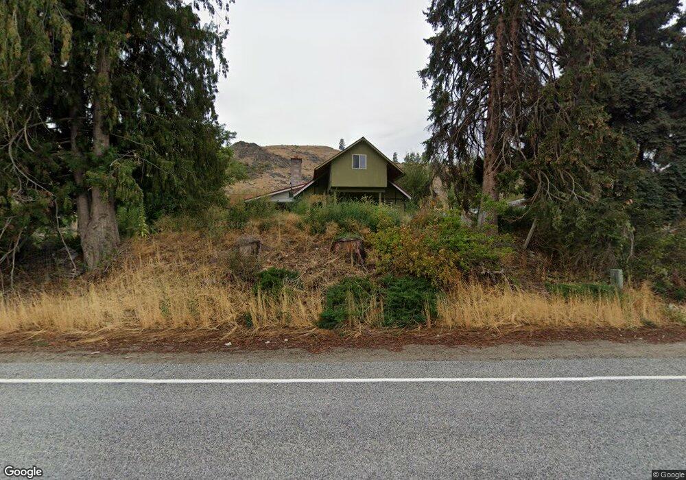
969 Hwy 153 Methow, WA 98834
Estimated Value: $353,440 - $485,000
3
Beds
1
Bath
1,578
Sq Ft
$256/Sq Ft
Est. Value
About This Home
This home is located at 969 Hwy 153, Methow, WA 98834 and is currently estimated at $403,610, approximately $255 per square foot. 969 Hwy 153 is a home located in Okanogan County with nearby schools including Pateros Elementary School and Pateros High School.
Ownership History
Date
Name
Owned For
Owner Type
Purchase Details
Closed on
Jan 19, 2022
Sold by
Marty Stark
Bought by
Sky Investments Llc
Current Estimated Value
Purchase Details
Closed on
Apr 12, 2011
Sold by
Mickels Ronald
Bought by
Stark Marty
Create a Home Valuation Report for This Property
The Home Valuation Report is an in-depth analysis detailing your home's value as well as a comparison with similar homes in the area
Home Values in the Area
Average Home Value in this Area
Purchase History
| Date | Buyer | Sale Price | Title Company |
|---|---|---|---|
| Sky Investments Llc | $14,852 | Wfg National Title | |
| Stark Marty | $140,000 | Inland Professional Title |
Source: Public Records
Tax History Compared to Growth
Tax History
| Year | Tax Paid | Tax Assessment Tax Assessment Total Assessment is a certain percentage of the fair market value that is determined by local assessors to be the total taxable value of land and additions on the property. | Land | Improvement |
|---|---|---|---|---|
| 2025 | $2,083 | $279,400 | $92,700 | $186,700 |
| 2024 | $2,083 | $248,300 | $92,700 | $155,600 |
| 2022 | $1,964 | $160,700 | $83,200 | $77,500 |
| 2021 | $1,768 | $160,700 | $83,200 | $77,500 |
| 2020 | $1,753 | $142,800 | $83,200 | $59,600 |
| 2019 | $1,543 | $142,800 | $83,200 | $59,600 |
| 2018 | $1,845 | $142,800 | $83,200 | $59,600 |
| 2017 | $1,884 | $160,500 | $91,300 | $52,200 |
| 2016 | $1,916 | $160,500 | $108,300 | $52,200 |
| 2015 | $2,046 | $143,500 | $91,300 | $52,200 |
| 2013 | -- | $190,900 | $138,700 | $52,200 |
Source: Public Records
Map
Nearby Homes
- 0 Flycast Rd Unit NWM2358192
- 6 Cowboy Rd
- 31 Cowboy Rd
- 4 Brook Trout Ln
- 251 Burma Rd
- 1077 Washington 153
- 38A Main St
- 29 Barn Dance Dr
- 0 Sky Ridge Rd Unit NWM2346303
- 2xx Buckhorn Mountain Rd
- 15 Cowboy Rd
- 15 Sawtooth View Rd
- 2 Island View Ln
- 2 River Vista Short Plat
- 12 Charlie Dr
- Lot 4 High Ranch Rd
- 3 Xx Buckhorn Mountain Rd
- 2 Methow Plateau Short Plat
- 0 Lot 2 Highland Vista
- 577 Bill Shaw Rd
- 13 Whitewater Dr
- 30 Whitewater Dr
- 6 Hunter Mountain Dr
- 17 Hunter Mountain Dr
- 999 Highway 153
- 0 Backcast Rd Unit 29102233
- 998 Highway 153
- 935 Highway 153
- 12 Backcast Rd
- 100 Burma Rd
- 0 Lot 3 Chinook
- 0 Lot 4 Steelhead Short Plat
- 43 Flycast Rd
- 0 Lot 28 Cowboy Rd
- 0 Lot 12 Cowboy Rd
- 6 (LOT 6) Cowboy Rd
- 0 Cowboy Rd Unit 28 MMR2 1887592
- 0 Cowboy Rd Unit 25 MMR2 1887551
- 7 Cowboy Rd
- 38 Cowboy Rd Unit 38