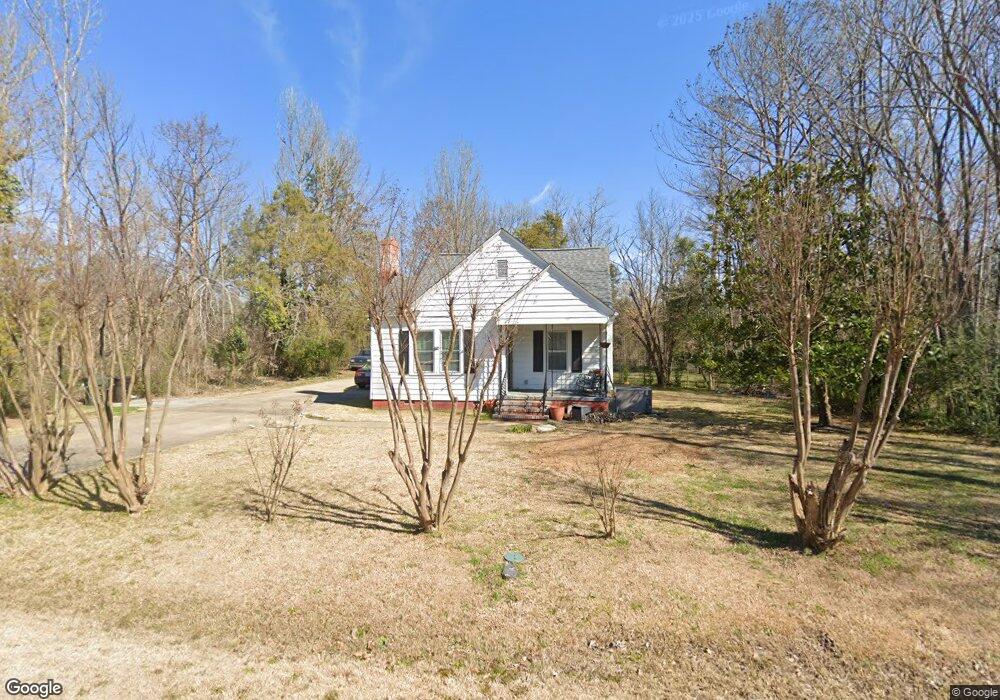
969 Pearson Dr Rock Hill, SC 29730
Estimated Value: $179,000 - $213,867
2
Beds
1
Bath
994
Sq Ft
$198/Sq Ft
Est. Value
About This Home
This home is located at 969 Pearson Dr, Rock Hill, SC 29730 and is currently estimated at $196,717, approximately $197 per square foot. 969 Pearson Dr is a home located in York County with nearby schools including Mount Holly Elementary School, Saluda Trail Middle School, and Rock Hill High School.
Ownership History
Date
Name
Owned For
Owner Type
Purchase Details
Closed on
Feb 10, 2023
Sold by
5Th & Pearson Llc
Bought by
Nolte Carol Mariah
Current Estimated Value
Home Financials for this Owner
Home Financials are based on the most recent Mortgage that was taken out on this home.
Original Mortgage
$149,650
Outstanding Balance
$144,774
Interest Rate
6.12%
Mortgage Type
New Conventional
Estimated Equity
$51,943
Purchase Details
Closed on
Dec 10, 2008
Sold by
Federal Home Loan Mortgage Corporation
Bought by
Felton Kevin J and Huffman Lonnie W
Home Financials for this Owner
Home Financials are based on the most recent Mortgage that was taken out on this home.
Original Mortgage
$30,000
Interest Rate
5.48%
Mortgage Type
Purchase Money Mortgage
Purchase Details
Closed on
Apr 14, 2008
Sold by
Cunningham Helen D
Bought by
Federal Home Loan Mortgage Corporation
Create a Home Valuation Report for This Property
The Home Valuation Report is an in-depth analysis detailing your home's value as well as a comparison with similar homes in the area
Home Values in the Area
Average Home Value in this Area
Purchase History
| Date | Buyer | Sale Price | Title Company |
|---|---|---|---|
| Nolte Carol Mariah | $149,650 | -- | |
| Felton Kevin J | $40,000 | -- | |
| Federal Home Loan Mortgage Corporation | $2,500 | -- |
Source: Public Records
Mortgage History
| Date | Status | Borrower | Loan Amount |
|---|---|---|---|
| Open | Nolte Carol Mariah | $149,650 | |
| Previous Owner | Felton Kevin J | $30,000 |
Source: Public Records
Tax History Compared to Growth
Tax History
| Year | Tax Paid | Tax Assessment Tax Assessment Total Assessment is a certain percentage of the fair market value that is determined by local assessors to be the total taxable value of land and additions on the property. | Land | Improvement |
|---|---|---|---|---|
| 2024 | $1,239 | $5,645 | $1,400 | $4,245 |
| 2023 | $649 | $2,950 | $1,400 | $1,550 |
| 2022 | $1,869 | $4,425 | $2,100 | $2,325 |
| 2021 | -- | $4,425 | $2,100 | $2,325 |
| 2020 | $1,832 | $4,425 | $0 | $0 |
| 2019 | $1,795 | $4,230 | $0 | $0 |
| 2018 | $1,769 | $4,230 | $0 | $0 |
| 2017 | $1,708 | $4,230 | $0 | $0 |
| 2016 | $1,662 | $4,200 | $0 | $0 |
| 2014 | $1,639 | $4,200 | $1,200 | $3,000 |
| 2013 | $1,639 | $4,320 | $1,200 | $3,120 |
Source: Public Records
Map
Nearby Homes
- 1104 Parkmont Ln
- 263 Fairway Cir
- 264 Abigail Ct
- 1212 Shenandoah Cir
- 831 Yale St Unit 30
- 1209 Shenandoah Cir
- 288 Fairway Cir
- 1182 Saluda St
- 805 Brunswick Dr
- 914 Bunker Trace
- 1361 Mount Holly Rd
- 846 Mallory Dr
- 753 Schuyler Dr
- 922 Bunker Trace
- 706 Blake St
- 172 Fairway Cir
- Pratt II Plan at Colvin Park
- Winslow Plan at Colvin Park
- Brooks II Plan at Colvin Park
- Charlotte II Plan at Colvin Park
- 1009 Pearson Dr
- 957 Pearson Dr
- 970 Pearson Dr
- 978 Pearson Dr
- 964 Pearson Dr
- 1012 Pearson Dr
- 949 Pearson Dr
- 958 Pearson Dr
- 1020 Pearson Dr
- 941 Pearson Dr
- 1028 Pearson Dr
- 942 Pearson Dr
- 935 Pearson Dr
- 936 Pearson Dr
- 934 Pearson Dr
- 927 Pearson Dr
- 1036 Pearson Dr
- 1073 Pearson Dr
- 930 Pearson Dr
- 905 Southland Dr