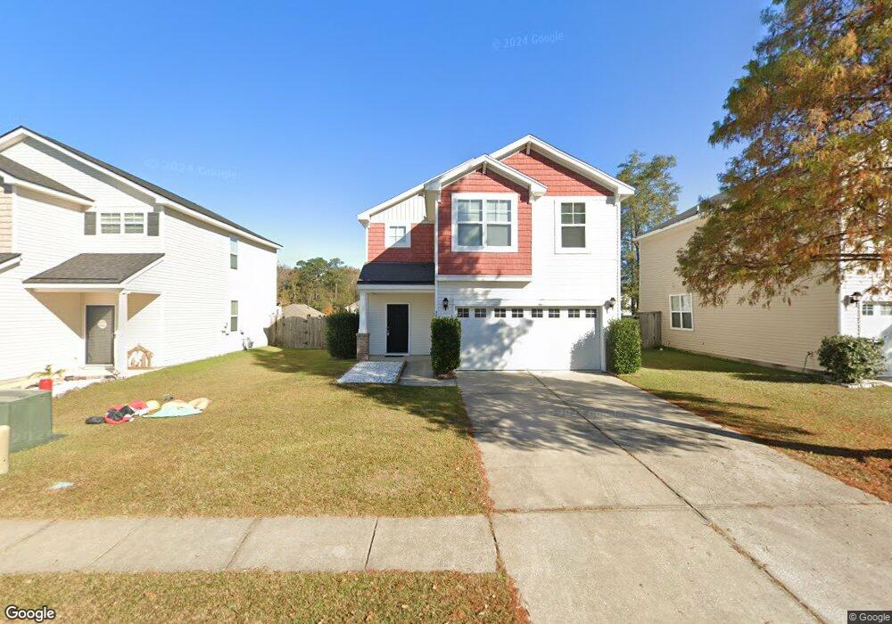
9690 Mosgrove Ave Ladson, SC 29456
Estimated Value: $314,610 - $346,000
3
Beds
3
Baths
1,678
Sq Ft
$196/Sq Ft
Est. Value
About This Home
This home is located at 9690 Mosgrove Ave, Ladson, SC 29456 and is currently estimated at $329,153, approximately $196 per square foot. 9690 Mosgrove Ave is a home located in Dorchester County with nearby schools including Joseph R. Pye Elementary, Oakbrook Middle School, and Fort Dorchester High School.
Ownership History
Date
Name
Owned For
Owner Type
Purchase Details
Closed on
Aug 13, 2019
Sold by
Pham Dat
Bought by
Nguyen Minh Tram Le
Current Estimated Value
Purchase Details
Closed on
Sep 9, 2010
Sold by
Centex Homes
Bought by
Pham Dat
Home Financials for this Owner
Home Financials are based on the most recent Mortgage that was taken out on this home.
Original Mortgage
$140,065
Interest Rate
4.2%
Mortgage Type
FHA
Create a Home Valuation Report for This Property
The Home Valuation Report is an in-depth analysis detailing your home's value as well as a comparison with similar homes in the area
Purchase History
| Date | Buyer | Sale Price | Title Company |
|---|---|---|---|
| Nguyen Minh Tram Le | -- | None Available | |
| Pham Dat | $141,952 | -- |
Source: Public Records
Mortgage History
| Date | Status | Borrower | Loan Amount |
|---|---|---|---|
| Previous Owner | Pham Dat | $140,065 |
Source: Public Records
Tax History
| Year | Tax Paid | Tax Assessment Tax Assessment Total Assessment is a certain percentage of the fair market value that is determined by local assessors to be the total taxable value of land and additions on the property. | Land | Improvement |
|---|---|---|---|---|
| 2025 | $5,541 | $18,842 | $6,900 | $11,942 |
| 2024 | $5,490 | $18,842 | $6,900 | $11,942 |
| 2023 | $5,490 | $10,925 | $3,300 | $7,625 |
| 2022 | $4,882 | $10,870 | $2,760 | $8,110 |
| 2021 | $4,882 | $10,870 | $2,760 | $8,110 |
| 2020 | $4,773 | $9,450 | $2,400 | $7,050 |
| 2019 | $4,735 | $9,450 | $2,400 | $7,050 |
| 2018 | $4,063 | $6,300 | $1,600 | $4,700 |
| 2017 | $3,998 | $6,300 | $1,600 | $4,700 |
| 2016 | $1,550 | $6,300 | $1,600 | $4,700 |
| 2015 | $1,546 | $6,300 | $1,600 | $4,700 |
| 2014 | $1,450 | $140,600 | $0 | $0 |
| 2013 | -- | $5,620 | $0 | $0 |
Source: Public Records
Map
Nearby Homes
- 4829 Hawkins Dr
- 4810 Hawkins Dr
- 9754 Seed St
- 9664 Wilhammer Ct
- 9817 Seed St
- 9720 Brandishing Rd
- 9656 Brandishing Rd
- 9008 Fieldstone Trace
- 9020 Greenbriar Dr
- 4833 Cherry Blossom Dr
- 9747 Transplanter Cir
- 4860 Hearthside Dr
- 9068 Fieldstone Trace
- 9237 Ayscough Rd
- 9041 Fieldstone Trace
- 4938 Ballantine Dr
- 206 Equinox Cir
- 5027 Thornton Dr
- 5018 W Liberty Meadows Dr
- 9430 Sweep Dr
- 9692 Mosgrove Ave
- 9688 Mosgrove Ave
- 9686 Mosgrove Ave
- 4833 Hawkins Dr
- 9684 Mosgrove Ave
- 9687 Mosgrove Ave
- 4827 Hawkins Dr
- 9691 Mosgrove Ave
- 9689 Mosgrove Ave
- 9693 Mosgrove Ave
- 4835 Hawkins Dr
- 4825 Hawkins Dr
- 9698 Mosgrove Ave
- 9685 Mosgrove Ave
- 9682 Mosgrove Ave
- 9695 Mosgrove Ave
- 4823 Hawkins Dr
- 9683 Mosgrove Ave
- 4837 Hawkins Dr
- 9697 Mosgrove Ave