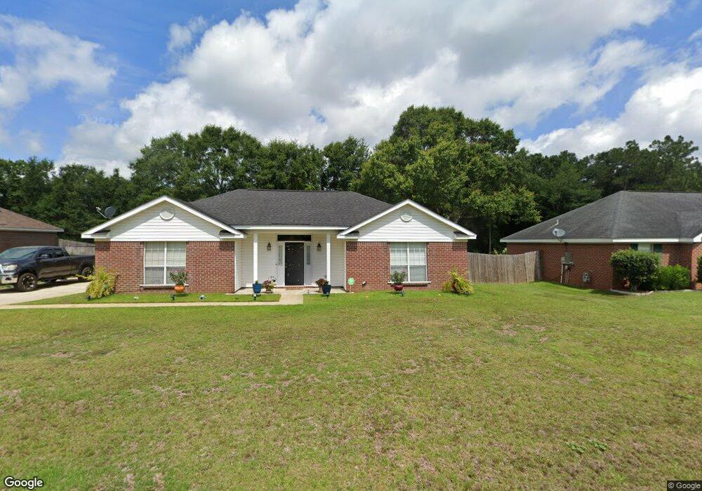
9690 Oak Forrest Dr Mobile, AL 36695
Baker NeighborhoodEstimated Value: $197,000 - $240,000
3
Beds
2
Baths
1,513
Sq Ft
$144/Sq Ft
Est. Value
About This Home
This home is located at 9690 Oak Forrest Dr, Mobile, AL 36695 and is currently estimated at $217,242, approximately $143 per square foot. 9690 Oak Forrest Dr is a home located in Mobile County with nearby schools including Elsie Collier Elementary School, Bernice J Causey Middle School, and Baker High School.
Ownership History
Date
Name
Owned For
Owner Type
Purchase Details
Closed on
Jan 21, 2005
Sold by
Vaughn Matthew Payton and Thompson Jason Wayne
Bought by
Beech Stuart L and Beech Gabriela M
Current Estimated Value
Purchase Details
Closed on
Jul 5, 2000
Sold by
John Howard Homes Ltd
Bought by
Vaughn Matthew Payton and Thompson Jason Wayne
Home Financials for this Owner
Home Financials are based on the most recent Mortgage that was taken out on this home.
Original Mortgage
$98,364
Interest Rate
8.54%
Create a Home Valuation Report for This Property
The Home Valuation Report is an in-depth analysis detailing your home's value as well as a comparison with similar homes in the area
Home Values in the Area
Average Home Value in this Area
Purchase History
| Date | Buyer | Sale Price | Title Company |
|---|---|---|---|
| Beech Stuart L | -- | Slt | |
| Vaughn Matthew Payton | -- | -- |
Source: Public Records
Mortgage History
| Date | Status | Borrower | Loan Amount |
|---|---|---|---|
| Previous Owner | Vaughn Matthew Payton | $98,364 |
Source: Public Records
Tax History
| Year | Tax Paid | Tax Assessment Tax Assessment Total Assessment is a certain percentage of the fair market value that is determined by local assessors to be the total taxable value of land and additions on the property. | Land | Improvement |
|---|---|---|---|---|
| 2025 | $784 | $16,150 | $4,000 | $12,150 |
| 2024 | $784 | $15,050 | $4,000 | $11,050 |
| 2023 | $733 | $14,510 | $4,000 | $10,510 |
| 2022 | $565 | $13,030 | $4,000 | $9,030 |
| 2021 | $556 | $12,840 | $4,000 | $8,840 |
| 2020 | $571 | $13,150 | $3,200 | $9,950 |
| 2019 | $574 | $13,220 | $0 | $0 |
| 2018 | $587 | $13,480 | $0 | $0 |
| 2017 | $598 | $12,260 | $0 | $0 |
| 2016 | $528 | $12,260 | $0 | $0 |
| 2013 | $602 | $12,980 | $0 | $0 |
Source: Public Records
Map
Nearby Homes
- 9650 Oak Forrest Dr
- 9613 Oak Forrest Place
- 9630 Oak Forrest Dr Unit 2
- 1170 Wellington Ct S
- 0 New Neck Rd Unit 387066
- 1145 Dominion Dr E
- 9410 Ashwood Ct
- 9375 Ashwood Ct
- 860 Trailwood Dr E
- 9633 Royal Woods Dr S
- 10023 Springfield Ct
- 9751 Pine Knoll Rd
- 835 Royal Woods Dr E
- 10635 Burlington Estates Dr
- 1235 Wakefield Dr E
- 10153 Tarawood Ct
- 10164 Waterford Way
- 750 Hale Rd
- 9841 Shadow Wood Dr
- 801 Copperfield Dr E
- 9710 Oak Forrest Dr
- 9670 Oak Forrest Dr
- 9685 Oak Forrest Dr
- 9675 Oak Forrest Dr
- 9695 Oak Forrest Dr
- 9720 Oak Forrest Dr
- 9705 Oak Forrest Dr
- 9705 Oak Forrest Dr
- 9660 Oak Forrest Dr
- 9655 Oak Forrest Dr
- 9715 Oak Forrest Dr
- 9730 Oak Forrest Dr
- 9640 Hanford Ct
- 9635 Hanford Ct
- 9725 Oak Forrest Dr
- 9623 Oak Forrest Place
- 9740 Oak Forrest Dr
- 9632 Cheyney Ct
- 9630 Hanford Ct
- 9640 Oak Forrest Dr
Your Personal Tour Guide
Ask me questions while you tour the home.