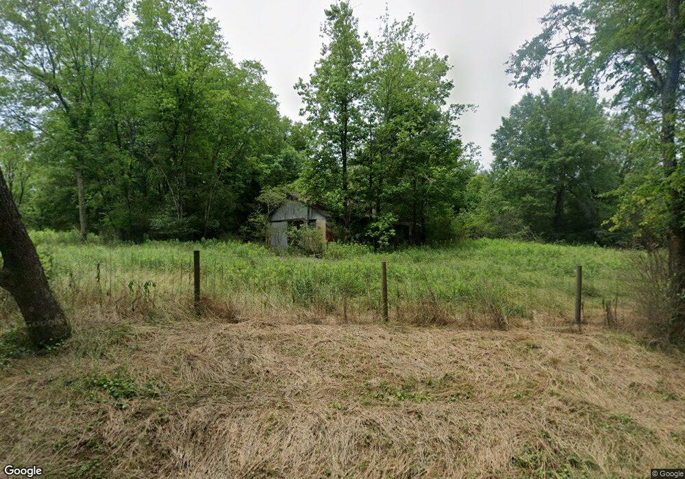
9694 Lower Thomaston Rd Macon, GA 31220
Estimated Value: $222,000 - $361,000
--
Bed
--
Bath
1,549
Sq Ft
$177/Sq Ft
Est. Value
About This Home
This home is located at 9694 Lower Thomaston Rd, Macon, GA 31220 and is currently estimated at $273,842, approximately $176 per square foot. 9694 Lower Thomaston Rd is a home with nearby schools including Skyview Elementary School, Rutland Middle School, and Rutland High School.
Ownership History
Date
Name
Owned For
Owner Type
Purchase Details
Closed on
Jul 30, 2019
Sold by
Mcelmurray Douglas
Bought by
Groselle Dan
Current Estimated Value
Home Financials for this Owner
Home Financials are based on the most recent Mortgage that was taken out on this home.
Original Mortgage
$192,000
Interest Rate
3.7%
Mortgage Type
Seller Take Back
Purchase Details
Closed on
Jul 11, 2018
Sold by
Mcelmurray Douglas
Bought by
Groselle Dan
Purchase Details
Closed on
Jun 1, 1989
Sold by
Mcelmurray Edith A
Bought by
Mcelmurray Douglas
Create a Home Valuation Report for This Property
The Home Valuation Report is an in-depth analysis detailing your home's value as well as a comparison with similar homes in the area
Home Values in the Area
Average Home Value in this Area
Purchase History
| Date | Buyer | Sale Price | Title Company |
|---|---|---|---|
| Groselle Dan | $240,000 | None Available | |
| Groselle Dan | $188,640 | None Available | |
| Mcelmurray Douglas | -- | -- |
Source: Public Records
Mortgage History
| Date | Status | Borrower | Loan Amount |
|---|---|---|---|
| Closed | Groselle Dan | $192,000 |
Source: Public Records
Tax History Compared to Growth
Tax History
| Year | Tax Paid | Tax Assessment Tax Assessment Total Assessment is a certain percentage of the fair market value that is determined by local assessors to be the total taxable value of land and additions on the property. | Land | Improvement |
|---|---|---|---|---|
| 2025 | $405 | $81,426 | $76,654 | $4,772 |
| 2024 | $387 | $81,426 | $76,654 | $4,772 |
| 2023 | $379 | $81,426 | $76,654 | $4,772 |
| 2022 | $391 | $68,797 | $67,365 | $1,432 |
| 2021 | $412 | $55,153 | $53,892 | $1,261 |
| 2020 | $407 | $55,068 | $53,892 | $1,176 |
| 2019 | $396 | $54,953 | $53,892 | $1,061 |
| 2018 | $1,242 | $84,661 | $82,450 | $2,211 |
| 2017 | $647 | $84,661 | $82,450 | $2,211 |
| 2016 | $582 | $84,662 | $82,450 | $2,211 |
| 2015 | $751 | $83,586 | $82,450 | $1,136 |
| 2014 | $740 | $84,155 | $82,450 | $1,705 |
Source: Public Records
Map
Nearby Homes
- 2198 Dennis Rd
- 137 Shady Dale Dr
- 8294 Shelley Trail
- 2550 Midway Rd
- 9390 Hopewell Rd
- 519 Bluewater Bay Dr
- 402 Harbor Cove Dr
- 402 Harbor Cove Dr Unit 32
- 511 Bluewater Bay Dr
- 112 Peninsula Ave
- 104 Peninsula Ave
- 104 Peninsula Ave Unit LOT 49
- 156 Peninsula Ave
- 140 Peninsula Ave
- 8278 Lower Thomaston Rd
- 1302 Barrington Place Cove
- Plan 3040 at Barrington Place
- Plan 2700 at Barrington Place
- Plan 2620 at Barrington Place
- Plan 2100 at Barrington Place
- 9743 Lower Thomaston Rd
- 9737 Lower Thomaston Rd
- 9747 Lower Thomaston Rd
- 2090 Dennis Rd
- 9751 Lower Thomaston Rd
- 9759 Lower Thomaston Rd
- 9711 Lower Thomaston Rd
- 9761 Lower Thomaston Rd
- 9555 Lower Thomaston Rd
- 2128 Dennis Rd
- 2140 Dennis Rd
- 9801 Lower Thomaston Rd
- 9801 Lower Thomaston Rd Unit 1A
- 2420 Dennis Rd
- 2455 Dennis Rd
- 2170 Dennis Rd
- 9900 Lower Thomaston Rd
- 9066 Thomaston Rd
- 9058 Thomaston Rd
- 10015 Lower Thomaston Rd