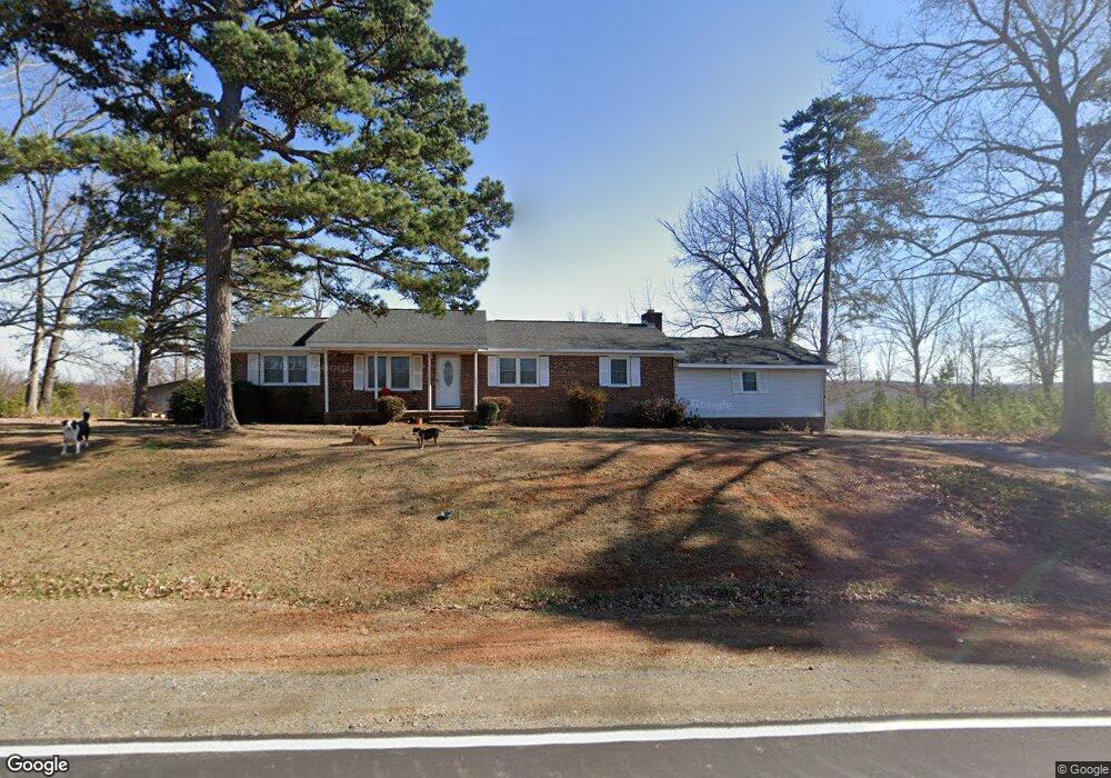
9696 Dirgie Mine Rd Roxboro, NC 27574
Estimated Value: $167,989 - $254,000
--
Bed
1
Bath
1,120
Sq Ft
$186/Sq Ft
Est. Value
About This Home
This home is located at 9696 Dirgie Mine Rd, Roxboro, NC 27574 and is currently estimated at $208,747, approximately $186 per square foot. 9696 Dirgie Mine Rd is a home located in Person County with nearby schools including Person High School.
Ownership History
Date
Name
Owned For
Owner Type
Purchase Details
Closed on
Jul 11, 2024
Sold by
Whitt Larry and Rahman-Whitt Hafeezah
Bought by
Rahman Whitt Family Trust and Whitt
Current Estimated Value
Purchase Details
Closed on
Sep 27, 2013
Sold by
Vantium Reo Capital Markets Lp
Bought by
Whitt Larry and Rahman Whitt Hafeezah
Purchase Details
Closed on
Jul 23, 2013
Sold by
Wells Fargo Bank Na
Bought by
Vantium Reo Capital Markets Lp
Purchase Details
Closed on
Jun 19, 2013
Sold by
Whitt Larry R
Bought by
Wells Fargo Bank N A
Create a Home Valuation Report for This Property
The Home Valuation Report is an in-depth analysis detailing your home's value as well as a comparison with similar homes in the area
Home Values in the Area
Average Home Value in this Area
Purchase History
| Date | Buyer | Sale Price | Title Company |
|---|---|---|---|
| Rahman Whitt Family Trust | -- | None Listed On Document | |
| Whitt Larry | $55,000 | None Available | |
| Vantium Reo Capital Markets Lp | -- | None Available | |
| Wells Fargo Bank N A | $80,000 | None Available |
Source: Public Records
Tax History Compared to Growth
Tax History
| Year | Tax Paid | Tax Assessment Tax Assessment Total Assessment is a certain percentage of the fair market value that is determined by local assessors to be the total taxable value of land and additions on the property. | Land | Improvement |
|---|---|---|---|---|
| 2025 | $1,292 | $191,981 | $0 | $0 |
| 2024 | $1,002 | $128,880 | $0 | $0 |
| 2023 | $1,002 | $128,880 | $0 | $0 |
| 2022 | $998 | $128,880 | $0 | $0 |
| 2021 | $969 | $128,880 | $0 | $0 |
| 2020 | $795 | $105,548 | $0 | $0 |
| 2019 | $806 | $105,548 | $0 | $0 |
| 2018 | $755 | $105,548 | $0 | $0 |
| 2017 | $745 | $105,553 | $0 | $0 |
| 2016 | $745 | $105,553 | $0 | $0 |
| 2015 | $745 | $105,553 | $0 | $0 |
| 2014 | $745 | $105,553 | $0 | $0 |
Source: Public Records
Map
Nearby Homes
- 0 Blue Wing Rd
- 9175 Virgilina Rd
- 0 Shady Oak Rd Unit 10102994
- 0 Shady Oak Rd Unit 23863061
- 8365 Aaron Creek Church Rd
- 9593 N Carolina 96
- 1310 Gillis Rd
- 0 Webb Chapel Rd Unit 10099652
- 0 New Mayo Dr Unit 10121125
- 00 New Mayo Dr
- 17.03ac New Mayo Dr
- 0 Thomas Green Rd Unit 10110795
- 682 Wolf Pit Rd
- 87.39 AC Virgilina Rd
- 8596 Redding Rd
- 0 Noel Tuck Rd
- 84 Macbeth Ln
- A67 85 Bowmantown Rd
- A67 178 Bowmantown Rd
- 1105 Fontaine Rd
- 9675 Dirgie Mine Rd
- 9641 Dirgie Mine Rd
- 9607 Dirgie Mine Rd
- 9771 Dirgie Mine Rd
- 9519 Dirgie Mine Rd
- 9358 Dirgie Mine Rd
- 9343 Dirgie Mine Rd
- 9276 Dirgie Mine Rd
- 397 Raymond Lowery Dr
- 615 Faulkner Long Rd
- 0 Raymond Lowery Dr
- 676 Faulkner Long Rd
- 8706 Dirgie Mine Rd
- 8522 Charlie Stovall Rd
- 851 Faulkner Long Rd