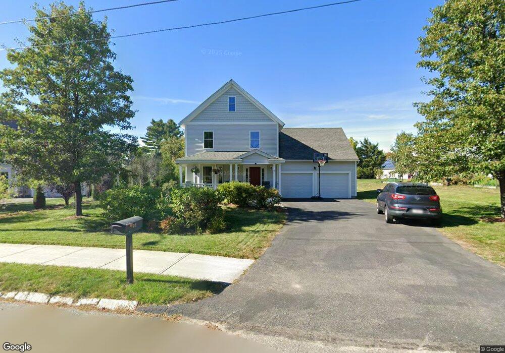
97 Adams Cir Devens, MA 01434
Estimated Value: $706,785 - $900,000
3
Beds
3
Baths
2,004
Sq Ft
$413/Sq Ft
Est. Value
About This Home
This home is located at 97 Adams Cir, Devens, MA 01434 and is currently estimated at $828,196, approximately $413 per square foot. 97 Adams Cir is a home with nearby schools including Hildreth Elementary School, The Bromfield School, and Francis W. Parker Charter Essential School.
Ownership History
Date
Name
Owned For
Owner Type
Purchase Details
Closed on
Jun 4, 2012
Sold by
Transformations Inc
Bought by
Hailemariam Hilina T and Demissie Mesfin B
Current Estimated Value
Home Financials for this Owner
Home Financials are based on the most recent Mortgage that was taken out on this home.
Original Mortgage
$375,250
Outstanding Balance
$156,835
Interest Rate
3.9%
Mortgage Type
New Conventional
Estimated Equity
$671,361
Create a Home Valuation Report for This Property
The Home Valuation Report is an in-depth analysis detailing your home's value as well as a comparison with similar homes in the area
Home Values in the Area
Average Home Value in this Area
Purchase History
| Date | Buyer | Sale Price | Title Company |
|---|---|---|---|
| Hailemariam Hilina T | $395,000 | -- | |
| Hailemariam Hilina T | $395,000 | -- |
Source: Public Records
Mortgage History
| Date | Status | Borrower | Loan Amount |
|---|---|---|---|
| Open | Hailemariam Hilina T | $375,250 | |
| Closed | Hailemariam Hilina T | $375,250 |
Source: Public Records
Tax History
| Year | Tax Paid | Tax Assessment Tax Assessment Total Assessment is a certain percentage of the fair market value that is determined by local assessors to be the total taxable value of land and additions on the property. | Land | Improvement |
|---|---|---|---|---|
| 2025 | $7,353 | $585,900 | $144,700 | $441,200 |
| 2024 | $7,258 | $561,300 | $136,400 | $424,900 |
| 2023 | $7,162 | $527,400 | $136,400 | $391,000 |
| 2022 | $7,176 | $472,700 | $136,400 | $336,300 |
| 2021 | $7,320 | $469,500 | $136,400 | $333,100 |
| 2020 | $7,420 | $462,600 | $136,400 | $326,200 |
| 2019 | $7,153 | $451,600 | $131,400 | $320,200 |
| 2018 | $6,932 | $447,800 | $131,400 | $316,400 |
| 2017 | $7,060 | $435,000 | $146,500 | $288,500 |
| 2016 | $6,551 | $392,500 | $141,000 | $251,500 |
Source: Public Records
Map
Nearby Homes
- 107 Old Mill Rd
- 1 Patterson Rd
- 64 Peabody Rd Unit E
- 9 Blanchard Rd
- 14 Brook St
- 0 Ayer & Old Mill Rd
- 63 E Main St
- 0ABC Park St
- 21 High St
- 7 Baldwin Ct Unit 7
- 23 Nashua St
- 24 Harvard Rd Unit C
- 100 Central Ave Unit 4
- 83 Clark Rd Unit L-19
- 37 Willard St
- 18A S Shaker Rd
- 10 Nashua St
- 98 Pleasant St
- 54 Prospect Hill Rd
- 60 Prospect Hill Rd
- 93 Adams Cir
- 14 Adams Cir
- 4 Adams Cir
- 6 Adams Cir
- 8 Adams Cir
- 89 Adams Cir
- 2 Adams Cir
- 8 Cavite St
- 34 Auman St Devens
- 2 Bates St Unit C
- 2 Bates St Unit B
- 2 Bates St Unit A
- 4 Bates St Unit C
- 4 Bates St Unit B
- 4 Bates St Unit A
- 6 Bates St
- 6 Bates St Unit A
- 6 Bates St Unit B
- 8 Bates St Unit A
- 8 Bates St Unit B
Your Personal Tour Guide
Ask me questions while you tour the home.