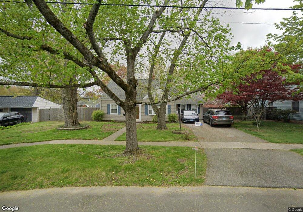
97 Albright Ave Stratford, CT 06614
Estimated Value: $428,000 - $476,000
4
Beds
1
Bath
1,508
Sq Ft
$297/Sq Ft
Est. Value
About This Home
This home is located at 97 Albright Ave, Stratford, CT 06614 and is currently estimated at $448,062, approximately $297 per square foot. 97 Albright Ave is a home located in Fairfield County with nearby schools including Second Hill Lane Elementary School, Harry B. Flood Middle School, and Bunnell High School.
Ownership History
Date
Name
Owned For
Owner Type
Purchase Details
Closed on
Jul 30, 2010
Sold by
Gawricki James and Gawricki Laurie
Bought by
Wylan Amy
Current Estimated Value
Purchase Details
Closed on
Jun 19, 1997
Sold by
Dandrea Domenick and Dandrea Nancy
Bought by
Gawricki James D and Gawricki Laurie P
Home Financials for this Owner
Home Financials are based on the most recent Mortgage that was taken out on this home.
Original Mortgage
$133,850
Interest Rate
7.87%
Mortgage Type
Unknown
Create a Home Valuation Report for This Property
The Home Valuation Report is an in-depth analysis detailing your home's value as well as a comparison with similar homes in the area
Home Values in the Area
Average Home Value in this Area
Purchase History
| Date | Buyer | Sale Price | Title Company |
|---|---|---|---|
| Wylan Amy | $230,000 | -- | |
| Gawricki James D | $138,000 | -- |
Source: Public Records
Mortgage History
| Date | Status | Borrower | Loan Amount |
|---|---|---|---|
| Previous Owner | Gawricki James D | $140,000 | |
| Previous Owner | Gawricki James D | $127,752 | |
| Previous Owner | Gawricki James D | $133,850 |
Source: Public Records
Tax History Compared to Growth
Tax History
| Year | Tax Paid | Tax Assessment Tax Assessment Total Assessment is a certain percentage of the fair market value that is determined by local assessors to be the total taxable value of land and additions on the property. | Land | Improvement |
|---|---|---|---|---|
| 2025 | $6,036 | $150,150 | $72,660 | $77,490 |
| 2024 | $6,036 | $150,150 | $72,660 | $77,490 |
| 2023 | $6,036 | $150,150 | $72,660 | $77,490 |
| 2022 | $5,925 | $150,150 | $72,660 | $77,490 |
| 2021 | $5,926 | $150,150 | $72,660 | $77,490 |
| 2020 | $5,952 | $150,150 | $72,660 | $77,490 |
| 2019 | $6,213 | $155,820 | $74,970 | $80,850 |
| 2018 | $6,217 | $155,820 | $74,970 | $80,850 |
| 2017 | $6,228 | $155,820 | $74,970 | $80,850 |
| 2016 | $6,075 | $155,820 | $74,970 | $80,850 |
| 2015 | $5,762 | $155,820 | $74,970 | $80,850 |
| 2014 | $5,602 | $157,220 | $78,610 | $78,610 |
Source: Public Records
Map
Nearby Homes
- 45 Albright Ave
- 125 Meadowbrook Rd
- 877 Nichols Ave
- 26 Porter St
- 71 Glenfield Ave
- 1257 Nichols Ave
- 810 Nichols Ave
- 58 Auburn St
- 56 Vought Place Unit 56
- 2803 Broadbridge Ave
- 90 Mercer St
- 137 Marsh Way
- 128 Auburn St
- 598 Nichols Ave
- 152 Stonybrook Rd
- 145 Wiebe Ave
- 83 William St
- 106 Red Bird Dr
- 309 Freeman Ave
- 422 Swanson Ave
- 85 Albright Ave
- 111 Albright Ave
- 52 Albert Ave
- 72 Albert Ave
- 32 Albert Ave
- 71 Albright Ave
- 92 Albert Ave
- 125 Albright Ave
- 112 Albright Ave
- 12 Albert Ave
- 10 Adolphson Ave
- 181 Porter St
- 114 Albright Ave
- 134 Albright Ave
- 156 Albright Ave
- 178 Porter St
- 82 Albright Ave
- 390 Greenfield Ave
- 370 Greenfield Ave
- 142 Albright Ave