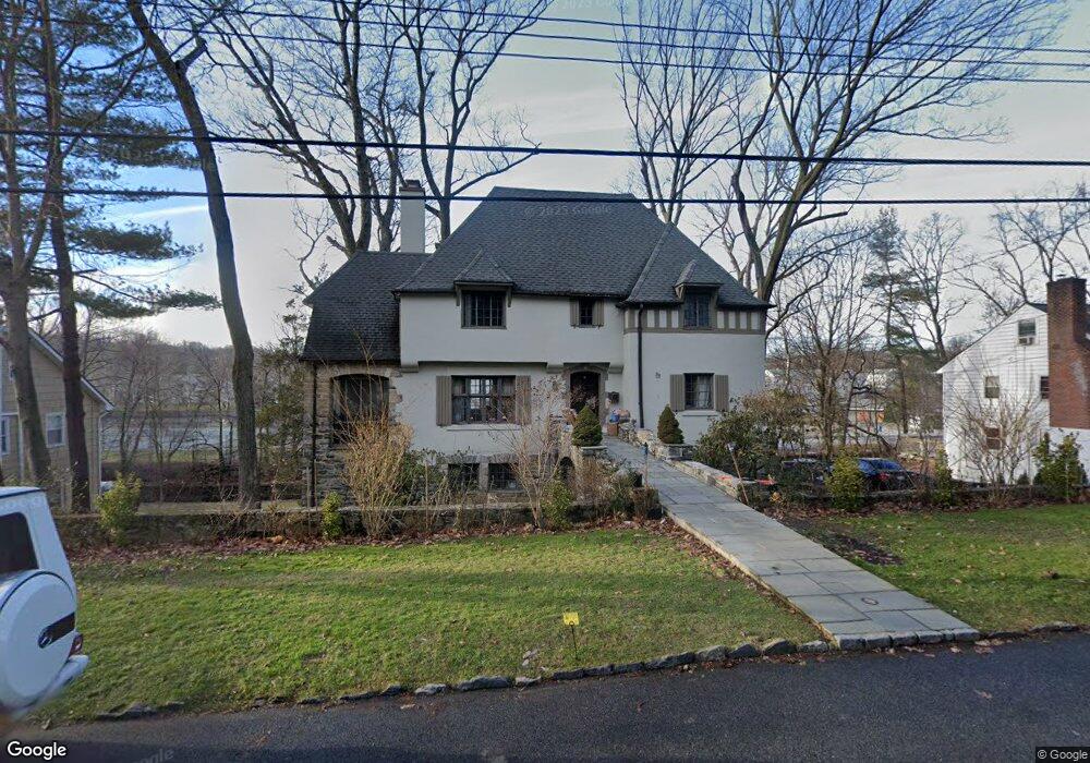
97 Birch Brook Rd Bronxville, NY 10708
Cedar Knolls NeighborhoodEstimated Value: $1,441,000 - $1,795,000
5
Beds
5
Baths
3,904
Sq Ft
$415/Sq Ft
Est. Value
About This Home
This home is located at 97 Birch Brook Rd, Bronxville, NY 10708 and is currently estimated at $1,619,753, approximately $414 per square foot. 97 Birch Brook Rd is a home located in Westchester County with nearby schools including St. Eugene School and Saint Joseph School.
Ownership History
Date
Name
Owned For
Owner Type
Purchase Details
Closed on
Nov 5, 2014
Sold by
Bryant Heather B
Bought by
Ahmed Benzier and Chowdhury Abdul
Current Estimated Value
Home Financials for this Owner
Home Financials are based on the most recent Mortgage that was taken out on this home.
Original Mortgage
$523,800
Outstanding Balance
$413,716
Interest Rate
4.87%
Mortgage Type
Adjustable Rate Mortgage/ARM
Estimated Equity
$1,206,037
Purchase Details
Closed on
Jun 12, 2014
Sold by
Bryant Samuel C and Bryant Heather B
Bought by
Bryant Heather B
Create a Home Valuation Report for This Property
The Home Valuation Report is an in-depth analysis detailing your home's value as well as a comparison with similar homes in the area
Home Values in the Area
Average Home Value in this Area
Purchase History
| Date | Buyer | Sale Price | Title Company |
|---|---|---|---|
| Ahmed Benzier | $873,000 | Record & Return Title Agency | |
| Bryant Heather B | -- | None Available |
Source: Public Records
Mortgage History
| Date | Status | Borrower | Loan Amount |
|---|---|---|---|
| Open | Ahmed Benzier | $523,800 |
Source: Public Records
Tax History Compared to Growth
Tax History
| Year | Tax Paid | Tax Assessment Tax Assessment Total Assessment is a certain percentage of the fair market value that is determined by local assessors to be the total taxable value of land and additions on the property. | Land | Improvement |
|---|---|---|---|---|
| 2024 | $3,938 | $22,100 | $6,700 | $15,400 |
| 2023 | $3,917 | $22,100 | $6,700 | $15,400 |
| 2022 | $3,892 | $22,100 | $6,700 | $15,400 |
| 2021 | $18,994 | $22,100 | $6,700 | $15,400 |
| 2020 | $20,721 | $22,100 | $6,700 | $15,400 |
| 2019 | $21,868 | $22,100 | $6,700 | $15,400 |
| 2018 | $18,665 | $22,100 | $6,700 | $15,400 |
| 2017 | $0 | $22,100 | $6,700 | $15,400 |
| 2016 | $19,675 | $22,100 | $6,700 | $15,400 |
| 2015 | -- | $22,100 | $6,700 | $15,400 |
| 2014 | -- | $22,100 | $6,700 | $15,400 |
| 2013 | -- | $22,100 | $6,700 | $15,400 |
Source: Public Records
Map
Nearby Homes
- 9 Winchester Ave Unit 2B
- 1 Arlington St Unit 2B
- 1523 Central Park Ave Unit 5F
- 12 Winchester Ave Unit 2b
- 46 Dellwood Rd
- 209 Pondfield Rd W
- 212 Pondfield Rd W
- 139 Ellison Ave
- 133 Pondfield Rd W Unit 2B
- 1537 Central Park Ave Unit E8
- 1543 Central Park Ave Unit F8
- 119 Pondfield Rd W
- 1549 Central Park Ave Unit G-11
- 49 Rockledge Rd Unit 12E
- 1561 Central Park Ave Unit I-5
- 1561 Central Park Ave Unit I2
- 540 Tuckahoe Rd Unit 10A
- 560 Tuckahoe Rd Unit 1B
- 615 Palmer Rd Unit 602
- 615 Palmer Rd Unit 102
- 97 Birchbrook Rd
- 87 Birch Brook Rd
- 87 Birch Brook Rd
- 105 Birch Brook Rd
- 96 Birch Brook Rd
- 100 Birch Brook Rd
- 79 Birchbrook Rd
- 79 Birch Brook Rd
- 113 Birch Brook Rd
- 113 Birchbrook Rd
- 88 Birch Brook Rd
- 108 Birch Brook Rd
- 78 Birch Brook Rd
- 71 Birch Brook Rd
- 107 Dellwood Rd
- 121 Birch Brook Rd
- 129 Dellwood Rd
- 70 Birchbrook Rd
- 70 Birch Brook Rd
- 135 Dellwood Rd