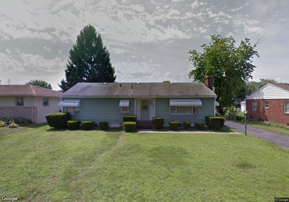
97 Cullman Rd Columbus, OH 43207
Obetz-Lockbourne NeighborhoodEstimated Value: $214,004 - $236,000
3
Beds
2
Baths
1,248
Sq Ft
$181/Sq Ft
Est. Value
About This Home
This home is located at 97 Cullman Rd, Columbus, OH 43207 and is currently estimated at $225,751, approximately $180 per square foot. 97 Cullman Rd is a home located in Franklin County with nearby schools including Parsons Elementary School, Buckeye Middle School, and Marion-Franklin High School.
Ownership History
Date
Name
Owned For
Owner Type
Purchase Details
Closed on
Jun 8, 2007
Sold by
Rawlings Kathleen P
Bought by
Newlen Jeffrey W and Newlen Roberta J
Current Estimated Value
Home Financials for this Owner
Home Financials are based on the most recent Mortgage that was taken out on this home.
Original Mortgage
$106,200
Outstanding Balance
$71,607
Interest Rate
8.55%
Mortgage Type
Purchase Money Mortgage
Estimated Equity
$154,144
Purchase Details
Closed on
Nov 18, 1981
Bought by
Rawlings Kathleen P
Create a Home Valuation Report for This Property
The Home Valuation Report is an in-depth analysis detailing your home's value as well as a comparison with similar homes in the area
Home Values in the Area
Average Home Value in this Area
Purchase History
| Date | Buyer | Sale Price | Title Company |
|---|---|---|---|
| Newlen Jeffrey W | $118,000 | Talon Group | |
| Rawlings Kathleen P | -- | -- |
Source: Public Records
Mortgage History
| Date | Status | Borrower | Loan Amount |
|---|---|---|---|
| Open | Newlen Jeffrey W | $106,200 |
Source: Public Records
Tax History
| Year | Tax Paid | Tax Assessment Tax Assessment Total Assessment is a certain percentage of the fair market value that is determined by local assessors to be the total taxable value of land and additions on the property. | Land | Improvement |
|---|---|---|---|---|
| 2025 | $3,117 | $69,450 | $19,920 | $49,530 |
| 2024 | $3,117 | $69,450 | $19,920 | $49,530 |
| 2023 | $3,077 | $69,440 | $19,915 | $49,525 |
| 2022 | $2,071 | $39,940 | $14,810 | $25,130 |
| 2021 | $2,075 | $39,940 | $14,810 | $25,130 |
| 2020 | $2,078 | $39,940 | $14,810 | $25,130 |
| 2019 | $2,096 | $34,550 | $12,880 | $21,670 |
| 2018 | $2,003 | $34,550 | $12,880 | $21,670 |
| 2017 | $2,095 | $34,550 | $12,880 | $21,670 |
| 2016 | $2,110 | $31,850 | $8,190 | $23,660 |
| 2015 | $1,915 | $31,850 | $8,190 | $23,660 |
| 2014 | $1,920 | $31,850 | $8,190 | $23,660 |
| 2013 | $1,994 | $33,530 | $8,610 | $24,920 |
Source: Public Records
Map
Nearby Homes
- 212 E Alcott Rd
- 19 E Castle Rd
- 211 Delaney Dr
- 84 Betz Rd
- 272 Southard Dr
- 228 Currier Dr
- 162 Phelps Rd
- 2501 S 6th St
- 3127 Parsons Ave
- 253 Benfield Ave
- 3204 Lee Ellen Place
- 460 Coulter Ave
- 2382 S 6th St
- 1633-1635 E Greenway Ave
- 83 Rumsey Rd
- 3458 S 8th St
- 611 Lock Ave
- 3251 Hilock Ct
- 245 Marilla Rd
- 780 Basswood Rd
- 89 Cullman Rd
- 109 Cullman Rd
- 83 Cullman Rd
- 77 Cullman Rd
- 123 Cullman Rd
- 90 Schryver Rd
- 0 Schryver Rd
- 96 Schryver Rd
- 98 Cullman Rd
- 104 Cullman Rd
- 90 Cullman Rd
- 127 Cullman Rd
- 2782-2788 Thorndale Ave
- 112 Cullman Rd
- 104 Schryver Rd
- 2782 Thorndale Ave Unit 788
- 2792 Thorndale Ave
- 2778 Thorndale Ave
- 82 Cullman Rd
- 2796 Thorndale Ave
Your Personal Tour Guide
Ask me questions while you tour the home.