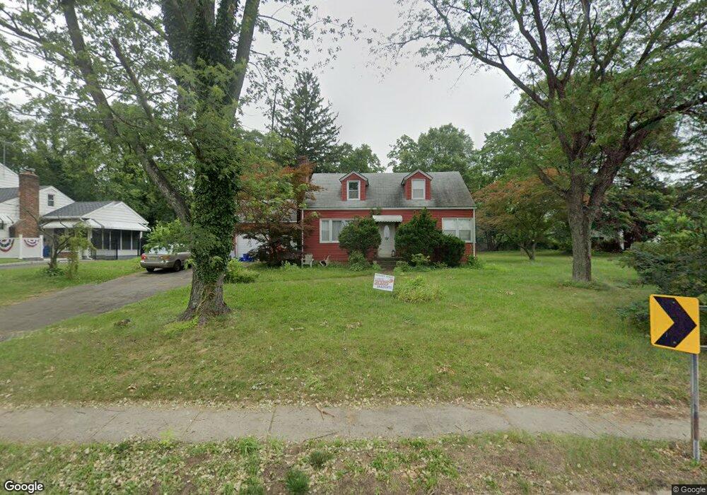
97 Devoe Ave Spotswood, NJ 08884
Estimated Value: $567,000 - $661,676
3
Beds
2
Baths
2,072
Sq Ft
$298/Sq Ft
Est. Value
About This Home
This home is located at 97 Devoe Ave, Spotswood, NJ 08884 and is currently estimated at $618,419, approximately $298 per square foot. 97 Devoe Ave is a home located in Middlesex County with nearby schools including G. Austin Schoenly Elementary School, E. Raymond Appleby Elementary School, and Spotswood Memorial School.
Ownership History
Date
Name
Owned For
Owner Type
Purchase Details
Closed on
Jul 17, 2009
Sold by
Pengue Nick
Bought by
Betelman Yan and Garrison Jennifer M
Current Estimated Value
Home Financials for this Owner
Home Financials are based on the most recent Mortgage that was taken out on this home.
Original Mortgage
$309,294
Outstanding Balance
$202,377
Interest Rate
5.36%
Mortgage Type
FHA
Estimated Equity
$416,042
Purchase Details
Closed on
May 23, 2008
Sold by
Tucker Alan Dean and Bradford Todd Hall Trust
Bought by
Pengue Nick
Create a Home Valuation Report for This Property
The Home Valuation Report is an in-depth analysis detailing your home's value as well as a comparison with similar homes in the area
Home Values in the Area
Average Home Value in this Area
Purchase History
| Date | Buyer | Sale Price | Title Company |
|---|---|---|---|
| Betelman Yan | $315,000 | Old Republic National Title | |
| Pengue Nick | $200,000 | Multiple |
Source: Public Records
Mortgage History
| Date | Status | Borrower | Loan Amount |
|---|---|---|---|
| Open | Betelman Yan | $309,294 |
Source: Public Records
Tax History
| Year | Tax Paid | Tax Assessment Tax Assessment Total Assessment is a certain percentage of the fair market value that is determined by local assessors to be the total taxable value of land and additions on the property. | Land | Improvement |
|---|---|---|---|---|
| 2025 | $12,099 | $332,300 | $176,700 | $155,600 |
| 2024 | $11,900 | $332,300 | $176,700 | $155,600 |
| 2023 | $11,900 | $332,300 | $176,700 | $155,600 |
| 2022 | $11,657 | $332,300 | $176,700 | $155,600 |
| 2021 | $11,564 | $332,300 | $176,700 | $155,600 |
| 2020 | $11,295 | $332,300 | $176,700 | $155,600 |
| 2019 | $11,036 | $332,300 | $176,700 | $155,600 |
| 2018 | $10,770 | $332,300 | $176,700 | $155,600 |
| 2017 | $10,580 | $332,300 | $176,700 | $155,600 |
| 2016 | $10,298 | $332,300 | $176,700 | $155,600 |
| 2015 | $9,829 | $332,300 | $176,700 | $155,600 |
| 2014 | $9,743 | $332,300 | $176,700 | $155,600 |
Source: Public Records
Map
Nearby Homes
- 25 Evergreen St
- 549 Main St
- 54 Red Bank Rd
- 12 Brookside Rd
- 25 Maple St
- 58 Manalapan Rd
- 83 Walnut St
- 22 Herman Dr
- 105 Snowhill St
- 53 Newark Ave
- 294 Devoe Ave
- 19 Walker Ave
- 321 Main St
- 49 Morton Ave
- 289 Main St Unit 6E
- 289 Main St Unit 3C
- 289 Main St Unit 10F
- LOT18 Brooklyn Ave
- Lot19 Brooklyn Ave
- 21 Bruning Ln
Your Personal Tour Guide
Ask me questions while you tour the home.