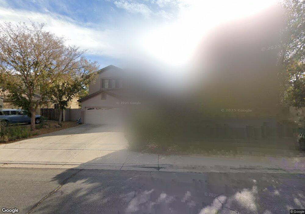
97 E Benrich Dr Gilbert, AZ 85295
Southwest Gilbert NeighborhoodEstimated Value: $779,066 - $965,000
5
Beds
3
Baths
4,194
Sq Ft
$213/Sq Ft
Est. Value
About This Home
This home is located at 97 E Benrich Dr, Gilbert, AZ 85295 and is currently estimated at $893,517, approximately $213 per square foot. 97 E Benrich Dr is a home located in Maricopa County with nearby schools including Quartz Hill Elementary School, South Valley Jr. High School, and Campo Verde High School.
Ownership History
Date
Name
Owned For
Owner Type
Purchase Details
Closed on
Nov 12, 2021
Sold by
Wynia Todd and Wynia Jean
Bought by
Todd & Jean Wynia Trust and Wynia
Current Estimated Value
Purchase Details
Closed on
Apr 14, 2009
Sold by
Petersen Lawerence and Petersen Stella
Bought by
Wynia Todd and Wynia Jean
Home Financials for this Owner
Home Financials are based on the most recent Mortgage that was taken out on this home.
Original Mortgage
$280,000
Interest Rate
5.17%
Mortgage Type
New Conventional
Purchase Details
Closed on
Mar 7, 2003
Sold by
Tousa Homes Inc
Bought by
Petersen Lawrence J and Petersen Stella
Home Financials for this Owner
Home Financials are based on the most recent Mortgage that was taken out on this home.
Original Mortgage
$284,900
Interest Rate
5.6%
Mortgage Type
New Conventional
Create a Home Valuation Report for This Property
The Home Valuation Report is an in-depth analysis detailing your home's value as well as a comparison with similar homes in the area
Home Values in the Area
Average Home Value in this Area
Purchase History
| Date | Buyer | Sale Price | Title Company |
|---|---|---|---|
| Todd & Jean Wynia Trust | -- | None Listed On Document | |
| Wynia Todd | $350,000 | Security Title Agency | |
| Petersen Lawrence J | -- | First American Title Ins Co | |
| Petersen Lawrence J | $372,400 | First American Title Ins Co |
Source: Public Records
Mortgage History
| Date | Status | Borrower | Loan Amount |
|---|---|---|---|
| Previous Owner | Wynia Todd | $280,000 | |
| Previous Owner | Petersen Lawrence J | $284,900 |
Source: Public Records
Tax History Compared to Growth
Tax History
| Year | Tax Paid | Tax Assessment Tax Assessment Total Assessment is a certain percentage of the fair market value that is determined by local assessors to be the total taxable value of land and additions on the property. | Land | Improvement |
|---|---|---|---|---|
| 2025 | $3,615 | $45,905 | -- | -- |
| 2024 | $3,478 | $43,719 | -- | -- |
| 2023 | $3,478 | $58,200 | $11,640 | $46,560 |
| 2022 | $3,365 | $44,610 | $8,920 | $35,690 |
| 2021 | $3,501 | $42,630 | $8,520 | $34,110 |
| 2020 | $3,439 | $40,210 | $8,040 | $32,170 |
| 2019 | $3,150 | $38,500 | $7,700 | $30,800 |
| 2018 | $3,053 | $37,710 | $7,540 | $30,170 |
| 2017 | $2,942 | $37,020 | $7,400 | $29,620 |
| 2016 | $3,032 | $37,270 | $7,450 | $29,820 |
| 2015 | $2,777 | $36,130 | $7,220 | $28,910 |
Source: Public Records
Map
Nearby Homes
- 75 E Elgin St
- 246 E Frances Ln
- 28 E Joseph Way
- 311 E Frances Ln
- 344 E Hopkins Rd
- 194 E Canyon Creek Dr
- 2600 E Springfield Place Unit 64
- 2600 E Springfield Place Unit 58
- 2600 E Springfield Place Unit 104
- 2600 E Springfield Place Unit 13
- 1193 S Roger Way
- 2514 E Browning Place
- 2471 E Derringer Way
- 15802 S Gilbert Rd Unit 58
- 2477 E Flintlock Place Unit II
- 15606 S Gilbert Rd Unit 128
- 73 S 132nd St
- 76 N 133rd St
- 13640 E Williams Field Rd
- 6 S 132nd St