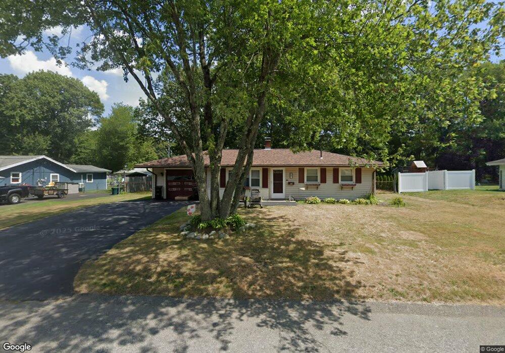
97 Elsie Rd Brockton, MA 02302
Montello NeighborhoodEstimated Value: $426,000 - $464,000
3
Beds
1
Bath
1,080
Sq Ft
$409/Sq Ft
Est. Value
About This Home
This home is located at 97 Elsie Rd, Brockton, MA 02302 and is currently estimated at $441,243, approximately $408 per square foot. 97 Elsie Rd is a home located in Plymouth County with nearby schools including Brookfield Elementary School, Mary E. Baker Elementary School, and Downey Elementary School.
Create a Home Valuation Report for This Property
The Home Valuation Report is an in-depth analysis detailing your home's value as well as a comparison with similar homes in the area
Home Values in the Area
Average Home Value in this Area
Tax History
| Year | Tax Paid | Tax Assessment Tax Assessment Total Assessment is a certain percentage of the fair market value that is determined by local assessors to be the total taxable value of land and additions on the property. | Land | Improvement |
|---|---|---|---|---|
| 2025 | $4,459 | $368,200 | $162,300 | $205,900 |
| 2024 | $4,208 | $350,100 | $162,300 | $187,800 |
| 2023 | $4,294 | $330,800 | $112,600 | $218,200 |
| 2022 | $4,090 | $292,800 | $102,400 | $190,400 |
| 2021 | $3,883 | $267,800 | $95,700 | $172,100 |
| 2020 | $3,619 | $238,900 | $83,700 | $155,200 |
| 2019 | $3,596 | $231,400 | $80,200 | $151,200 |
| 2018 | $3,569 | $222,200 | $80,200 | $142,000 |
| 2017 | $2,996 | $186,100 | $80,200 | $105,900 |
| 2016 | $2,934 | $169,000 | $76,400 | $92,600 |
| 2015 | $2,768 | $152,500 | $76,400 | $76,100 |
| 2014 | $2,502 | $138,000 | $76,400 | $61,600 |
Source: Public Records
Map
Nearby Homes
Your Personal Tour Guide
Ask me questions while you tour the home.