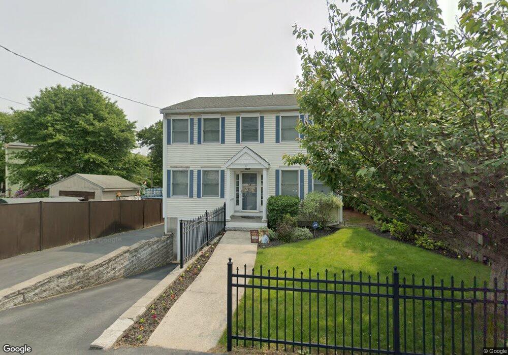
97 Foster Rd Swampscott, MA 01907
Estimated Value: $842,275 - $956,000
4
Beds
3
Baths
2,265
Sq Ft
$399/Sq Ft
Est. Value
About This Home
This home is located at 97 Foster Rd, Swampscott, MA 01907 and is currently estimated at $904,319, approximately $399 per square foot. 97 Foster Rd is a home located in Essex County with nearby schools including Swampscott Middle School, Swampscott High School, and St. Pius V. School.
Ownership History
Date
Name
Owned For
Owner Type
Purchase Details
Closed on
Jan 10, 2012
Sold by
Ulberg Jason and Ulberg Jaime
Bought by
Ulberg Ft and Ulberg
Current Estimated Value
Purchase Details
Closed on
Oct 6, 2006
Sold by
Great Dane Hill Rt and Dandreo
Bought by
Ulberg Jaime and Ulberg Jason
Home Financials for this Owner
Home Financials are based on the most recent Mortgage that was taken out on this home.
Original Mortgage
$407,200
Interest Rate
6.54%
Mortgage Type
Purchase Money Mortgage
Create a Home Valuation Report for This Property
The Home Valuation Report is an in-depth analysis detailing your home's value as well as a comparison with similar homes in the area
Home Values in the Area
Average Home Value in this Area
Purchase History
| Date | Buyer | Sale Price | Title Company |
|---|---|---|---|
| Ulberg Ft | -- | -- | |
| Ulberg Ft | -- | -- | |
| Ulberg Jaime | $509,000 | -- | |
| Ulberg Jaime | $509,000 | -- |
Source: Public Records
Mortgage History
| Date | Status | Borrower | Loan Amount |
|---|---|---|---|
| Previous Owner | Ulberg Jaime | $407,200 | |
| Previous Owner | Ulberg Jaime | $468,700 |
Source: Public Records
Tax History
| Year | Tax Paid | Tax Assessment Tax Assessment Total Assessment is a certain percentage of the fair market value that is determined by local assessors to be the total taxable value of land and additions on the property. | Land | Improvement |
|---|---|---|---|---|
| 2025 | $8,613 | $750,900 | $242,700 | $508,200 |
| 2024 | $8,379 | $729,200 | $231,200 | $498,000 |
| 2023 | $8,203 | $698,700 | $231,200 | $467,500 |
| 2022 | $8,008 | $624,200 | $196,900 | $427,300 |
| 2021 | $7,462 | $540,700 | $154,100 | $386,600 |
| 2020 | $7,642 | $534,400 | $154,100 | $380,300 |
| 2019 | $7,863 | $517,300 | $137,000 | $380,300 |
| 2018 | $7,752 | $484,500 | $119,900 | $364,600 |
| 2017 | $7,990 | $457,900 | $111,300 | $346,600 |
| 2016 | $7,788 | $449,400 | $102,800 | $346,600 |
| 2015 | $7,707 | $449,400 | $102,800 | $346,600 |
| 2014 | $7,755 | $414,700 | $85,600 | $329,100 |
Source: Public Records
Map
Nearby Homes
- 60 Roy St
- 96 Burpee Rd Unit 1
- 16 Isabella St
- 56 Clark St
- 21 E Park Ave
- 55 Addison Ave
- 4 Valley Rd Unit 4
- 64 Stetson Ave
- 46 Stetson Ave
- 106 Norfolk Ave
- 80 Norfolk Ave Unit 1
- 91 Oakwood Ave
- 8 Wyman Ave
- 122-126 Marianna St
- 50 Webster St
- 16 Clinton St
- 8 Summit View Dr
- 30 Clifton Ave
- 582 Eastern Ave
- 441 Essex St Unit 302
- 93 Foster Rd
- 98 Foster Rd
- 94 Foster Rd
- 23 Carson Terrace
- 104 Foster Rd
- 109 Foster Rd
- 88 Foster Rd
- 33 Carson Terrace
- 110 Foster Rd
- 82 Foster Rd
- 85 Foster Rd
- 114 Foster Rd
- 39 Carson Terrace
- 118 Foster Rd
- 13 Vaughan Place
- 26 Carson Terrace
- 26 Carson Terrace Unit 1
- 15 Vaughan Place
- 10 Vaughan Place
- 45 Carson Terrace
Your Personal Tour Guide
Ask me questions while you tour the home.