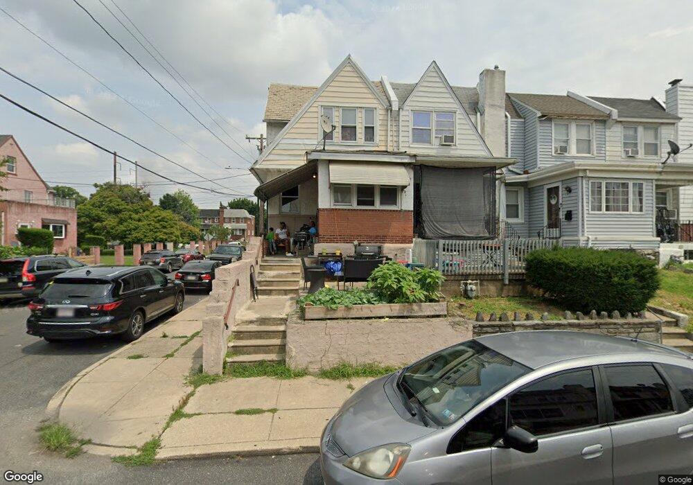
97 Hartley Rd Lansdowne, PA 19050
Estimated Value: $156,000 - $196,000
3
Beds
1
Bath
1,202
Sq Ft
$148/Sq Ft
Est. Value
About This Home
This home is located at 97 Hartley Rd, Lansdowne, PA 19050 and is currently estimated at $178,319, approximately $148 per square foot. 97 Hartley Rd is a home located in Delaware County with nearby schools including Charles Kelly El School, Upper Darby High School, and Vision Academy Charter School.
Ownership History
Date
Name
Owned For
Owner Type
Purchase Details
Closed on
Dec 13, 2005
Sold by
Lilliston Anjeanette
Bought by
Sherrod Shannon and Sherrod Anjeanette
Current Estimated Value
Home Financials for this Owner
Home Financials are based on the most recent Mortgage that was taken out on this home.
Original Mortgage
$109,260
Outstanding Balance
$61,494
Interest Rate
6.39%
Mortgage Type
Stand Alone Refi Refinance Of Original Loan
Estimated Equity
$116,825
Purchase Details
Closed on
Jun 12, 2003
Sold by
Magrann Michael and Magrann Patricia M
Bought by
Lilliston Anjeanette
Home Financials for this Owner
Home Financials are based on the most recent Mortgage that was taken out on this home.
Original Mortgage
$71,832
Interest Rate
5.77%
Mortgage Type
FHA
Create a Home Valuation Report for This Property
The Home Valuation Report is an in-depth analysis detailing your home's value as well as a comparison with similar homes in the area
Home Values in the Area
Average Home Value in this Area
Purchase History
| Date | Buyer | Sale Price | Title Company |
|---|---|---|---|
| Sherrod Shannon | -- | None Available | |
| Lilliston Anjeanette | $72,400 | T A Title Insurance Company |
Source: Public Records
Mortgage History
| Date | Status | Borrower | Loan Amount |
|---|---|---|---|
| Open | Sherrod Shannon | $109,260 | |
| Closed | Lilliston Anjeanette | $71,832 |
Source: Public Records
Tax History Compared to Growth
Tax History
| Year | Tax Paid | Tax Assessment Tax Assessment Total Assessment is a certain percentage of the fair market value that is determined by local assessors to be the total taxable value of land and additions on the property. | Land | Improvement |
|---|---|---|---|---|
| 2025 | $3,528 | $83,410 | $14,410 | $69,000 |
| 2024 | $3,528 | $83,410 | $14,410 | $69,000 |
| 2023 | $3,494 | $83,410 | $14,410 | $69,000 |
| 2022 | $3,400 | $83,410 | $14,410 | $69,000 |
| 2021 | $4,585 | $83,410 | $14,410 | $69,000 |
| 2020 | $3,857 | $59,630 | $18,020 | $41,610 |
| 2019 | $3,790 | $59,630 | $18,020 | $41,610 |
| 2018 | $3,746 | $59,630 | $0 | $0 |
| 2017 | $3,649 | $59,630 | $0 | $0 |
| 2016 | $327 | $59,630 | $0 | $0 |
| 2015 | $327 | $59,630 | $0 | $0 |
| 2014 | $327 | $59,630 | $0 | $0 |
Source: Public Records
Map
Nearby Homes
- 230 Wynnewood Ave
- 226 E Greenwood Ave
- 209 E Greenwood Ave
- 319 E Essex Ave
- 317 E Essex Ave
- 315 E Essex Ave
- 178 N Union Ave
- 75 E Stewart Ave
- 608 Pembroke Ave
- 164 Woodland Ave
- 37 E Stratford Ave
- 32 N Wycombe Ave
- 209 Wabash Ave
- 239 N Maple Ave
- 46 S Maple Ave
- 88 E Essex Ave
- 7229 Clinton Rd
- 7216 Clinton Rd
- 726 Copley Rd
- 669 Long Ln