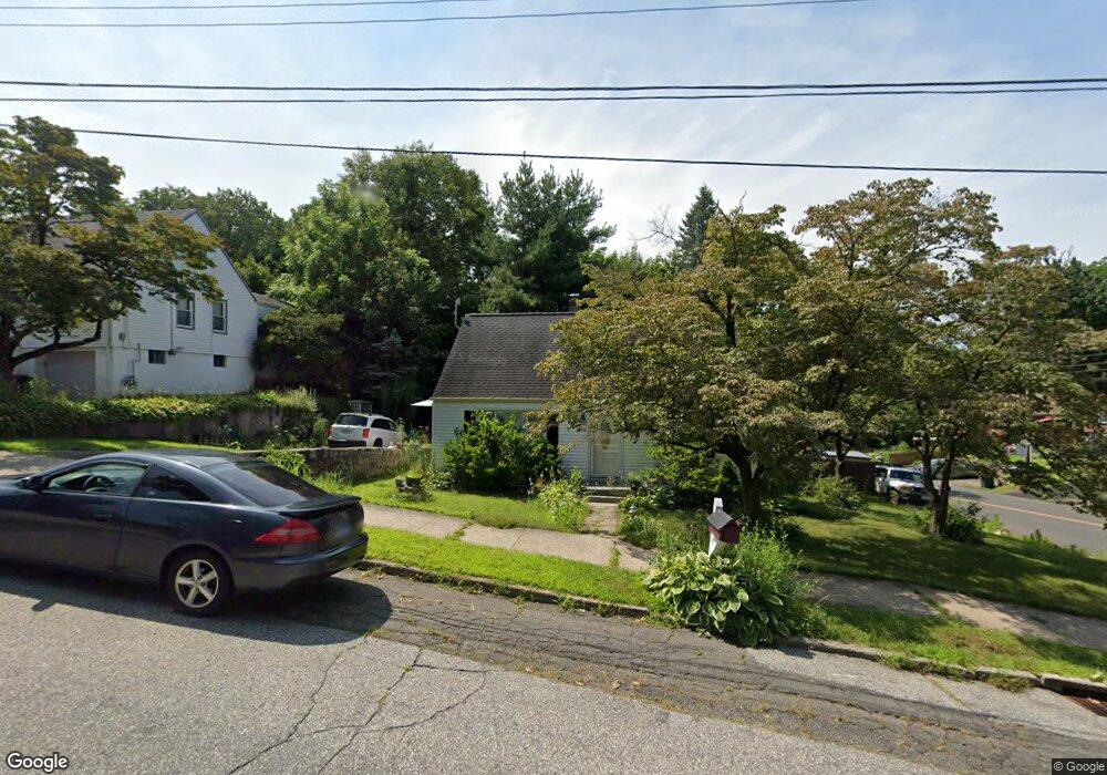
97 Memory Ln Bridgeport, CT 06606
Reservoir-Whiskey Hill NeighborhoodEstimated Value: $380,125 - $427,000
3
Beds
1
Bath
1,152
Sq Ft
$349/Sq Ft
Est. Value
About This Home
This home is located at 97 Memory Ln, Bridgeport, CT 06606 and is currently estimated at $402,281, approximately $349 per square foot. 97 Memory Ln is a home located in Fairfield County with nearby schools including Wilbur L. Cross Elementary School, Central High School, and Northeastern Adventist Academy - Fairfield County.
Ownership History
Date
Name
Owned For
Owner Type
Purchase Details
Closed on
May 31, 2002
Sold by
Inham Ricardo
Bought by
Cabrera Dorothy and Cabrera Elliot
Current Estimated Value
Home Financials for this Owner
Home Financials are based on the most recent Mortgage that was taken out on this home.
Original Mortgage
$166,650
Outstanding Balance
$71,409
Interest Rate
7%
Estimated Equity
$330,872
Purchase Details
Closed on
May 21, 1996
Sold by
Szenes Susan
Bought by
Inhan Ricardo H
Home Financials for this Owner
Home Financials are based on the most recent Mortgage that was taken out on this home.
Original Mortgage
$79,300
Interest Rate
7.77%
Mortgage Type
Unknown
Create a Home Valuation Report for This Property
The Home Valuation Report is an in-depth analysis detailing your home's value as well as a comparison with similar homes in the area
Home Values in the Area
Average Home Value in this Area
Purchase History
| Date | Buyer | Sale Price | Title Company |
|---|---|---|---|
| Cabrera Dorothy | $168,000 | -- | |
| Cabrera Dorothy | $168,000 | -- | |
| Inhan Ricardo H | $83,500 | -- | |
| Inhan Ricardo H | $83,500 | -- |
Source: Public Records
Mortgage History
| Date | Status | Borrower | Loan Amount |
|---|---|---|---|
| Open | Inhan Ricardo H | $166,650 | |
| Closed | Inhan Ricardo H | $166,650 | |
| Previous Owner | Inhan Ricardo H | $79,300 |
Source: Public Records
Tax History
| Year | Tax Paid | Tax Assessment Tax Assessment Total Assessment is a certain percentage of the fair market value that is determined by local assessors to be the total taxable value of land and additions on the property. | Land | Improvement |
|---|---|---|---|---|
| 2025 | $5,698 | $131,130 | $66,930 | $64,200 |
| 2024 | $5,698 | $131,130 | $66,930 | $64,200 |
| 2023 | $5,698 | $131,130 | $66,930 | $64,200 |
| 2022 | $5,698 | $131,130 | $66,930 | $64,200 |
| 2021 | $5,698 | $131,130 | $66,930 | $64,200 |
| 2020 | $5,428 | $100,530 | $46,630 | $53,900 |
| 2019 | $5,428 | $100,530 | $46,630 | $53,900 |
| 2018 | $5,466 | $100,530 | $46,630 | $53,900 |
| 2017 | $5,466 | $100,530 | $46,630 | $53,900 |
| 2016 | $5,466 | $100,530 | $46,630 | $53,900 |
| 2015 | $5,577 | $132,150 | $59,400 | $72,750 |
| 2014 | $5,577 | $132,150 | $59,400 | $72,750 |
Source: Public Records
Map
Nearby Homes
- 1403 Old Town Rd Unit 1403
- 74 Village Ln
- 563 Lakeside Dr
- 1376 Chopsey Hill Rd
- 1320 Chopsey Hill Rd
- 46 Oakleaf St
- 11 Linda Dr
- 364 Griffin Ave
- 26 Karen Ct Unit A
- 165 Yaremich Dr
- 82 Yaremich Dr
- 45 Frenchtown Rd
- 65 Clearview Dr
- 291 Frenchtown Rd
- 274 Platt St
- 65 Bonnie View Dr
- 181 Cityview Ave
- 365 Platt St
- 410 Alba Ave
- 85 Platt St
- 85 Memory Ln
- 1882 Chopsey Hill Rd
- 102 Memory Ln
- 69 Memory Ln
- 88 Memory Ln
- 1903 Chopsey Hill Rd
- 1913 Chopsey Hill Rd
- 1893 Chopsey Hill Rd
- 1925 Chopsey Hill Rd
- 72 Memory Ln
- 1864 Chopsey Hill Rd
- 1887 Chopsey Hill Rd
- 55 Memory Ln
- 1941 Chopsey Hill Rd
- 58 Memory Ln
- 1867 Chopsey Hill Rd
- 1860 Chopsey Hill Rd Unit 1862
- 1860 Chopsey Hill Rd Unit 2
- 1860 Chopsey Hill Rd Unit 1
- 1953 Chopsey Hill Rd
Your Personal Tour Guide
Ask me questions while you tour the home.