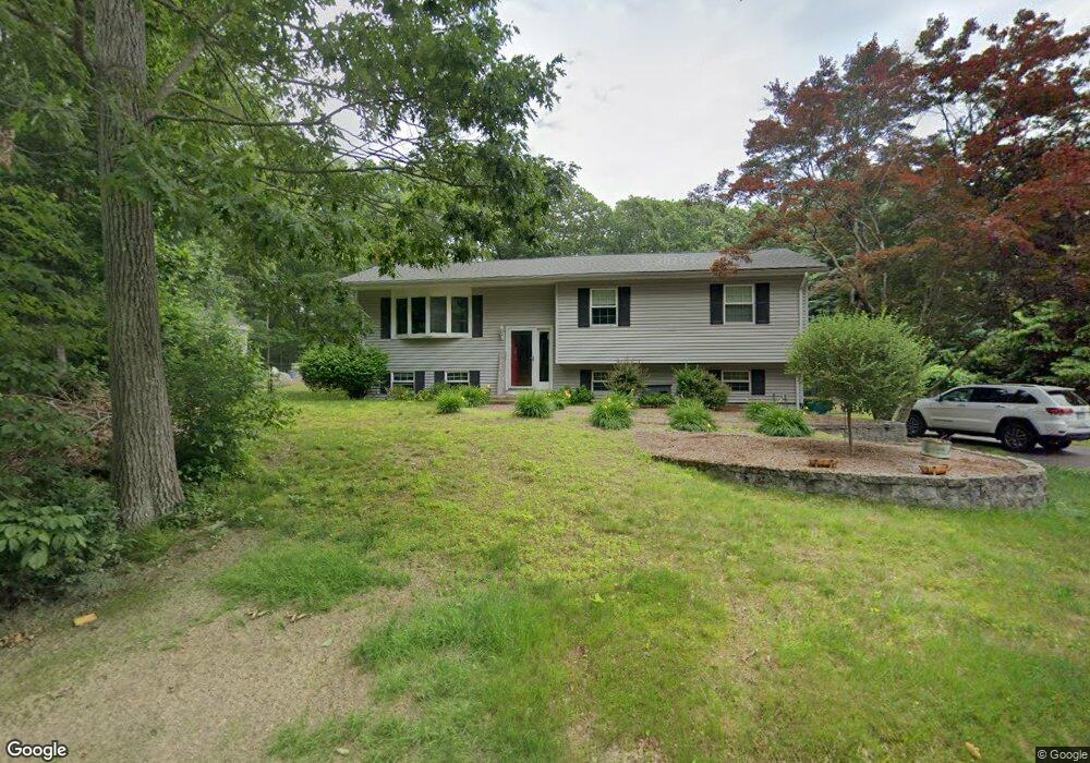
97 N Main St North Easton, MA 02356
Estimated Value: $609,000 - $713,000
3
Beds
2
Baths
1,236
Sq Ft
$545/Sq Ft
Est. Value
About This Home
This home is located at 97 N Main St, North Easton, MA 02356 and is currently estimated at $673,792, approximately $545 per square foot. 97 N Main St is a home located in Bristol County with nearby schools including Easton Middle School.
Ownership History
Date
Name
Owned For
Owner Type
Purchase Details
Closed on
Sep 3, 2002
Sold by
97 N Main Street Rt
Bought by
Murphy Brian and Murphy Nicole
Current Estimated Value
Home Financials for this Owner
Home Financials are based on the most recent Mortgage that was taken out on this home.
Original Mortgage
$252,720
Interest Rate
6.55%
Mortgage Type
Purchase Money Mortgage
Purchase Details
Closed on
May 21, 2002
Sold by
Mello Audrey J
Bought by
97 N Main St Rt
Create a Home Valuation Report for This Property
The Home Valuation Report is an in-depth analysis detailing your home's value as well as a comparison with similar homes in the area
Home Values in the Area
Average Home Value in this Area
Purchase History
| Date | Buyer | Sale Price | Title Company |
|---|---|---|---|
| Murphy Brian | $315,900 | -- | |
| 97 N Main St Rt | $217,500 | -- | |
| 97 N Main St Rt | $217,500 | -- |
Source: Public Records
Mortgage History
| Date | Status | Borrower | Loan Amount |
|---|---|---|---|
| Open | 97 N Main St Rt | $230,000 | |
| Closed | 97 N Main St Rt | $252,720 |
Source: Public Records
Tax History Compared to Growth
Tax History
| Year | Tax Paid | Tax Assessment Tax Assessment Total Assessment is a certain percentage of the fair market value that is determined by local assessors to be the total taxable value of land and additions on the property. | Land | Improvement |
|---|---|---|---|---|
| 2025 | $7,779 | $623,300 | $372,400 | $250,900 |
| 2024 | $6,867 | $514,400 | $293,800 | $220,600 |
| 2023 | $6,612 | $453,200 | $293,800 | $159,400 |
| 2022 | $6,328 | $411,200 | $256,600 | $154,600 |
| 2021 | $6,118 | $395,200 | $240,600 | $154,600 |
| 2020 | $5,911 | $384,300 | $230,900 | $153,400 |
| 2019 | $5,824 | $364,900 | $209,500 | $155,400 |
| 2018 | $5,523 | $340,700 | $198,200 | $142,500 |
| 2017 | $5,338 | $329,100 | $198,200 | $130,900 |
| 2016 | $5,119 | $316,200 | $191,500 | $124,700 |
| 2015 | $4,578 | $272,800 | $167,500 | $105,300 |
| 2014 | $4,454 | $267,500 | $160,100 | $107,400 |
Source: Public Records
Map
Nearby Homes
- 175 N Main St
- 12 Holmes St
- 15 King Ave
- 93 Palisades Cir
- 8 Hobart Way
- 11 Olde Stable Ln
- 1600 West St
- 1 Whittier Ln Unit 1
- 18 Prudence Crandall Ln Unit 18
- 224 Main St
- Lot 8 Cooper Ln
- 225 Main St
- 67 Center St
- 56 Williams St
- 14 Marshall Rd
- 4 Eagle Rock Rd
- 334-336 Main St
- 86 Union St
- 110 Union St
- 32 Spooner St
- 97 N Main St Unit 4
- 97 N Main St Unit 5
- 97 N Main St Unit 3
- 99 N Main St
- 95 N Main St
- 100 N Main St
- 96 N Main St
- 3 Partridge Way
- 87 N Main St
- 3 Vineyard Place
- 94 N Main St
- 83 N Main St
- 2 Partridge Way
- 129 N Main St
- 1 Partridge Way
- 7 Vineyard Place
- 92 N Main St
- 92A N Main St
- 6 Vineyard Place
- 135 N Main St