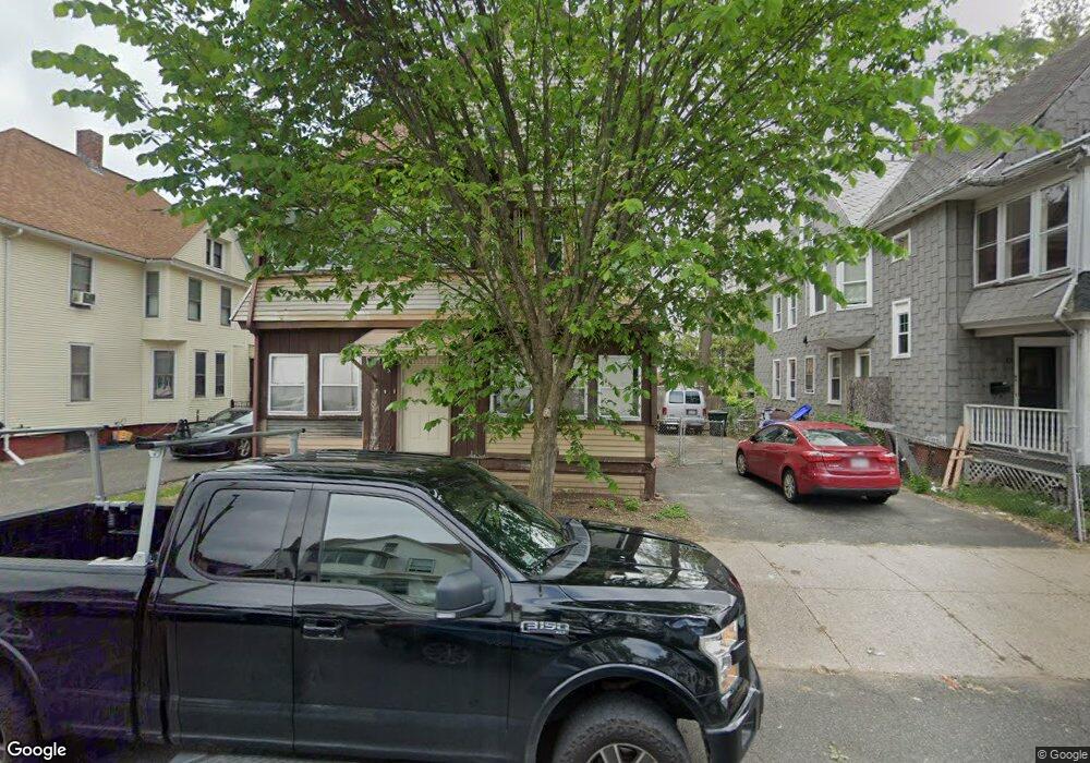
97 Northampton Ave Springfield, MA 01109
Upper Hill NeighborhoodEstimated Value: $264,000 - $451,000
4
Beds
2
Baths
2,506
Sq Ft
$130/Sq Ft
Est. Value
About This Home
This home is located at 97 Northampton Ave, Springfield, MA 01109 and is currently estimated at $325,129, approximately $129 per square foot. 97 Northampton Ave is a home located in Hampden County with nearby schools including Glickman Elementary, M Marcus Kiley Middle, and Springfield High School of Science and Technology.
Ownership History
Date
Name
Owned For
Owner Type
Purchase Details
Closed on
Oct 2, 2024
Sold by
Roberson Cynthia E
Bought by
Aga Brothers Llc
Current Estimated Value
Purchase Details
Closed on
Jun 23, 2015
Sold by
Roberson Elizabeth A E and Roberson R
Bought by
Roberson Cynthia E
Purchase Details
Closed on
Nov 9, 1981
Bought by
Roberson Elizabeth Anna
Create a Home Valuation Report for This Property
The Home Valuation Report is an in-depth analysis detailing your home's value as well as a comparison with similar homes in the area
Home Values in the Area
Average Home Value in this Area
Purchase History
| Date | Buyer | Sale Price | Title Company |
|---|---|---|---|
| Aga Brothers Llc | $65,000 | None Available | |
| Aga Brothers Llc | $65,000 | None Available | |
| Roberson Cynthia E | -- | -- | |
| Roberson Cynthia E | -- | -- | |
| Roberson Elizabeth Anna | -- | -- |
Source: Public Records
Tax History
| Year | Tax Paid | Tax Assessment Tax Assessment Total Assessment is a certain percentage of the fair market value that is determined by local assessors to be the total taxable value of land and additions on the property. | Land | Improvement |
|---|---|---|---|---|
| 2025 | $3,268 | $208,400 | $30,600 | $177,800 |
| 2024 | $3,214 | $200,100 | $30,600 | $169,500 |
| 2023 | $2,996 | $175,700 | $27,800 | $147,900 |
| 2022 | $3,602 | $191,400 | $26,000 | $165,400 |
| 2021 | $3,381 | $178,900 | $18,400 | $160,500 |
| 2020 | $3,135 | $160,500 | $18,400 | $142,100 |
| 2019 | $2,871 | $145,900 | $15,700 | $130,200 |
| 2018 | $2,737 | $139,100 | $15,700 | $123,400 |
| 2017 | $2,601 | $132,300 | $14,800 | $117,500 |
| 2016 | $2,239 | $113,900 | $14,800 | $99,100 |
| 2015 | $2,201 | $111,900 | $14,800 | $97,100 |
Source: Public Records
Map
Nearby Homes
- 21 Westford Cir
- 19 Westford Ave
- 290 Quincy St
- 189 Northampton Ave
- 124-126 Westford Cir
- 52-56 Andrew St
- 41 Olive St
- 46 Mapledell St
- 65 Montrose St
- 135-137 Suffolk St
- 48-50 Dresden St
- 31-33 Suffolk St
- 62-64 Bristol St
- 89 Bristol St
- 25 Dresden St
- 0 NS (24) Alden St
- 145 Cambridge St
- 22-24 Westminster St
- 15 Kenyon St
- 118 Quincy St
- 95-97 Northampton Ave
- 91 Northampton Ave
- 99-101 Northampton Ave
- 99 Northampton Ave
- 101 Northampton Ave
- 85 Northampton Ave
- 107 Northampton Ave
- 100 Northampton Ave
- 100 Northampton Ave Unit 1
- 100 Westford Ave
- 94 Northampton Ave
- 94 Westford Ave
- 83 Northampton Ave
- 88 Northampton Ave
- 111 Northampton Ave
- 84 Northampton Ave
- 84 Northampton Ave Unit 1
- 86 Westford Ave
- 108 Northampton Ave Unit 110
- 75 Northampton Ave
Your Personal Tour Guide
Ask me questions while you tour the home.