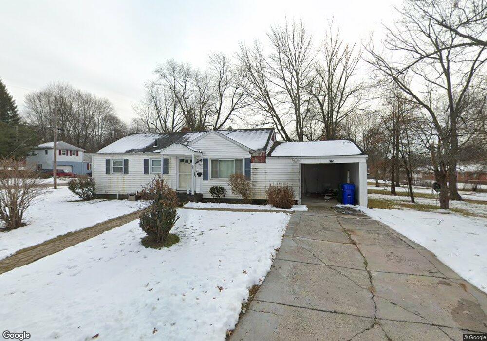
97 Pershing St Bloomfield, CT 06002
Blue Hills NeighborhoodEstimated Value: $284,685 - $312,000
2
Beds
3
Baths
975
Sq Ft
$308/Sq Ft
Est. Value
About This Home
3 beds, 2 baths, 2395.sq ft - Newly renovated single family home located on a corner lot. This lovely home is move-in ready with plenty of indoor and outdoor space. This ideal location has close access to public transportation, amble carport, driveway and street parking. Electric stove, microwave, refrigerator, heat, air conditioning, and washer and dryer hook-up. Large front, sides and back yards. Interior features include a large living room and remodeled eat-in kitchen. Partially finished basement featuring ample storage area. NO PETS ALLOWED.
Create a Home Valuation Report for This Property
The Home Valuation Report is an in-depth analysis detailing your home's value as well as a comparison with similar homes in the area
Home Values in the Area
Average Home Value in this Area
Property History
| Date | Event | Price | List to Sale | Price per Sq Ft |
|---|---|---|---|---|
| 02/05/2025 02/05/25 | Off Market | -- | -- | -- |
| 01/06/2025 01/06/25 | For Rent | $2,800 | 0.0% | -- |
| 01/06/2025 01/06/25 | For Rent | -- | -- | -- |
| 01/06/2025 01/06/25 | Price Changed | $2,800 | -6.7% | $3 / Sq Ft |
| 12/16/2024 12/16/24 | Off Market | $3,000 | -- | -- |
| 11/13/2024 11/13/24 | For Rent | $3,000 | -- | -- |
Tax History Compared to Growth
Tax History
| Year | Tax Paid | Tax Assessment Tax Assessment Total Assessment is a certain percentage of the fair market value that is determined by local assessors to be the total taxable value of land and additions on the property. | Land | Improvement |
|---|---|---|---|---|
| 2024 | $3,435 | $84,630 | $19,390 | $65,240 |
| 2023 | $3,375 | $84,630 | $19,390 | $65,240 |
| 2022 | $3,134 | $84,630 | $19,390 | $65,240 |
| 2021 | $3,223 | $84,630 | $19,390 | $65,240 |
| 2020 | $3,174 | $84,630 | $19,390 | $65,240 |
| 2019 | $3,345 | $83,720 | $19,390 | $64,330 |
| 2018 | $2,972 | $74,270 | $19,390 | $54,880 |
| 2017 | $2,975 | $74,270 | $19,390 | $54,880 |
Source: Public Records
Map
Nearby Homes
- 26 Baltic St Unit 28
- 35 Baltic St
- 11 Pershing St Unit 13
- 97 Boothbay St
- 97 E Burnham St
- 70 Burnham St Unit 72
- 86 Hartland St
- 90 Manchester St
- 747 Blue Hills Ave
- 13 Patton Rd
- 67 Elizabeth Ave
- 83 Colebrook St Unit 85
- 179 Manchester St
- 51 Pembroke St
- 180 Brookline Ave
- 216 Cornwall St
- 171 N Canaan St
- 102 Thomaston St Unit 104
- 166 Pembroke St
- 275 Westland St
- 51 Pershing St Unit 53
- 49 Pershing St
- 55 Pershing St Unit 57
- 48 Pershing St Unit 50
- 52 Pershing St Unit 54
- 50 Lebanon St Unit 52
- 52 Lebanon St
- 56 Pershing St Unit 58
- 44 Lebanon St Unit 46
- 61 Pershing St Unit 63
- 60 Lebanon St Unit 62
- 62 Pershing St Unit 64
- 66 Lebanon St Unit 68
- 40 Lebanon St Unit 42
- 40-42 Lebanon St Unit 42
- 67 Pershing St
- 68 Lebanon St
- 16 Baltic St Unit 18
- 61 Lebanon St Unit 63
- 31 Pershing St