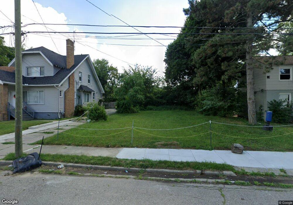
97 S Marshall St Pontiac, MI 48342
Estimated Value: $58,000 - $261,000
--
Bed
1
Bath
--
Sq Ft
5,009
Sq Ft Lot
About This Home
This home is located at 97 S Marshall St, Pontiac, MI 48342 and is currently estimated at $159,500. 97 S Marshall St is a home located in Oakland County with nearby schools including Walt Whitman Elementary School, Pontiac Middle School, and Pontiac High School.
Ownership History
Date
Name
Owned For
Owner Type
Purchase Details
Closed on
Mar 10, 2025
Sold by
Mcnarry Ronnie
Bought by
El Annotep Sahotep
Current Estimated Value
Purchase Details
Closed on
Jul 30, 2020
Sold by
Tolbert Roderick
Bought by
Mcneary Ronnie
Purchase Details
Closed on
Nov 7, 2016
Sold by
Oakland County
Bought by
Tolbert Roderick Shawn
Purchase Details
Closed on
Mar 20, 2012
Sold by
Oakland County Treasurer
Bought by
Croft Mary
Purchase Details
Closed on
May 27, 2011
Sold by
Pryor Willie J
Bought by
Croft Mary
Purchase Details
Closed on
Apr 30, 2001
Sold by
Martin Willie J and Martin Dennis J
Bought by
Pryor Willie J
Create a Home Valuation Report for This Property
The Home Valuation Report is an in-depth analysis detailing your home's value as well as a comparison with similar homes in the area
Home Values in the Area
Average Home Value in this Area
Purchase History
| Date | Buyer | Sale Price | Title Company |
|---|---|---|---|
| El Annotep Sahotep | -- | None Listed On Document | |
| El Annotep Sahotep | -- | None Listed On Document | |
| Mcneary Ronnie | $400 | None Available | |
| Tolbert Roderick Shawn | -- | Oakland County Title | |
| Croft Mary | $229 | None Available | |
| Croft Mary | -- | None Available | |
| Pryor Willie J | $21,500 | -- |
Source: Public Records
Tax History Compared to Growth
Tax History
| Year | Tax Paid | Tax Assessment Tax Assessment Total Assessment is a certain percentage of the fair market value that is determined by local assessors to be the total taxable value of land and additions on the property. | Land | Improvement |
|---|---|---|---|---|
| 2024 | $105 | $3,500 | $0 | $0 |
| 2023 | $101 | $2,800 | $0 | $0 |
| 2022 | $97 | $2,550 | $0 | $0 |
| 2021 | $95 | $1,700 | $0 | $0 |
| 2020 | $72 | $1,310 | $0 | $0 |
| 2019 | $74 | $1,310 | $0 | $0 |
| 2018 | $74 | $1,310 | $0 | $0 |
| 2017 | $73 | $1,310 | $0 | $0 |
| 2016 | $0 | $0 | $0 | $0 |
| 2015 | -- | $0 | $0 | $0 |
| 2014 | -- | $1,450 | $0 | $0 |
| 2011 | -- | $16,890 | $0 | $0 |
Source: Public Records
Map
Nearby Homes
- 28 S Marshall St
- 505 Auburn Ave
- 176 S Francis Ave
- 511 E Pike St
- 46 N Anderson Ave
- 33 S Tasmania St
- 717 E Pike St
- 291 Michigan Ave
- 18 S Shirley St
- 88 N Astor St
- 53 N Midland Dr
- 328 Whittemore St
- 389 Osmun St
- 187 Wall St
- 53 N Roselawn St
- 55 N Roselawn St
- 57 N Roselawn St
- 70 N Roselawn St
- 97 N Roselawn St
- 397 S Jessie St
- 93 S Marshall St
- 101 S Marshall St
- 105 S Marshall St
- 100 Ml King jr Blvd S
- 100 Martin Luther King jr Blvd S
- 31820 S Marshall St
- 86 Martin Luther King jr
- 84 Martin Luther King jr
- 96 S Marshall St
- 77 S Marshall St
- 88 Martin Luther King jr Blvd S Unit Bldg-Unit
- 94 Martin Luther King jr Blvd S
- 90 Martin Luther King jr Blvd S
- 88 Martin Luther King jr Blvd S
- 86 Martin Luther King jr Blvd S
- 78 Martin Luther King jr Blvd S
- 84 Martin Luther King jr Blvd S
- 82 Martin Luther King jr Blvd S
- 98 Martin Luther King jr Blvd S
- 78 Martin Luther King jr Blvd S